
Overload pressure
Decision 1287/QD-TTg dated November 2, 2023, of the Prime Minister approving the Da Nang City Planning for the period 2021-2030, with a vision to 2050, and the plan for organizing the city's urban system, identifies six districts as modern, high-quality, friendly, and livable central urban areas.
In this area, the redevelopment plan is oriented towards a compact urban model, increasing land use efficiency, adding urban amenities and integrating with the public transportation system, controlling the coastal corridor; and implementing measures to respond to climate change and sea level rise.
Accordingly, many modern, large-scale projects have been implemented, a series of high-rise buildings have sprung up along the river and coast in the central area, public infrastructure has been prioritized for investment; the mixed-use land ratio has increased and diversified its functions, etc. It can be said that the compact urban model with a unipolar structure in the city core has demonstrated many advantages and optimized the efficiency of land and infrastructure resources.
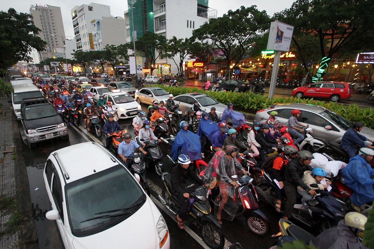
However, with the continuous expansion of the city, especially after the merger with Quang Nam province, the unipolar structure of the densely populated urban area concentrated in the six former districts has also created problems of overloaded urban infrastructure, public transportation, and high population density in the urban core, leading to negative consequences for the quality of life.
In the city center, many intersections are frequently congested, especially at points such as the Le Thanh Nghi - Hoa Xuan Bridge intersection, the intersection west of the Dragon Bridge, and the Hung Vuong - Ham Nghi intersection. Most recently, the subsidence incident at the Capital Square project construction site has raised many questions regarding urban planning and development orientation for the city in the coming years.
Urban planning for central cities
After the merger, Da Nang City covers an area of nearly 12,000 km², making it the largest city in the country. Its economy has expanded to include many economic sectors and businesses operating along North-South and East-West transportation corridors, industrial zones, and the Chu Lai open economic zone. Therefore, the urban structure needs to be redistributed to ensure balanced economic development between regions, and to strategically allocate transportation, social, population, and employment infrastructure to maximize the exploitation of geo-economic factors and unique advantages to create new growth poles.
Accordingly, it is necessary to consider urban planning that incorporates multiple urban centers, each with its own distinct function, in order to attract residents and economic and social activities, thereby reducing the burden on the core urban center and creating balanced development for the entire city.
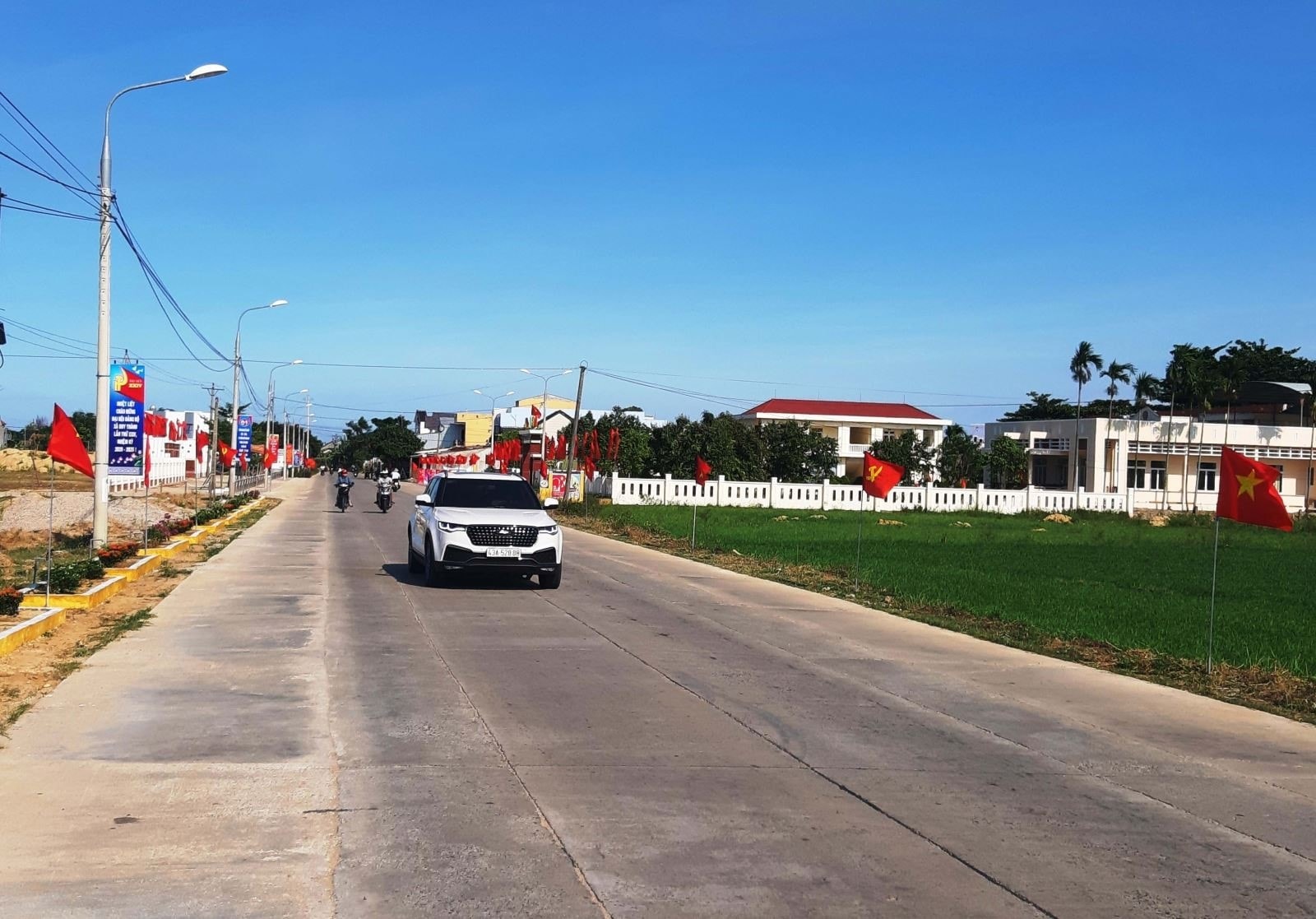
The city's structural planning is divided into two regions, East and West, using the Da Nang - Quang Ngai expressway as a soft boundary to guide spatial development. The eastern region, comprising coastal plain communes and wards, is the driving force behind the city's growth and provides financial resources for investment in the western region.
The planning of the central urban areas in the Eastern region can be considered according to the following main subdivisions:
The central urban core comprises six districts of the former Da Nang city – Dien Ban – Hoi An, characterized by its tourism, culture, education and training, finance, entertainment, industry, science, innovation, and international exchange, all with the rich cultural heritage of Quang Nam province. The core of this model lies in the new planning and adjustment of existing plans for residential, commercial, service, and employment areas around public transportation hubs. This facilitates convenient travel for residents, reduces congestion on the road transport system, optimizes infrastructure utilization, and contributes to the development of a green and sustainable urban environment.
Simultaneously, there needs to be a combination of investment in transportation and urban infrastructure with digital infrastructure to deploy the Internet of Things and apply AI to operate and manage smart cities, aiming to optimize traffic, social amenities, security, and energy management in residential and urban areas.
The central urban area of Duy Xuyen - Thang Binh is characterized by its eco-tourism and resort features along the river and coast, high-tech industries, nursing homes, commercial centers, and administrative centers. This area offers many advantages in designing and planning new urban areas and residential zones, creating new living spaces with short commute times of 10-15 minutes to workplaces. This urban area is identified as an opportunity and a destination for major investors, and is strategically important for the city in terms of tourism, real estate, and world-class entertainment.
The Tam Ky - Nui Thanh urban area is characterized by its economic development in industry, port and air logistics services, trade, and coastal tourism, with the Chu Lai open economic zone as its center and nucleus. This creates a living basin for new urban and residential areas with travel times of 10-15 minutes, connecting them to production and business facilities in industrial parks, industrial clusters, and the Chu Lai open economic zone.
Connectivity infrastructure creates momentum for development.
A favorable factor in the investment and development of the central urban areas of Duy Xuyen - Thang Binh and Tam Ky - Nui Thanh is that the former Quang Nam province and the new Da Nang city have already planned to invest in an inner-city railway line from Chu Lai airport to Hoi An. Therefore, early investment is needed to create a boost in the formation of new economic and administrative centers with short travel times connected to this transportation system, creating momentum to attract investment in high-end coastal and riverside resort tourism projects, urban areas, commercial zones, etc., and promoting the development of the real estate market in the southern part of the city.
The formation of these central urban areas emphasizes the differences in travel times between residential areas, aiming to create close-knit, friendly, and convenient living spaces linked to efficient urban operation and management tools, contributing to improving the quality of life in a "livable city". The formation of new urban areas will create new growth poles, helping to alleviate population density in the central area and reduce inner-city traffic pressure, creating balanced development for the entire city.
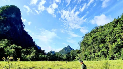
The western region, comprising the mountainous communes of the city, needs focused investment in upgrading the transportation axis connecting the eastern and western regions, such as National Highways 14B, 14G, 14H, 14E, 40B, and the Nam Giang international border gate and the Tay Giang sub-border gate. This will serve as a bridge for trade, agricultural product consumption, and the promotion of the East-West economic corridor, opening a gateway for long-term cooperation and development with Sekong and Champasak provinces in Laos, Ubon Ratchathani province in Thailand, and the Central Highlands region, fundamentally addressing the socio-economic development challenges of the mountainous areas.
Simultaneously, focus on planning for natural forest ecosystem conservation areas; developing national forest product and medicinal plant raw material areas; horticultural, farm, and livestock farming; and reviewing hydropower and mineral resource planning to develop sustainable management and exploitation plans.
Addressing bottlenecks in rural planning and development, particularly in landslide-prone residential areas, involves relocating residents to integrated multi-functional infrastructure (community centers, schools, health stations, etc.) linked to sustainable livelihoods, close to nature, resilient to natural disasters, adaptable to climate change, and creating long-term stable living conditions.
Review Resolution No. 48/NQ-HĐND dated December 6, 2018, of the Provincial People's Council on socio-economic development of border communes combined with strengthening and consolidating national defense, security, and foreign affairs in Quang Nam province, 2019-2025, to amend and supplement it to suit the conditions of the merged city; plan the construction of model settlement villages in border areas, creating conditions for people to have land for production, linked with protecting the border line, implementing policies on land allocation, granting land use right certificates, and contracting forest management to mountainous communities for management, protection, and benefiting from the forest...
Source: https://baodanang.vn/de-giam-tai-do-thi-loi-da-nang-3317989.html
![[Photo] Solemn bathing ceremony and Buddha procession in Hue](https://vphoto.vietnam.vn/thumb/1200x675/vietnam/resource/IMAGE/2026/05/31/1780228263543_1-jpg.webp)
![[Photo] Admire the coral "masterpiece" amidst the million-year-old heritage of Dak Lak province.](https://vphoto.vietnam.vn/thumb/1200x675/vietnam/resource/IMAGE/2026/05/31/1780221235105_anh-man-hinh-2026-05-31-luc-16-53-27.png)
![[Photo] The General Secretary, President and his wife begin their state visit to the Philippines.](https://vphoto.vietnam.vn/thumb/1200x675/vietnam/resource/IMAGE/2026/05/31/1780230559452_anh-man-hinh-2026-05-31-luc-19-28-11.png)
![[Image] Hanoi Police officially crowned champions of V-League 2025/2026](https://vphoto.vietnam.vn/thumb/1200x675/vietnam/resource/IMAGE/2026/05/31/1780244769054_ndo_br_039d561b692be875b13a-jpg.webp)


![[Video] Sunset at Lap An Lagoon – Where the sun sets over the fishing nets](https://vphoto.vietnam.vn/thumb/340x192/vietnam/resource/IMAGE/2026/05/31/1780192137701_beach-landscape-sea-water-nature-grass-745871-pxhere-com.jpeg)


![[Photo] Admire the coral "masterpiece" amidst the million-year-old heritage of Dak Lak province.](https://vphoto.vietnam.vn/thumb/402x226/vietnam/resource/IMAGE/2026/05/31/1780221235105_anh-man-hinh-2026-05-31-luc-16-53-27.png)


Comment (0)