
According to the Hai Phong City Hydrometeorological Station, in the past 24 hours, Hai Phong area has had showers and thunderstorms. Rainfall from 1:00 a.m. on August 16 to 1:00 a.m. on August 17 was generally from 15 - 30mm, higher in some places.
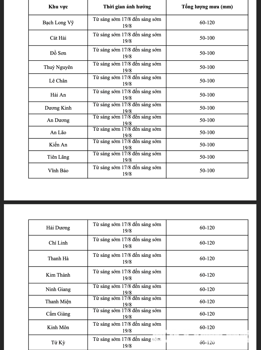
Forecast in the next 24 to 48 hours, due to the influence of the low pressure trough with axis through the North combined with high-altitude wind convergence, the Hai Phong area from early morning of August 17 to early morning of August 19 will have moderate rain, heavy rain, some places will have very heavy rain and thunderstorms. The common rainfall is from 60-120mm. During the thunderstorm, there is a possibility of tornadoes, lightning and strong gusts of wind.
Warning day and night 19/8, Hai Phong area has showers and thunderstorms. Warning of natural disaster risk due to heavy rain level 1.
Heavy rain is forecast to pose a high risk of landslides, especially in areas with steep terrain.
Heavy rain can be accompanied by thunderstorms, tornadoes, lightning, hail and strong winds that can break trees, damage houses, traffic works and infrastructure; cause flooding of crops, make the soil saturated with water, or cause trees to fall and damage crops...
BANKSource: https://baohaiphong.vn/du-bao-ngay-17-8-hai-phong-co-noi-mua-rat-to-va-dong-518334.html


![[Photo] Party and State leaders visit President Ho Chi Minh's Mausoleum and offer incense to commemorate Heroes and Martyrs](https://vphoto.vietnam.vn/thumb/402x226/vietnam/resource/IMAGE/2025/8/17/ca4f4b61522f4945b3715b12ee1ac46c)


Comment (0)