
With the land ownership certificate in hand, you can rest assured of a secure place to live.
Ha Giang 1 Ward, like many other wards and communes in the former Ha Giang province, has the advantage of having completed land surveying and cadastral mapping. According to Mr. Tran Song Ha, Chairman of the People's Committee of Ha Giang 1 Ward: Currently, after surveying and revising the cadastral map, most households have been granted land use rights certificates. Only scattered plots of garden land, rice land, and forest garden land that were previously surveyed and divided have yet to be processed.
Upon review, approximately 400 households remain, particularly in the former two communes of Phuong Thien and Phuong Do. Since the beginning of July 2025, the Ward People's Committee has issued 3 land use right certificates. This work is being expedited to ensure the rights and interests of the people.
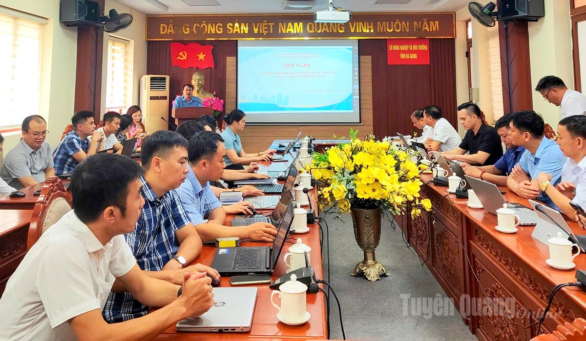 |
| The Department of Agriculture and Environment organized eight training courses for land administration officials in 124 communes and wards across the province on procedures for issuing land use right certificates. |
After more than a month of operating the two-tiered local government system, the task of issuing initial land use right certificates has been initiated in many communes and wards. The earliest steps were taken in My Lam, Minh Xuan, An Tuong communes and some communes in the central area, especially those where many key projects and constructions are underway and resettlement is planned. This task has been prioritized by the communes and wards to meet the needs and aspirations of the people and ensure their rights and interests.
There are still many difficulties.
However, the process of issuing land use right certificates in the province still faces many difficulties. These include a shortage of personnel and a lack of synchronized data, which are persistent problems that did not arise after the implementation of the two-tiered local government system.
According to Mr. Nguyen The He, Vice Chairman of the People's Committee of Khuon Lung commune: After surveying and mapping the cadastral boundaries, the rate of issuing land use right certificates in the commune has reached over 96%. However, at the time of issuing land use right certificates, mainly aerial photographs were used, along with manual surveying methods such as existing photographic films and aerial rectification and enlargement equipment; the surveying and mapping work did not follow a unified coordinate system, and the maps issued for certificates were not surveyed using modern technology, leading to discrepancies compared to the actual situation. Land use changes were not updated in a timely manner, causing many difficulties in local land management, such as: determining the boundaries and scope of land use right certificates, and resolving land disputes…
Through working with relevant agencies, the commune government has requested funding for the updating and construction of the cadastral database, accelerating the development of the cadastral database in Khuon Lung (new) commune to standardize accurate, complete, and consistent information on land parcels, land users, land use rights, and assets attached to land, helping management agencies update and monitor land changes quickly and promptly.
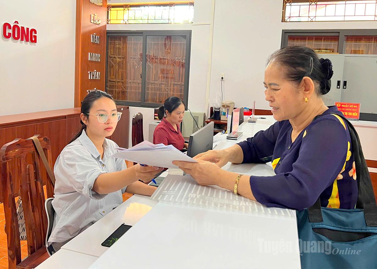 |
| Land registry officials in Thai Hoa commune guide residents through the procedures for registering and obtaining land use rights certificates. |
While the communes and wards of the former Ha Giang province had undergone formal cadastral surveying using the VN 2000 coordinate system, in the former Tuyen Quang province, only the communes of the former Son Duong district had completed cadastral surveying. This created difficulties for state land management in general, and the issuance of land use right certificates in particular, and inadvertently led to an overload in cadastral surveying at the local level.
Ms. Nguyen Thi Lan Anh, a land and agriculture official in Thai Hoa commune, understands this better than anyone. According to data from applications submitted to the Thai Hoa Commune Public Administrative Service Center since the beginning of July, there are over 200 applications for land use right certificates. However, only 2-3 applications have been surveyed. Many cases registered for surveying since the beginning of 2025 have still not been surveyed. Not to mention many cases where people submitted applications but lacked complete documentation or were not sent through the correct channels…
The Center for Resource and Environmental Technology, under the Department of Agriculture and Environment, which is responsible for land surveying, currently has 86 civil servants and employees. Of these, approximately 40 are engaged in land surveying. According to Mr. Nguyen Van Khai, Director of the Center, the overload situation has not only started in July 2025 but has persisted for many years.
In reality, the public's demand for land surveying services is very high, while the unit's workforce is limited. To address this problem, since 2022, the former Department of Natural Resources and Environment has sent a document to all communes, wards, and towns in the province, providing a list of 12 units and businesses with land surveying functions, but this has not yet reduced the pressure on the unit.
Mr. Hoang Duc Tuyen, Director of Tan Ha Surveying and Mapping Company Limited, stated: The company is a business licensed by the former Ministry of Natural Resources and Environment . However, for the past five years, the number of surveying files handled by the company has only been around 20. The reason given is that people are still accustomed to working with units under the direct control of the Department, which are managed by the State.
Furthermore, even after private companies complete the surveys, they still need to have officials from the Department of Agriculture and Environment re-evaluate them, while in reality, this evaluation is not always completed immediately. Therefore, according to Mr. Tuyen, for many years, the unit has almost not performed this function and has had to shift to other activities to ensure revenue.
Overcoming difficulties
“Along with support, guidance, and training, the Department of Agriculture and Environment is proposing to the Ministry of Agriculture and Environment to allocate funds for the implementation of a cadastral surveying and mapping project in the province. The goal is to complete the cadastral surveying and mapping throughout the province by the end of 2028. This is key to reducing pressure and accelerating the process of issuing land use right certificates to localities.” Comrade Vu Viet Hung, Head of the Land Management Sub-Department, Department of Agriculture and Environment |
Empowering the commune level is a sound policy, especially in the context of building a "service-oriented government" which is becoming a consistent direction. When people no longer have to travel through multiple levels to submit documents, the time and costs are significantly reduced. Currently, the merged communes are actively reviewing land resources and coordinating with specialized agencies to compile lists of households eligible for land use right certificates.
As soon as the two-tiered local government system was put into operation, the functional units of the Department of Agriculture and Environment took decisive action, working closely with the commune level to address each task according to their respective functions and responsibilities.
Comrade Nguyen Dinh Tu, Deputy Director of the Department of Agriculture and Environment, said: The unit has established 4 working groups assigned to provide support according to region. Their tasks include guiding local officials on the procedures and processes for carrying out administrative procedures related to land; providing professional advice and resolving difficulties during implementation; supporting the collection, standardization, and updating of land data into the system; and guiding the operation, exploitation, and management of the commune-level land database.
In addition, the working groups also coordinated the review of the implementation of administrative procedures at the local level, promptly identifying shortcomings and inadequacies and proposing solutions to improve the efficiency of administrative procedures and land management at the grassroots level.
In addition, the Department organized 8 training courses for officials and civil servants in 124 communes and wards in the area on the procedures for issuing land use right certificates, the transfer of documents to tax authorities, land registration offices, etc. At the same time, it guided communes and wards to proactively review the entire process of receiving land documents in their localities. Most importantly, it focused on streamlining documents from the initial stage, ensuring they are handled by the correct authority and address, while clearly and publicly informing citizens about the functions, duties, and responsibilities of each unit in the administrative procedure process.
According to Mr. Tu, all training courses are conducted over two days, Saturday and Sunday, ensuring that local officials and civil servants do not experience any disruption to their work.
Simultaneously, a Zalo group titled "Department Leaders and 124 Commune/Ward Chairmen" was also established to ensure two-way communication, shorten processing time, and create a timely and effective feedback channel between the provincial and commune levels.
The Department of Agriculture and Environment has just received a civil servant from the Land Management Department to support the implementation of land-related tasks under the two-tiered local government model for a period of three months, starting from August 15th. The assigned civil servant will guide and support local officials and civil servants in organizing and resolving specialized tasks in the land sector that have been decentralized and delegated. Simultaneously, they will coordinate in resolving difficulties and obstacles; compile reports and advise competent authorities on proposals and recommendations arising during the implementation process.
With decisive solutions, it is hoped that the "bottlenecks" regarding cadastral maps, legal documents, staff capacity, and information technology systems will soon be resolved to effectively carry out new tasks at the commune level in the field of land management. This is because the issuance of land use right certificates not only directly relates to the rights of the people but also serves as a basis for effective land management and the prevention of prolonged disputes and lawsuits.
Nguyen Dat
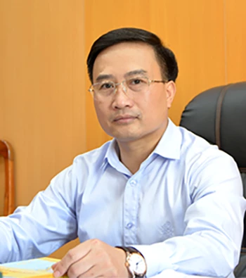 |
| Comrade Pham Manh Duyet Member of the Provincial Party Committee, Director of the Department of Agriculture and Environment |
Support to expedite the process of surveying and issuing land use right certificates.
According to the decentralization and delegation of authority within the two-tiered government system, the People's Committees of communes are responsible for issuing initial land use right certificates to the people. This is an extremely difficult task, especially in the land surveying stage, while the demand for land use right certificates has surged dramatically at this time.
To support local authorities in resolving difficulties and accelerating the process of issuing initial land certificates to citizens, right from the start of the two-tiered government system, the Department of Agriculture and Environment organized professional training focusing on land administration for leaders and specialized staff of commune and ward People's Committees.
The Department has also established a Zalo group with leaders of commune and ward People's Committees to exchange information and provide professional support during the implementation of tasks at the grassroots level. The Department issues documents informing local authorities about surveying centers with sufficient legal basis so that they can coordinate implementation. The Department's team of specialized staff is always ready to support local authorities in carrying out their tasks.
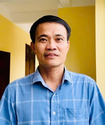 |
| Comrade Pham Van Son Chairman of the People's Committee of Yen Minh Commune |
Strengthen training for commune-level officials and specialists.
As administrative boundaries expand, the demand for land transactions, land use, and land use rights transfers increases, requiring land management to be organized systematically, uniformly, and accurately. In particular, the commune level plays a crucial role as the direct governing body, handling most administrative procedures related to land. Therefore, training for commune-level officials in the field of land management, especially regarding procedures for land registration and issuance of land use rights certificates, is extremely urgent.
Currently, the capacity for implementation at the commune level is limited, and officials lack experience. Therefore, it is necessary to continue training sessions on basic operational procedures such as: knowledge and specific guidance on using software for receiving and processing citizens' applications on the National Public Service Portal; updating and exploiting the centralized cadastral database to serve the registration, issuance of land use certificates, and management of cadastral records in accordance with regulations... This will help improve the effectiveness and efficiency of state management in the field of land; improve the quality of service to citizens and businesses, and ensure that land management is smooth, transparent, and effective.
 |
| Comrade Bui Anh Vu Head of the Economic Department, Lam Binh Commune |
Prioritize synchronized investment in technical infrastructure at the commune level.
The commune level is where administrative procedures are directly handled and services are provided to the people. However, currently, the locality is still facing significant difficulties regarding technical infrastructure and equipment.
The lack of modern equipment such as high-configuration computers, specialized scanners, or efficient data management systems has caused delays and increased effort in processing documents, especially in areas related to land and construction. This not only affects the productivity of officials but also causes inconvenience and reduces public satisfaction.
Therefore, I hope that leaders at all levels will consider and prioritize synchronized investment in technical infrastructure at the commune level. Adequate equipment will help improve management capacity, accelerate the digital transformation process, and most importantly, serve the people more quickly, accurately, and professionally.
 |
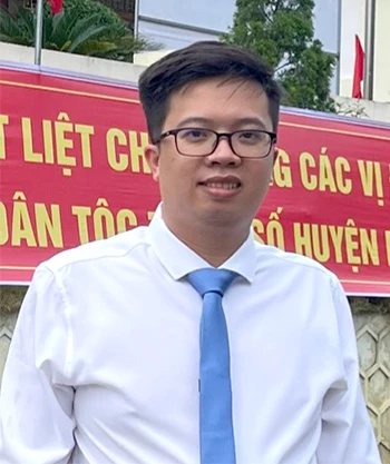
| Ms. Tran Thi Thanh Huong Ha Giang Ward I |
Citizens can easily look up information and submit applications.
I strongly agree with the policy of developing and strongly applying the electronic one-stop system in issuing land use right certificates. Previously, whenever I wanted to handle administrative procedures related to land documents, I had to go to the relevant agencies many times in person, which was cumbersome and time-consuming.
With the electronic one-stop system now in place, we can submit applications online, look up planning information, and track the progress of our applications clearly and transparently, without having to wait long or visit multiple agencies in person as before. This is truly a new step forward in administrative procedure reform, bringing convenience to the people. I hope that the relevant authorities will continue to strengthen guidance and support for the people, especially those unfamiliar with information technology, so that everyone can access and use this service.
The application of a one-stop electronic system for issuing land use right certificates not only saves time, reduces costs, and minimizes inconvenience, but also builds trust among the people. I have high expectations that this model will become increasingly sophisticated, contributing to the development of a modern, people-oriented, and people-serving administration.
Source: https://baotuyenquang.com.vn/xa-hoi/202508/go-kho-cap-so-do-o-xa-b332cfb/


![[Workers' Month 2026] Spreading love on the Vinh - Dong Hoi frontline: Nearly 1 billion VND spent on caring for the lives of workers.](https://vphoto.vietnam.vn/thumb/402x226/vietnam/resource/IMAGE/2026/05/20/1779237885217_img_8650.jpeg)


Comment (0)