
On November 12, at the National Convention Center (Hanoi), a solemn and proud atmosphere enveloped the 80th Anniversary of the Agriculture and Environment Sector, combined with the 1st Patriotic Emulation Congress. In the brilliant space of the Exhibition "80 Years of Achievements of the Agriculture and Environment Sector - Reaching the Green Era", the booth of the Department of Surveying, Mapping and Geographic Information of Vietnam made an impression, attracting special attention from many delegates and visitors.

The exhibition booth of the Department of Surveying, Mapping and Geographic Information of Vietnam tells the journey of transformation from paper maps to Vietnam's 'digital space'. Photo: Nguyen Thuy.
From paper maps to national digital maps
Entering the exhibition, visitors seem to be led through a journey of memories, back in time, back to the early days of the surveying and mapping industry when each point, each boundary of the Fatherland was determined by the sweat and effort of a generation of cadastral engineers clinging to the forests and mountains, recording each border, each coordinate to build the shape of the country. Precious documents about the first surveys after the restoration of peace or the map of demarcation and planting of national border markers evoke emotions and pride.

Administrative map of 34 provinces and cities at scale 1:9,000,000. Photo: Department of Surveying, Mapping and Geographic Information of Vietnam.
It is a journey of nearly 70 years of continuous creativity and dedication, a journey to record every inch of land, every nautical mile of Vietnam accurately and clearly, contributing to affirming the sacred territorial sovereignty of the Fatherland. Those map products not only demonstrate technical level, but also reflect the aspiration to build, protect and develop the country, an aspiration that always burns in the hearts of those who "draw the image of the Fatherland".
New breath of Vietnam's mapping industry
If the first exhibition area is “memory”, recreating the formation and development of the surveying and mapping industry, the central space is “the breath of the times”, where the most modern mapping technologies currently being applied in Vietnam converge.
Visitors were able to directly experience the 3D map model of Vietnam's terrain built using LiDAR (Light Detection and Ranging) technology - an advanced laser scanning system that allows the acquisition of terrain data with centimeter accuracy. Right next to it, the UAV (unmanned aerial vehicle) demonstration attracted attention because of its ability to take geospatial images quickly and flexibly, helping to significantly reduce measurement time and deployment costs.
In particular, GNSS (Global Navigation Satellite System) technology and the national satellite positioning station network were introduced as an important step forward, providing accurate coordinate data for land management, urban planning, transportation, smart agriculture and national defense and security.

Leaders of the Department of Surveying, Mapping and Geographic Information of Vietnam at the Exhibition booth. Photo: Nguyen Thuy.
From these pioneering technologies, the booth of the Vietnam Department of Surveying, Mapping and Geographic Information not only brings the image of an innovative engineering industry, but also tells the story of a Vietnam transforming strongly in the digital age. Interactive digital maps, 3D spatial models and the national geospatial database system are visually presented, helping viewers "touch" the technology and see the digital shape of the country.
The booth also introduced many highly interactive applications such as webGIS maps, geospatial data analysis platforms using artificial intelligence (AI) or automatic geographic object recognition systems from satellite images. These are pioneering technologies that help turn map data from a management tool into a forecasting tool, making smart decisions in fields from agriculture, environment, transportation to defense.
National geospatial data is considered as the “digital resources, breath and vitality” of the country, playing a key role in the management, planning and development of the country. This is also a clear demonstration of the vision of the Vietnamese surveying and mapping industry in creating a modern national spatial data infrastructure to meet the requirements of state management and socio-economic development, ensuring national defense and security and diverse social needs.
Affirming sovereignty, serving national development
A special exhibition corner records the arduous but proud journey of demarcation and border marker planting with China, Laos and Cambodia. Documentary photos, topographic maps and surveying equipment are displayed as "witnesses" of time, demonstrating the key role of the surveying and mapping industry in asserting territorial sovereignty. Not stopping there, the industry also makes an important contribution to the construction of administrative maps and plans to arrange administrative units at all levels, serving the process of streamlining the apparatus and improving the effectiveness of state management.

A special exhibition corner records the arduous but proud journey of national border demarcation and marker planting. Photo: Nguyen Thuy.
In the exhibition space, delegates and visitors clearly felt the innovative spirit of the surveying and mapping industry - an industry that is changing strongly with the development of the country. The products on display such as orthographic maps, digital surface models, point clouds or digital base map systems not only demonstrate the high level of technology mastery but also reflect the industry's long-term vision. Each product is a step forward in the process of digitizing spatial data, contributing to creating a foundation for smart management, sustainable development and digitalization in the future.
The booth of the Department of Surveying, Mapping and Geographic Information of Vietnam, with a harmonious combination of tradition and technology, contributed to honoring the 80-year journey of the Agriculture and Environment sector, where each sector and field shares the same aspiration: Creating green values, towards a prosperous and prosperous Vietnam.
Source: https://nongnghiepmoitruong.vn/hanh-trinh-tu-tam-ban-do-giay-den-khong-gian-so-viet-nam-d783933.html


![[Photo] The "scars" of Da Nang's mountains and forests after storms and floods](https://vphoto.vietnam.vn/thumb/1200x675/vietnam/resource/IMAGE/2025/11/13/1762996564834_sl8-jpg.webp)
![[Photo] Prime Minister Pham Minh Chinh attends a conference to review one year of deploying forces to participate in protecting security and order at the grassroots level.](https://vphoto.vietnam.vn/thumb/1200x675/vietnam/resource/IMAGE/2025/11/12/1762957553775_dsc-2379-jpg.webp)


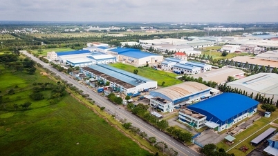
![[Photo] Highways passing through Dong Nai](https://vphoto.vietnam.vn/thumb/1200x675/vietnam/resource/IMAGE/2025/11/12/1762940149627_ndo_br_1-resize-5756-jpg.webp)


![Dong Nai OCOP transition: [Article 3] Linking tourism with OCOP product consumption](https://vphoto.vietnam.vn/thumb/402x226/vietnam/resource/IMAGE/2025/11/10/1762739199309_1324-2740-7_n-162543_981.jpeg)


Comment (0)