
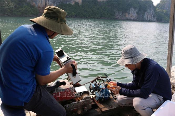
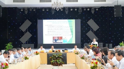
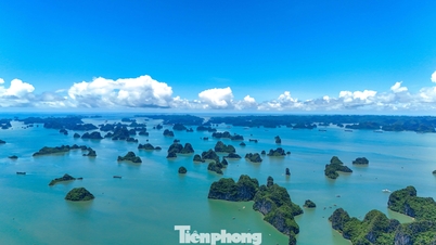
The socio -economic development in recent years has posed many environmental challenges in the Ha Long Bay and Cua Luc area (Quang Ninh province), especially the decline in seawater quality, threatening the endemic marine ecosystem. Meanwhile, traditional monitoring methods such as on-site sampling and analysis have revealed many limitations in terms of cost, time and monitoring range. Faced with this reality, Vietnamese and Polish scientists have coordinated to conduct research on the application of remote sensing and artificial intelligence in water quality monitoring - a modern, cost-effective approach that allows continuous monitoring over a large area. The collaborative research mission coded QTPL01.03/23-24, jointly implemented by the Vietnam Space Center (Vietnam Academy of Science and Technology) and the Polish Institute of Geophysics (Polish Academy of Sciences), helps provide more effective monitoring tools for marine environmental protection in key coastal areas.
Modern approach
According to Dr. Vu Anh Tuan, Deputy General Director of the Vietnam Space Center, who is in charge of the mission, this is the first project in Vietnam to simultaneously use Sentinel-2 satellite data, advanced machine learning algorithms and the GEE platform (Google's cloud computing platform) to model and monitor water quality parameters such as surface temperature, suspended solids, chlorophyll-a and chemical oxygen demand.

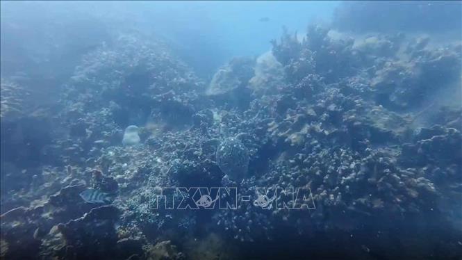
From the model results, the research team has built maps of water quality distribution in space and time, helping to monitor fluctuations and provide early warning of pollution risks in Ha Long Bay and Cua Luc. These are two strategic water areas in Quang Ninh province, not only rich in landscape and ecological values but also playing a key role in the province's economic and tourism development. These maps can be used in water resource management, supporting environmental protection and orienting sustainable development of coastal areas.
Dr. Vu Anh Tuan said that the novelty of the study lies in the synthesis and innovation of remote sensing, artificial intelligence and cloud computing technologies to solve the complex problem of monitoring water quality in Ha Long Bay, while also proposing feasible solutions to overcome the challenge of data shortage and providing in-depth analysis of high practical value. The study established machine learning models and calibrated and tested these models to achieve an accuracy of over 73% and created maps of the distribution of these parameters by season and by annual average. In addition, the study also opened a new approach in the application of remote sensing technology combined with machine learning to monitor water quality, thereby effectively supporting water resource management in key coastal areas.
Towards widespread deployment across the seas
Dr. Vu Anh Tuan added that the study used data from the Sentinel-2 satellite (MSI sensor) in the period 2019 - 2023, combined with actual measurement data from the Department of Natural Resources and Environment of Quang Ninh province and the National Oceanic and Atmospheric Administration (USA) to forecast water quality in the study area. In total, 78 satellite images were processed and analyzed on Google's cloud computing platform. Then, machine learning algorithms such as: Random Forest, Boosted Regression and AdaBoost Regression were applied to predict water quality indicators.
According to Dr. Vu Anh Tuan, the study also identified important spectral bands from Sentinel-2 satellite images, contributing to optimizing machine learning models and minimizing future data collection costs. From the model results, the research team built spatial-temporal water quality distribution maps, helping to monitor fluctuations and provide early warning of pollution risks in Ha Long Bay. These maps can be used in water resource management, supporting environmental protection and orienting sustainable development of coastal areas.
Regarding the next research direction, Dr. Vu Anh Tuan said that in the coming time, the research team proposes to increase the frequency of observation and sampling, and further integrate AI with satellite image data to improve the accuracy of calculation parameters. In particular, expanding the integration of different types of satellite data (currently, the team has tested on 3 types of satellites) will help increase the frequency of observation and not only limit it to 4 water quality parameters, but can be expanded to 5, 6 or more. One of the next important directions is that the team will widely deploy this research throughout Vietnam's seas. Although each sea has its own characteristics, with the same platform and research framework, calculation methods can be adjusted to bring accurate and appropriate results. The ultimate goal is that the team will establish a comprehensive system to continuously monitor and supervise seawater quality parameters. The system will provide important information to planners, giving timely warnings about water pollution, especially the impacts on aquaculture and other marine economic sectors.
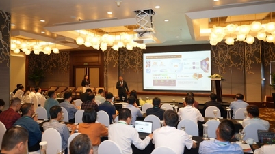
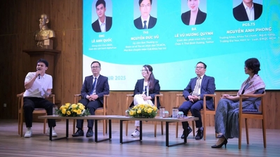
Evaluating the results of this research, Associate Professor, Dr. Pham Quang Vinh, member of the Acceptance Council of the Vietnam Academy of Science and Technology, said that by promoting the application of AI in water environment research, the research team has used new algorithms to process remote sensing data in coastal water environment research. This is a typical example of effective scientific cooperation with a joint publication between the two sides in the SCIE Q1 journal - a high-quality international journal; thereby, contributing to promoting scientific research cooperation between Vietnam and Poland, opening up new development directions for both countries.
Source: https://doanhnghiepvn.vn/cong-nghe/lan-dau-tien-tai-viet-nam-mo-hinh-ai-ket-hop-vien-tham-giam-sat-chat-luong-nuoc-bien/20250619075954419


![[Photo] Closing ceremony of the 18th Congress of Hanoi Party Committee](https://vphoto.vietnam.vn/thumb/1200x675/vietnam/resource/IMAGE/2025/10/17/1760704850107_ndo_br_1-jpg.webp)


![[Photo] Nhan Dan Newspaper launches “Fatherland in the Heart: The Concert Film”](https://vphoto.vietnam.vn/thumb/1200x675/vietnam/resource/IMAGE/2025/10/16/1760622132545_thiet-ke-chua-co-ten-36-png.webp)


Comment (0)