
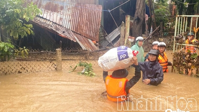
Specifically, the total rainfall from 7:00 a.m. on November 18 to 7:00 a.m. on November 19, in the northern part of the province, the rainfall was generally 100 - 200 mm, in some places higher than 250 mm such as Khanh Hiep 476.2 mm and Van Binh 264.4 mm; in the southern part of the province, the rainfall was generally from 20 - 50 mm, in some places higher. In the sea area of Khanh Hoa and Truong Sa special zone, there were scattered showers and thunderstorms, Northeast wind level 6, gusting level 7 - 8. On rivers in Khanh Hoa province, floods fluctuated at alert level 2 - 3, some rivers above alert level 3.
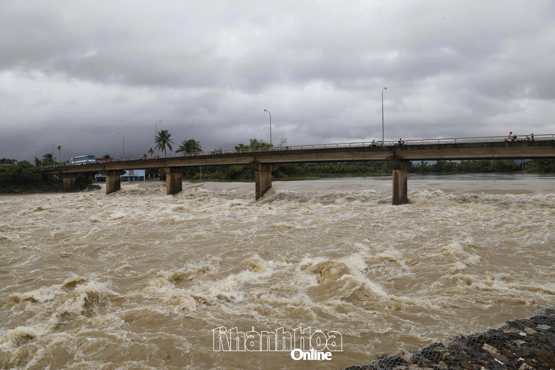 |
| Water level on Cai River Nha Trang is forecast to rise again at noon on November 19. |
Currently, the flood on the rivers has peaked and is slowly receding, except for the Dinh River which is slowly rising. The water level of the Dinh Ninh Hoa River at Duc My station is 16.02m (0.48m below alarm level 2); at Ninh Hoa station it is 5.77m (0.07m above alarm level 3). The water level of the Cai Nha Trang River at Dong Trang station is 8.52m (0.52m above alarm level 1); at Dien Phu station it is 5.67m (0.17m above alarm level 3). The water level of the Cai Phan Rang River at Tan My station is 36.03m (0.53m below alarm level 1); at Phan Rang station it is 2.25m (0.25m below alarm level 1).
From the early morning of November 19 to the early morning of November 21, Khanh Hoa province continued to have moderate rain, heavy rain, and in some places very heavy rain and thunderstorms. Total rainfall in the northern region is generally from 100 - 250mm, in some places over 300mm; in the southern region of the province is generally from 60 - 150mm, in some places higher. During thunderstorms, there is a possibility of tornadoes, lightning and strong gusts of wind. Warning of the risk of heavy rain (>80mm/3h).
Forecast for the day and night of November 19, on rivers in Khanh Hoa province, floods will rise again at noon on November 19, fluctuating at alert level 2 - 3. Floods on Dinh Ninh Hoa river will continue to rise and peak in the next 6 - 12 hours, the flood peak on Dinh Ninh Hoa river at Ninh Hoa station will be 0.2 - 0.5m above alert level 3. On Cai Nha Trang river at Dong Trang hydrological station, it will be approximately alert level 3; at Dien Phu station, it will be 0.8 - 1.1m above alert level 3. On Cai Phan Rang river, the flood peak at Tan My station will be approximately alert level 3; at Phan Rang station, it will be 0.4 - 0.8m below alert level 3.
It is forecasted that in Khanh Hoa coastal waters, waves will be 1 - 3.5m high; offshore, waves will be 3 - 5m high; and in Truong Sa special zone, waves will be 3 - 5m high.
H.D
Source: https://baokhanhhoa.vn/xa-hoi/202511/nuoc-lu-tren-song-cai-nha-trang-len-lai-vao-trua-nay-19-11-03d0f6f/


![[Photo] The Standing Committee of the Organizing Subcommittee serving the 14th National Party Congress meets on information and propaganda work for the Congress.](https://vphoto.vietnam.vn/thumb/1200x675/vietnam/resource/IMAGE/2025/11/19/1763531906775_tieu-ban-phuc-vu-dh-19-11-9302-614-jpg.webp)


Comment (0)