
On the afternoon of August 22, Deputy Prime Minister Tran Hong Ha, Deputy Head of the National Steering Committee for Civil Defense, chaired a meeting with several localities including Hue City, Thanh Hoa, Nghe An, Ha Tinh , and Quang Tri provinces on responding to the tropical depression that could strengthen into storm No. 5 (Kajiki).

Deputy Prime Minister Tran Hong Ha emphasized that storm No. 5 formed quickly from a tropical depression (ATND), has a wide circulation, and is forecast to be complex, requiring ministries, branches, and localities to be highly focused and absolutely not to let any mistakes happen, especially at a time when the whole country is looking forward to celebrating the 80th anniversary of National Day on September 2.
The Deputy Prime Minister requested ministries, branches and localities to urgently review all reservoirs, irrigation and hydroelectric dams. The Ministry of Industry and Trade is responsible for regulating reservoirs under its management, coordinating with the Ministry of Agriculture and Environment to operate the inter-reservoir effectively; along with that, the resettlement plan must be specific: in which cases people will be evacuated, which forces will participate, and where people will be moved.
The Deputy Prime Minister emphasized that in localities, the "four on-the-spot" motto is not only about people and means, but also about having adequate reserves: Food, medicine, drinking water, essential supplies, electricity, and communication. In particular, it is necessary to prepare for each residential area in remote areas, where a commune is sometimes larger than a district in the delta, and is easily isolated when storms and floods occur.
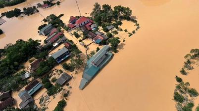
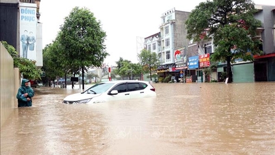
According to the report of the Department of Hydrometeorology (Ministry of Agriculture and Environment), when the storm moves into the East Sea, storm No. 5 moves quickly, at a speed of about 20 km/hour. Around August 24, when the storm moves to the Hoang Sa archipelago, its intensity can reach level 10-11, gusting to level 13-14 and can even get stronger when moving into the Gulf of Tonkin.
Storm No. 5 is forecast to maintain its intensity at level 11-12, with gusts of 16 when it approaches Vietnam’s mainland. On August 25, it will directly affect the central provinces from Thanh Hoa to Hue.
Mr. Hoang Duc Cuong, Deputy Director of the Department of Hydrometeorology, said that the characteristics of storm No. 5 are fast movement, wide circulation, short activity cycle (more than 3 days compared to the average of about 6-7 days), so the intensity increases continuously until it makes landfall. The area of strong winds of level 10 has a radius of about 170 km.
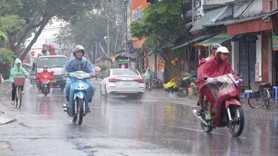
Due to the influence of storm circulation in the northern and central areas of the East Sea (including Hoang Sa special zone), from tomorrow, August 23, there will be strong winds of level 6-7, then increasing to level 8-9.
From August 24, strong winds will increase to level 10-11, gusting to level 13-15, waves 4-7 m high, very rough seas with thunderstorms, whirlwinds and heavy rain that can sink all ships, including large tonnage ships.
Source: https://baolaocai.vn/pho-thu-tuong-yeu-cau-du-bao-chinh-xac-ve-con-bao-so-5-kajiki-post880262.html


![[Photo] Prime Minister Pham Minh Chinh inspects and directs the work of overcoming the consequences of floods after the storm in Thai Nguyen](https://vphoto.vietnam.vn/thumb/1200x675/vietnam/resource/IMAGE/2025/10/08/1759930075451_dsc-9441-jpg.webp)
![[Photo] Prime Minister Pham Minh Chinh attends the World Congress of the International Federation of Freight Forwarders and Transport Associations - FIATA](https://vphoto.vietnam.vn/thumb/1200x675/vietnam/resource/IMAGE/2025/10/08/1759936077106_dsc-0434-jpg.webp)


Comment (0)