
Mr. Le Ngoc Quyen, Deputy Director of the Northern Hydrometeorological Station (Department of Hydrometeorology, Ministry of Natural Resources and Environment ) spoke with the press about the forecast of flood situation in the coming time:
Sir, the Northern region has recently witnessed a historic flood, especially severe in the provinces of Cao Bang , Lang Son, Thai Nguyen, causing severe flooding that has lasted until today (October 8). Can you tell us what is the cause of this rain?
Early on October 6, storm No. 11 made landfall in the Fangcheng area (Boxi province, China), then moved northwest and weakened into a low-pressure area. By the night of October 6, this low-pressure area was located in the mountainous areas of the northern provinces.
From the night of October 6 to the afternoon of October 7, the Southeast wind was strong from the ground up to an altitude of 5,000 m, combined with the Southwest wind from the Bay of Bengal moving up, forming a convergence zone of meridional winds in the mountainous, midland and Viet Bac regions. This phenomenon caused heavy to very heavy rain in the provinces of Cao Bang, Thai Nguyen, and Lang Son .
Rainfall in 36 hours (from 7:00 a.m. on October 6 to 7:00 p.m. on October 7) in Thai Nguyen is generally from 200 - 400 mm, some places are higher such as Dong Hy 596 mm, Nam Hoa 554 mm, Phan Dinh Phung ward 514 mm.
In Cao Bang, rainfall is generally 100 - 200 mm, higher in some places such as Xuan Truong 293 mm, Nguyen Binh 273 mm, Minh Tam 266 mm.
In Lang Son, rainfall is also common at 100-200 mm, some places are larger such as Yen Binh 334 mm, Thien Tan 279 mm.
The total rainfall in 36 hours exceeded the average value of the entire month of October for many years, showing that this was an extremely large amount of rain in a short period of time. Combined with the terrain characteristics of sloping from North to South, narrow and winding riverbeds, the flow was obstructed, causing slow drainage, causing serious flooding in Cao Bang, Thai Nguyen and Lang Son.
Sir, in the coming time, what is the weather and flood forecast in the Northern region?
According to our assessment, in the coming days, the weather in the Northern provinces will gradually improve. There will be sunshine again, showers and thunderstorms will only appear locally in some places, and there is no possibility of widespread heavy rain like in the past days.
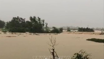
Regarding the flooding situation on the rivers of the North, in the past 24 hours, the water level on rivers such as Gam River, Giang River, Cau River, Thuong River, Trung River, in the provinces of Tuyen Quang, Cao Bang, Thai Nguyen, Lang Son, Bac Ninh all rose, many stations exceeded the alarm level 3. Notably, at Da Phuc station (Cau River), the water level reached 29.9 m, 2.9 m higher than alarm level III, 1.09 m higher than the historical level. At Huu Lung station (Trung River), the water level reached 24.31 m, 5.31 m higher than alarm level 3, 1.77 m higher than the historical level. At Cau Son station (Thuong River), the water level reached 17.97 m, 1.97 m higher than alarm level 3, 0.36 m higher than the historical level.
Currently, the water level on the rivers is gradually decreasing, except for the Trung River in Bac Ninh and Lang Son which is still rising. Tonight and tomorrow morning (October 9), it is forecasted that the flood peak on the Cau River will exceed alert level 3 by about 1 meter; on the Thuong River, it will exceed alert level III by 1.5-2 meters, even exceeding the historical level by about 0.5 meters; on the Trung River (Lang Son), the water level will continue to rise slowly, possibly reaching its peak in the afternoon or evening of October 8.
How will the flooding situation in the northern localities develop, sir?
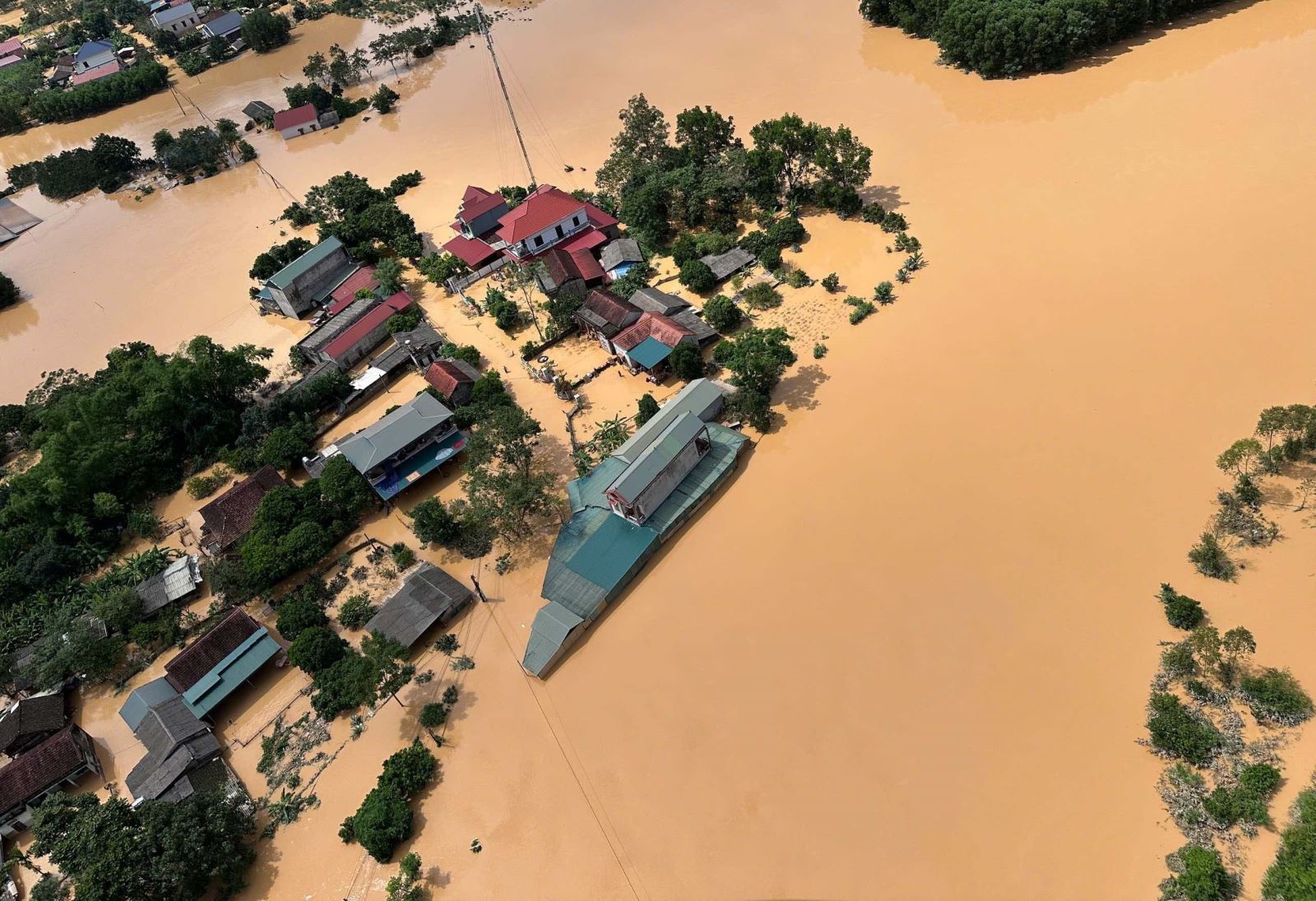
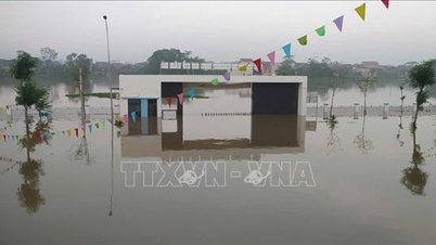
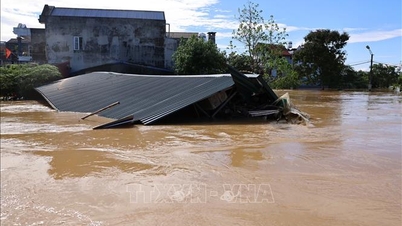
Flooding in Thai Nguyen, Bac Ninh, Lang Son and Cao Bang provinces is still at a high level. In Thai Nguyen, flooding is widespread, affecting more than 20 communes and wards. The flooding is expected to last for the next 3-4 days, and may last longer in some places.
In Bac Ninh, the flooding situation is even more serious, over 30 communes and wards are flooded, the flooding time is also from 3 to 4 days, in some places it lasts longer.
In Cao Bang, the flooding area is smaller, mainly lasting 1-2 days, concentrated along the An Hoa, Thuc Phan, Nung Chi Cao and Tan Giang rivers.
Thank you very much!
Source: https://baotintuc.vn/xa-hoi/ngap-lut-dien-rong-tai-mien-bac-co-the-keo-dai-den-het-tuan-nay-20251008192254519.htm
![[Photo] Prime Minister Pham Minh Chinh attends the World Congress of the International Federation of Freight Forwarders and Transport Associations - FIATA](https://vphoto.vietnam.vn/thumb/1200x675/vietnam/resource/IMAGE/2025/10/08/1759936077106_dsc-0434-jpg.webp)


![[Photo] Prime Minister Pham Minh Chinh inspects and directs the work of overcoming the consequences of floods after the storm in Thai Nguyen](https://vphoto.vietnam.vn/thumb/1200x675/vietnam/resource/IMAGE/2025/10/08/1759930075451_dsc-9441-jpg.webp)


![[Photo] Closing of the 13th Conference of the 13th Party Central Committee](https://vphoto.vietnam.vn/thumb/1200x675/vietnam/resource/IMAGE/2025/10/08/1759893763535_ndo_br_a3-bnd-2504-jpg.webp)


Comment (0)