
Project Overview
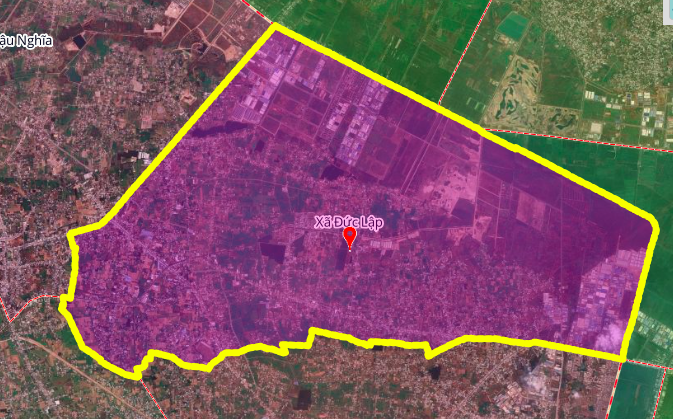
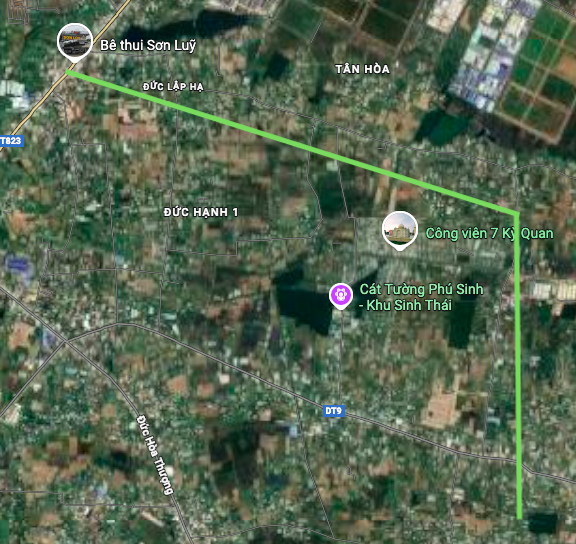
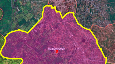
Duc Lap Commune, one of 96 communes and wards of Tay Ninh province, is about to have a new road crossing Provincial Road 9 with a length of about 7.5 km. The starting point of the route connects with Provincial Road 823 near Osaka Lake area, the end point approaches Linh Thanh Pagoda area. Planning information is based on the Land Use Planning Adjustment Map for the period 2021 - 2030 of Duc Hoa district, Long An province.
Geographic location analysis
The geographical location of Duc Lap commune has strategic significance in regional connectivity:
- North: Bordering Tan An Hoi and Cu Chi communes
- East: Bordering Xuan Thoi Son commune
- South: Bordering Vinh Loc, My Hanh and Hoa Khanh communes
- West: Bordering Hoa Khanh and Hau Nghia communes
This planned route will create a new traffic axis, crossing Provincial Road 9 and connecting residential areas and important religious works in the commune.
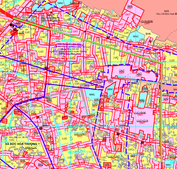
Details of planned route
The route has the following basic technical characteristics:
- Length: About 7.5 km
- Starting point: Intersection with Prefectural Road 823, area near Osaka Lake
- End point: Linh Thanh Pagoda area
- Cross-section location: Provincial Road 9
The route is shown on the planning map with a green line symbol, indicating that this is a key traffic infrastructure project in the 2021-2030 period.
Legal basis and planning
The project is based on the Land Use Planning Adjustment Map for the period 2021 - 2030 of Duc Hoa district, Long An province . This is an important legal basis for the authorities to carry out compensation, site clearance and construction investment.
It should be noted that the illustrated diagrams in the article are drawn relatively based on the official planning map. Detailed technical parameters such as road clearance, cross-section, construction materials will be clarified in the specific investment project preparation phase.
Impact on socio-economic development
The new route will have many positive impacts:
- Traffic connection: Shorten travel distance between areas in the commune and connect with provincial road 823
- Urban development: Create conditions for expanding urban space towards Osaka Lake and the spiritual area of Linh Thanh Pagoda
- Economic Promotion: Enhance market access for agricultural products, goods and services
- Real estate value: Land plots along the planned route have the potential to increase in value when the project is approved and implemented.
Important note for investors and residents
Legal warning: The planning information in this article is for reference only. Residents and investors need to:
- Look up official information from the People's Committee of Tay Ninh province and Duc Hoa district
- Verify the legality of the project at the local land management agency
- Note that the planning may be adjusted during the process of preparing and approving detailed investment projects.
- Land transactions along planned routes need to be cautious, ensuring red books are available and not violating suspended planning.
Conclude
The 7.5km route that cuts through Provincial Road 9 in Duc Lap Commune represents an effort to improve rural transport infrastructure, contribute to regional connectivity and promote local economic development. However, all investment activities must be based on a clear legal basis and official information from competent state agencies.
Source: https://baolamdong.vn/quy-hoach-duong-75-km-o-xa-duc-lap-tay-ninh-vi-tri-va-tac-dong-404374.html
![[Photo] Visit Hung Yen to admire the "wooden masterpiece" pagoda in the heart of the Northern Delta](/_next/image?url=https%3A%2F%2Fvphoto.vietnam.vn%2Fthumb%2F1200x675%2Fvietnam%2Fresource%2FIMAGE%2F2025%2F11%2F21%2F1763716446000_a1-bnd-8471-1769-jpg.webp&w=3840&q=75)

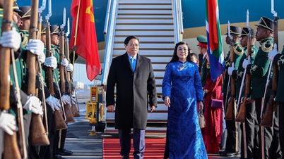
![[Photo] President Luong Cuong receives Speaker of the Korean National Assembly Woo Won Shik](/_next/image?url=https%3A%2F%2Fvphoto.vietnam.vn%2Fthumb%2F1200x675%2Fvietnam%2Fresource%2FIMAGE%2F2025%2F11%2F21%2F1763720046458_ndo_br_1-jpg.webp&w=3840&q=75)
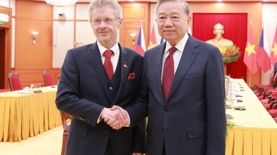
![[Photo] General Secretary To Lam receives President of the Senate of the Czech Republic Milos Vystrcil](/_next/image?url=https%3A%2F%2Fvphoto.vietnam.vn%2Fthumb%2F1200x675%2Fvietnam%2Fresource%2FIMAGE%2F2025%2F11%2F21%2F1763723946294_ndo_br_1-8401-jpg.webp&w=3840&q=75)
![[Photo] National Assembly Chairman Tran Thanh Man holds talks with President of the Senate of the Czech Republic Milos Vystrcil](/_next/image?url=https%3A%2F%2Fvphoto.vietnam.vn%2Fthumb%2F1200x675%2Fvietnam%2Fresource%2FIMAGE%2F2025%2F11%2F21%2F1763715853195_ndo_br_bnd-6440-jpg.webp&w=3840&q=75)


Comment (0)