
After the merger, Da Nang City has an area of nearly 12,000km², becoming the largest centrally-governed city in the country, with a population of more than 3 million people.
Along with the Prime Minister's approval of the planning for the 2021-2030 period, with a vision to 2050 for Da Nang and Quang Nam , the current requirement is to soon connect and unify urban spatial planning to form new growth poles, sustainable development, synchronous and with identity.
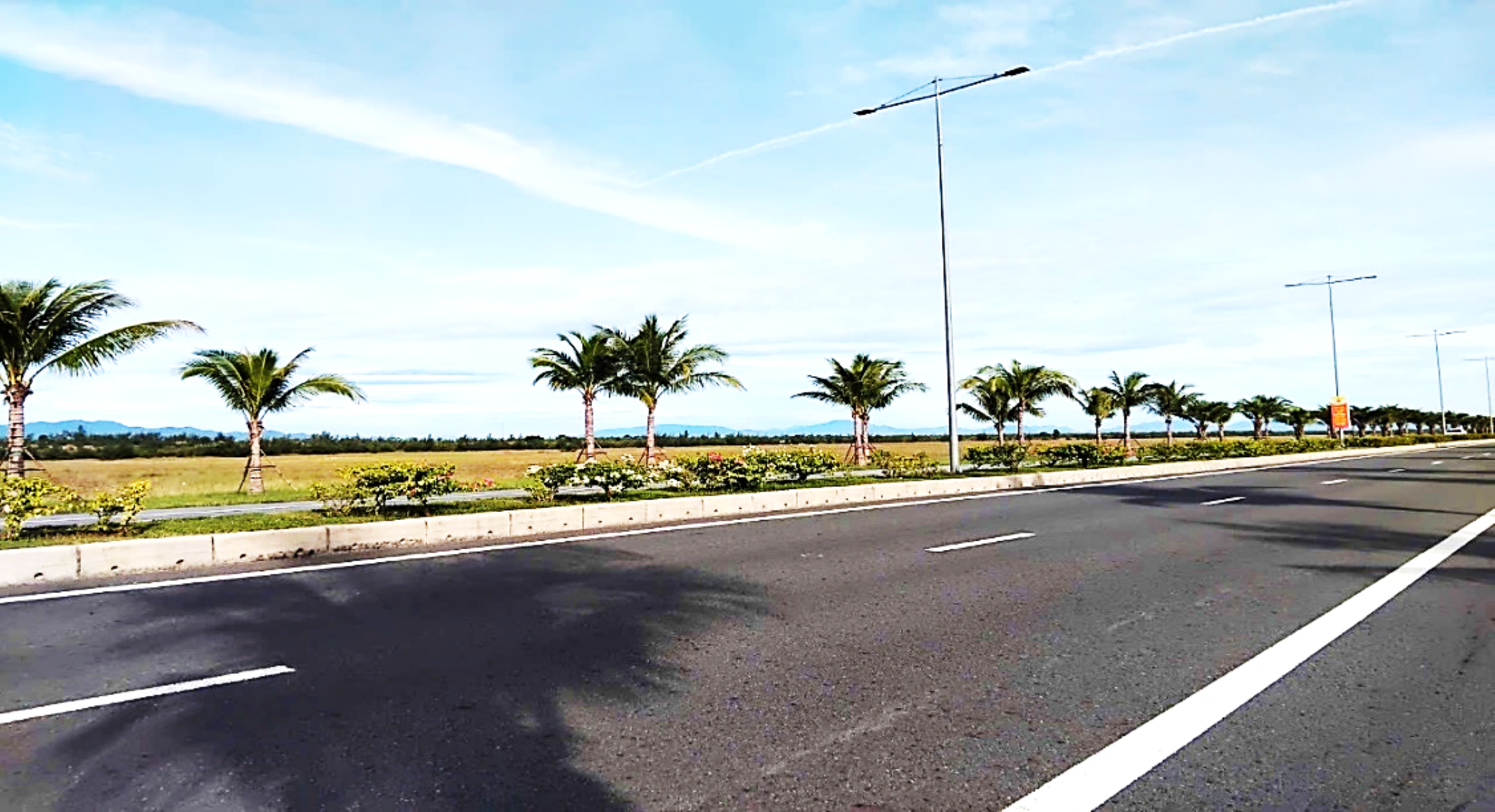
South direction - great room for development
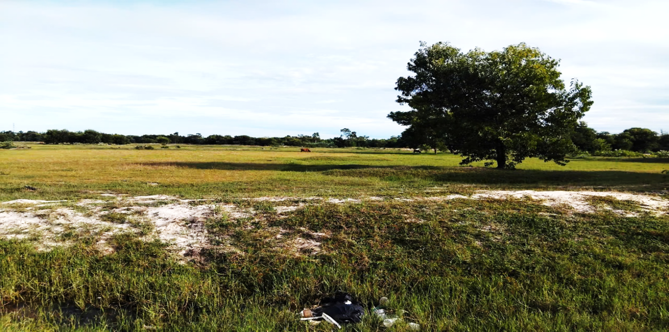
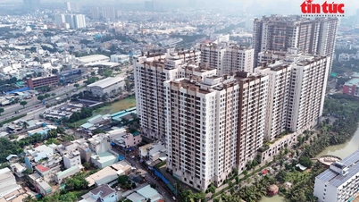
According to the master plan, Da Nang City is oriented to develop according to 3 typical urban areas and ecological zones including 12 sub-zones. In which, the central area is oriented towards a compact urban model, reducing construction density and adding urban utilities, controlling coastal corridors, adapting to climate change and rising sea levels. However, reality shows that the central area is currently under great pressure from population, infrastructure and public services.
In the old core area, the area of Hai Chau, Hoa Cuong, Thanh Khe, An Hai wards - the average population density ranges from 7,000 to more than 25,000 people/km². Thanh Khe ward alone reaches the highest level with 25,400 people/km², while Hai Chau ward is about 17,300 people/km².
Dense population concentration in a small space leads to a series of consequences: lack of green space, environmental pollution, traffic congestion, risk of fire and explosion, and overloaded technical infrastructure.
Therefore, Da Nang needs to soon restructure urban space, develop new growth poles to reduce the load on the core area, and at the same time create room for development in the long term.
In the picture of urban expansion, the southern direction stretching from Dien Ban to Nui Thanh is considered the most feasible and sustainable option. This area has a large land fund, stable geology, low population density, favorable for compensation, site clearance and construction of new urban areas, industrial parks, high-tech parks as well as tourism projects along Vo Chi Cong route.
This is a rare advantage to form a “Southern metropolis”, supplementing and sharing functions with the central core area. In fact, the South Da Nang – North Quang Nam region has seen the emergence of many large projects such as Dien Nam and Dien Ngoc urban areas, Tam Hiep and Tam Thang industrial parks, and a chain of coastal resorts extending to Hoi An.
However, the development is still fragmented, lacking connectivity and not guided by a common master plan. The coordination of the Da Nang - Quang Nam planning will help form a continuous industrial and tourist urban corridor, creating a new driving force for the whole region.
The Southern region also possesses a convenient infrastructure system connecting with the Da Nang - Quang Ngai expressway, national highways 40B, 14E, 14G and coastal routes, creating a complete traffic network.
This area is directly adjacent to Chu Lai Open Economic Zone, a national industrial, logistics and service center, where seaports, Truong Hai automobile supply chains and other strategic infrastructure projects converge.
At the same time, this area has advantages in natural landscape with long coastline, rivers, streams, mountains and hills, rich potential for developing eco-tourism and green urban areas.
If effectively connected with Hoi An ancient town, My Son sanctuary and a chain of traditional craft villages, the Southern region can become a "golden triangle" of culture, tourism and modern urban areas of the Central region.
Urban development to the South is not only a strategy for population dispersion, but also opens a new urban economic corridor, connecting from Da Nang to Chu Lai - Quang Ngai, connecting with the Central Highlands and the East - West economic corridor. This is the inevitable development direction of a dynamic urban area in the Central Highlands region.
Strategic solutions to realize unified planning
To promote advantages after the merger, Da Nang needs to focus on reviewing, adjusting and building a unified plan for the entire city, ensuring regional connectivity and long-term vision.
Inviting international experts and consultants to participate in research and propose suitable development models is necessary to create a foundation for an urban area with its own identity, which is dynamic, modern and the most livable in the region.
Along with that is the development of dynamic infrastructure. It is necessary to invest in upgrading Chu Lai airport to meet 4F international standards to share traffic with Da Nang airport; at the same time, planning the Chu Lai, Ky Ha, and Truong Hai seaport system to become the region's strategic logistics and freight transit centers.
Research on the Chu Lai – Hoi An – Da Nang urban railway line is also urgently needed, not only to solve traffic problems but also to expand space for coastal tourism and industrial development.
Another direction is to form a new financial and commercial pole in the South, gradually moving some economic activities out of the core area. The financial center and free trade zone can be linked to Chu Lai and Truong Hai industrial park, forming a sustainable service chain, reducing pressure on the central area.
Many large cities such as Seoul expanding to Incheon or Tokyo developing strongly in Yokohama are clear proof of the effectiveness of this development direction.
Da Nang also needs to promote the connection between urban - education - industry. Relocating and completing Da Nang University Village to the Dien Ban - Hoa Quy intersection area, connecting with the Chu Lai automobile complex, will form an ecosystem of training, research, production, creating high-quality human resources in the fields of mechanics, technology and automation.
Along with that, the city needs to remove obstacles for housing projects, residential areas, and urban areas located outside economic zones and industrial parks to soon create a foundation to attract investment and develop new urban areas.
In addition to infrastructure and economic development, social security factors should also be given top priority. Excess offices after reorganization can be converted into social housing, worker housing, both cost-saving and ensuring humaneness in urban development.
At the same time, the city needs to focus on planning green spaces, parks, cultural houses, schools, and medical stations to help new residents stabilize their lives and stay long-term.
In particular, it is necessary to promote the application of technology in smart urban management: from traffic, lighting, drainage to waste treatment, to improve operational efficiency and quality of life for people. The new urban area in the South has the advantage of being planned from the beginning, avoiding the shortcomings of the already overloaded central area.
Expanding the urban area to the South is not only an urgent requirement to reduce infrastructure pressure, but also a strategic vision to open up a dynamic, connected "open city" that harmonizes industry, services, tourism, and education.
When the planning is synchronized, the Central strip of land from Da Nang to Chu Lai will not only be a new development area, but also an important growth pole in the national development strategy, where the creative spirit, identity and aspirations of the most dynamic coastal city in Vietnam converge.
Source: https://daibieunhandan.vn/som-khop-noi-quy-hoach-da-nang-sau-hop-nhat-de-hinh-thanh-cuc-tang-truong-moi-10389688.html
![[Photo] Prime Minister Pham Minh Chinh chairs the Conference to deploy the National Target Program on Drug Prevention and Control until 2030](https://vphoto.vietnam.vn/thumb/1200x675/vietnam/resource/IMAGE/2025/10/09/1759990393779_dsc-0495-jpg.webp)

![[Photo] Prime Minister Pham Minh Chinh chairs a meeting of the Government Standing Committee on overcoming the consequences of natural disasters after storm No. 11](https://vphoto.vietnam.vn/thumb/1200x675/vietnam/resource/IMAGE/2025/10/09/1759997894015_dsc-0591-jpg.webp)


Comment (0)