
Myanmar lies on the boundary between the Indian Plate and the Eurasian Plate, where the two plates interact intensely. The Indian Plate is constantly moving northward at a rate of approximately 5 cm per year, directly colliding with the Eurasian Plate.
This movement creates immense pressure, deforming the Earth's crust and forming large faults in the region. When the pressure, accumulated over decades or centuries, reaches a limit, the energy is released suddenly, causing earthquakes.
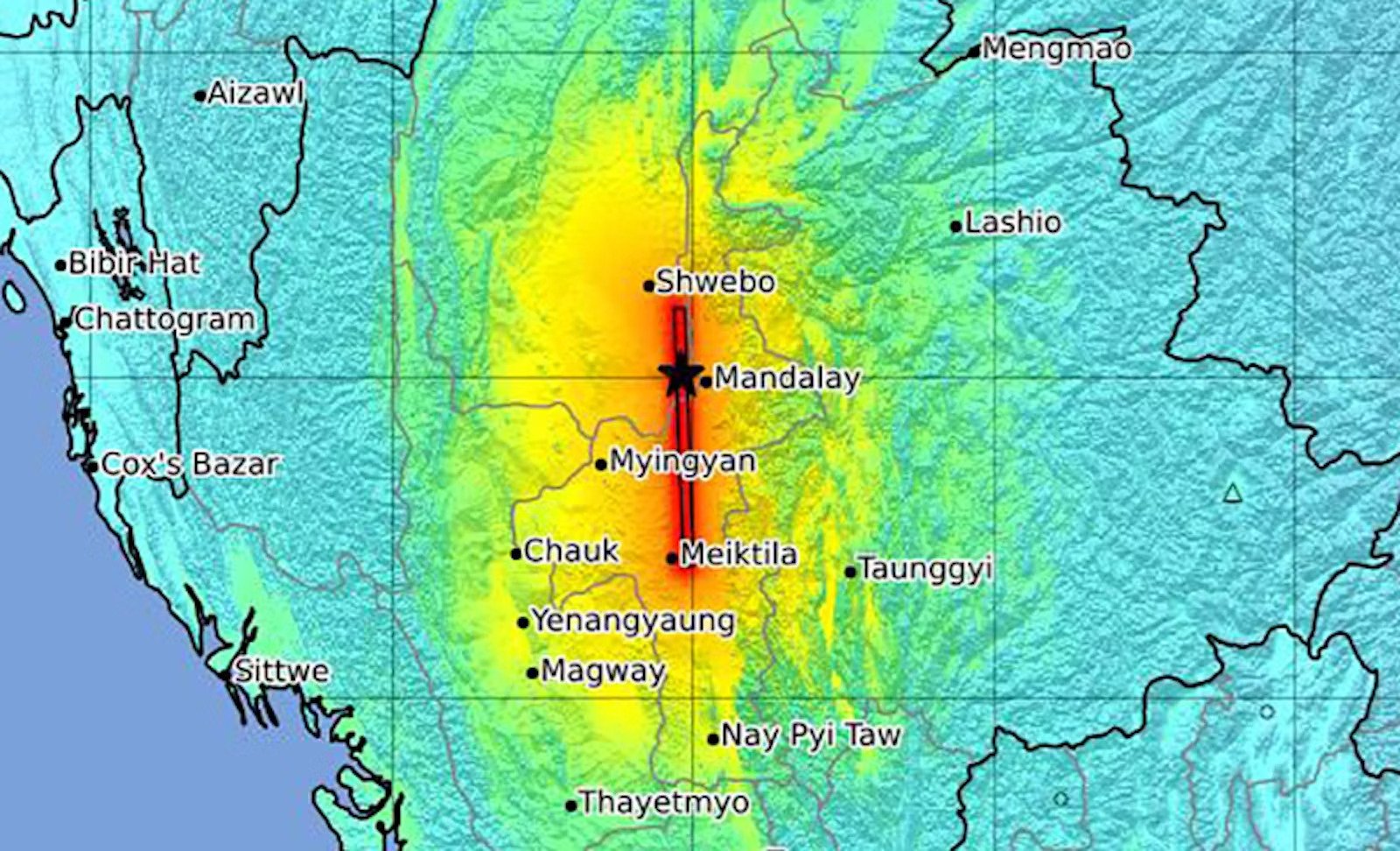
The map shows the extent of the earthquake's impact in Myanmar. The red and orange areas represent the most severely affected regions, concentrated along the main fault line. The black star on the map indicates the epicenter of the earthquake, near the city of Mandalay. Photo: USGS
The latest earthquake had its epicenter near the Sagaing Fault, one of the largest faults in Southeast Asia. This fault stretches approximately 1,200 km from north to south in Myanmar, passing through major cities such as Mandalay and Yangon.
This is a horizontal strike-slip fault, where two landmasses move horizontally. The sudden displacement along this fault was the direct cause of the recent earthquake.
Numerous geological studies have indicated that the Sagaing Fault has a sliding rate of approximately 18-20 mm per year, suggesting that the area is at high risk of strong earthquakes. Historically, Myanmar has experienced several devastating earthquakes linked to this fault, most notably the 7.3 magnitude earthquake in Bago in 1930, which killed at least 550 people.
The earthquake on March 28th was approximately 10 km deep, classifying it as a shallow earthquake. Earthquakes at this depth typically have a wide-ranging impact because the energy is not absorbed as much as it travels through the Earth's crust, resulting in strong tremors on the surface. This is why not only Myanmar but also many more distant areas, including Thailand, Vietnam, and China, felt intense shaking.
Experts warn that following the main earthquake, the area may continue to experience strong aftershocks in the coming days or weeks. These aftershocks could cause landslides, further damage weak structures, and affect people's lives.
Ngoc Anh (based on USGS, AJ, Nautil)
Source: https://www.congluan.vn/tai-sao-tran-dong-dat-o-myanmar-lai-manh-va-rong-lon-den-vay-post340576.html


![[Photo] Prime Minister Pham Minh Chinh presides over a meeting on private sector economic development.](/_next/image?url=https%3A%2F%2Fvphoto.vietnam.vn%2Fthumb%2F1200x675%2Fvietnam%2Fresource%2FIMAGE%2F2025%2F12%2F20%2F1766237501876_thiet-ke-chua-co-ten-40-png.webp&w=3840&q=75)
![[Photo] Prime Minister Pham Minh Chinh presides over the conference announcing the establishment of the International Finance Centre in Vietnam.](/_next/image?url=https%3A%2F%2Fvphoto.vietnam.vn%2Fthumb%2F1200x675%2Fvietnam%2Fresource%2FIMAGE%2F2025%2F12%2F21%2F1766309817714_ndo_br_dsc-3400-jpg.webp&w=3840&q=75)


Comment (0)