
Infrastructure leads the way for economic development.
Over the years, along with the identification of key economic zones, industrial parks, urban areas, and service centers, transportation infrastructure in Lam Dong, Dak Nong , and the former Binh Thuan has been gradually improved through investment. For example, in Binh Thuan, with the North-South expressway, National Highway 1A, seaports, airports, and coastal connecting routes, the basic transportation network will be fully completed in about 5 years, capable of supporting the existing development space.
However, with the merger to form the new Lam Dong province, the infrastructure challenge shifted to a much larger one, requiring connectivity across a much larger area, stretching from the highlands to the coast. Therefore, what was already relatively complete in the former Binh Thuan, Dak Nong, and Lam Dong provinces became part of this larger network, demanding a completely different approach to connectivity.
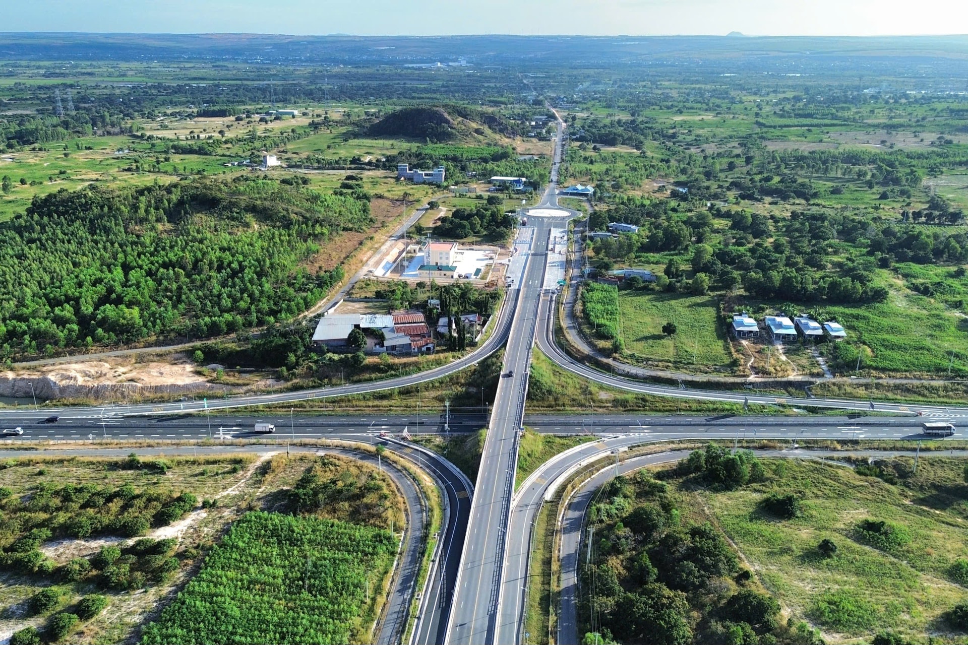
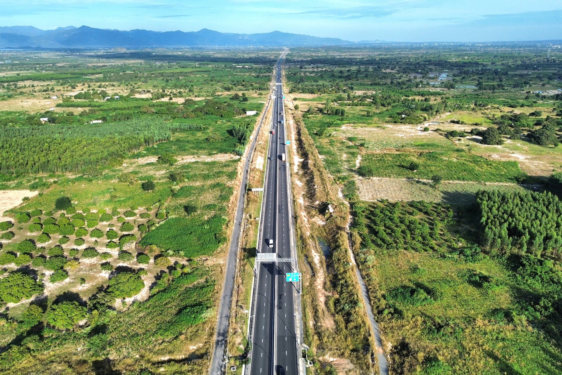
After the merger, the new Lam Dong province has an area of over 24,233 km², encompassing plateaus, forests, and the sea. Theoretically, this is a rare strategic advantage. However, in reality, the larger the area, the higher the connectivity costs, and the greater the risk of fragmented development. Looking at the current transportation landscape, the province has nearly 20,900 km of roads, 10 national highways totaling approximately 1,469 km, over 270 km of railways, 2 airports, and a system of seaports and fishing ports. While these figures are significant, the crucial point is that this infrastructure has not yet truly formed a unified development network, lacking the capacity to lead inter-regional economic value chains.
In reality, many large-scale agricultural production areas remain far from strategic transportation routes; logistics development is slow; and inter-regional tourism has not yet formed distinct products. In other words, roads exist, but they haven't "opened up" the space for development commensurate with the potential.
Based on that reality, Lam Dong province is shifting to a new approach, investing strategically in transportation infrastructure to lead development. In the coming period, Lam Dong province will implement a series of large projects, from upgrading Lien Khuong Airport to international 4E standards, to the Tan Phu - Bao Loc, Bao Loc - Lien Khuong, Gia Nghia - Chon Thanh, Da Lat - Nha Trang, Lien Khuong - Buon Ma Thuot expressways; the Binh Thuan - Lam Dong - Dak Nong expressway and the Gia Nghia - Bao Lam arterial road. Towards the coast, Son My seaport and connecting routes from the expressways and the planned high-speed rail to Phan Thiet will be implemented. These are identified as crucial links in the regional logistics chain. Notably, these projects are situated within a comprehensive network linking the highlands, the sea, and the border, in line with the spirit of restructuring development space after the merger.
The reality in Luong Son commune clearly demonstrates how infrastructure is transforming the local landscape. With approximately 109 km of major transportation routes, it has become a key hub connecting the North-South Expressway, National Highway 1A, National Highway 28B, Provincial Road 715, and the North-South railway line. Mr. Le Dang Phap, Vice Chairman of the Luong Son Commune People's Committee, stated that transportation infrastructure not only facilitates travel but is also directly enhancing land value, production, and investment attraction. Each newly opened road creates new development opportunities for the locality.
Transportation networks create "position poles".
In the post-merger development landscape, transportation infrastructure is no longer just about connecting point A to point B. According to Dr. Hoang Huu Phe, a planning and architecture expert and Director of R&D Consultants, infrastructure is the decisive factor in whether a region can become a center attracting capital, labor, and opportunities. When Lam Dong invests in new transportation routes, the province aims not only to improve traffic flow but also to create "strategic hubs," places where economic momentum and investment attraction converge.
Mr. Hoang Huu Phe analyzed that expressways, highland corridors, or coastal routes are tools to simultaneously unlock both tangible resources such as agricultural products, logistics, and minerals, and intangible resources such as the Da Lat tourism brand, landscape value, and regional identity. These roads change the value of the space. Land is activated, production is brought closer to the market, and new investment cycles begin. The core principle is to view transportation as part of an ecosystem that develops in parallel with land use planning, energy, and the environment.
The fundamental difference in Lam Dong after the merger lies in the fact that, for the first time, forests, plateaus, and the sea are placed within a single administrative entity. This space is no longer divided by geographical boundaries, opening up the possibility of integrated development from mountainous forest ecosystems to the sea. This necessitates a higher-level approach to infrastructure development, moving beyond simply adding highways, airports, or seaports, and instead focusing on redesigning the entire inter-regional value chain within a unified space.
Within that structure, each new route not only shortens geographical distances but also reorganizes the flow of agricultural products, processing industries, tourism, logistics, and green economic sectors. The plateau and the sea become mutually supportive links, creating a synergistic advantage that Lam Dong could hardly have fully achieved without the merger.
Mergers, therefore, are not merely about expanding administrative boundaries. They open up a new development space, large enough for long-term planning and deep enough to attract national and international projects. From existing routes to those being outlined in the planning, it is clear that Lam Dong is proactively paving the way and reorganizing its development space.
Opening up new routes is not just about building roads. It's about how Lam Dong chooses its position within the national development structure. When strategic transportation axes are synchronously connected, the province will not only be a destination, but will gradually become a transit point, a convergence point between the highlands and the sea, between resources and a modern economy.
Source: https://baolamdong.vn/tam-nhin-khai-lo-421924.html


Comment (0)