
This is an urgent solution to improve the effectiveness of forest resource protection, and is also an important step in sustainable forestry development and adaptation to climate change.
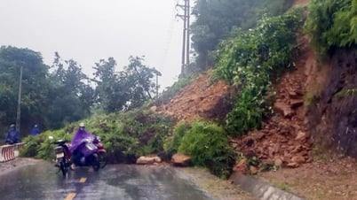
According to statistics, Phu Tho province has a total natural land area of more than 353,000 hectares, of which forest land and forestry land account for about 170,000 hectares. Cam Khe district, one of the key areas of the province, currently manages more than 6,700 hectares of forest and forestry land, including more than 728 hectares of natural forest, more than 1,200 hectares of protective forest and nearly 4,000 hectares of production forest. Previously, forest rangers mainly relied on paper maps and manual measurement methods to determine forest boundaries, inventory resources and handle violations. This method revealed many limitations, was inaccurate, time-consuming, and difficult to convince people to violate. However, everything changed when digital technology was put into use. “The application of handheld GPS devices and satellite images has helped us clearly identify forest boundaries, conveniently measure and quickly update forest developments. Satellite data helps detect unusual changes early, supporting us to proactively handle situations,” said Mr. Luong Anh Tuan, a ranger at Cam Khe Forest Protection Department. Currently, Cam Khe Forest Protection Department is exploiting software such as MapInfo, Global Mapper, ArcGIS Earth and the FRMS application - software for monitoring forest and forestry land developments. These tools are installed on computers and smartphones, allowing staff to access and monitor data directly from the field. Deputy Head of Cam Khe Forest Protection Department Nguyen Thanh Tuan said: “We can determine coordinates, travel distances and create accurate forest inspection maps for each plot.” Despite many positive results, the digital transformation process in forestry work in Phu Tho province still faces many challenges: Unusual weather and prolonged drought have increased the risk of forest fires. The review and marking of the boundaries of three types of forests (special-use, protection, production) according to Decision No. 3813/QD-UBND dated December 28, 2018 of the Provincial People's Committee has not been fully implemented, affecting forest planning and protection. In addition, some forestry development policies are not synchronous and lack practicality, which are also major barriers. However, in the context of many difficulties, the application of technology to forestry work in Phu Tho has brought about clear results. Head of the Phu Tho Provincial Forest Protection Department Nguyen Manh Hung said that thanks to the application of technology, the work of monitoring forest changes has been carried out more accurately and promptly. The handling of violations has become faster and in accordance with the law. Early warnings of forest fire and flash flood risks are effectively implemented through risk maps and weather data. Currently, the unit is operating four specialized software, including: FRMS Desktop, FRMS Mobile, wildlife facility management software and Webbase agricultural data management system. Up to now, all are effective in collecting, analyzing and managing forest data. In addition, the province has coordinated with Viettel Group - Phu Tho Branch to deploy a forest fire warning system via automatic SMS messages, sent directly to provincial leaders, departments, branches and forces at the grassroots level. Thanks to the use of FRMS fire warning software, forest rangers can analyze weather index, humidity, temperature, fire risk and direct response in a short time. Propaganda work has also been innovated in a multi-channel direction: from radio, billboards, slogans to social networks, websites; helps to quickly spread forest protection information to every village and household living near the forest. In addition, the use of FRMS Mobile on smartphones helps forest rangers record the current status of forests in the field, synchronize data instantly to the server, replace devices such as GPS cameras, compasses, paper maps, etc., helping to significantly improve statistics, planning and quick response to emergency situations. In particular, the promotion of key forestry products such as acacia wood, medicinal plants, bamboo products, etc. through digital platforms has opened up a new direction in forest economic development, helping people in forestry areas have more jobs and stable income. In order to continue to effectively implement Resolution No. 36-NQ/TW of the Politburo on digital economic development, the Phu Tho Provincial Forest Protection Department has identified the key task in the coming time as focusing on completing the digital database of the forestry sector, modernizing the forest management process towards transparency, accuracy and inter-sectoral connectivity. Head of Phu Tho Provincial Forest Protection Department Nguyen Manh Hung affirmed: “We will continue to promote training and fostering of information technology knowledge for forest rangers at all levels; upgrade software systems, apply remote sensing images in forest fire prevention, fighting and detecting violations. At the same time, closely coordinate with local authorities to raise public awareness in forest protection. With a methodical and drastic approach and the participation of the entire political system, the application of technology in forest management and protection in Phu Tho is gradually forming a solid foundation. This is a clear demonstration of the correct policy of digital transformation in the field of agriculture and forestry, bringing Phu Tho forestry to sustainable development, so that the "green lung" will always be green".
Source: https://nhandan.vn/tro-thu-dac-luc-bao-ve-la-phoi-xanh-o-phu-tho-post888480.html


![[Photo] Central Propaganda and Mass Mobilization Department meets with exemplary journalists](https://vphoto.vietnam.vn/thumb/1200x675/vietnam/resource/IMAGE/2025/6/21/9509840458074c03a5831541450d39f8)


![[Maritime News] Wan Hai Lines invests $150 million to buy 48,000 containers](https://vphoto.vietnam.vn/thumb/402x226/vietnam/resource/IMAGE/2025/6/20/c945a62aff624b4bb5c25e67e9bcc1cb)


Comment (0)