

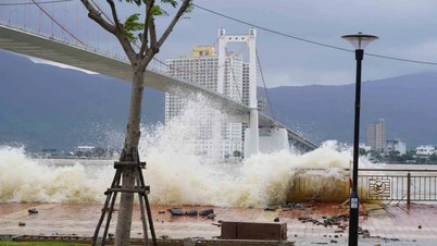
Storm No. 12 is currently in the sea north of Hoang Sa special zone, with a level 9-10 intensity, equivalent to wind speeds of 75-102km/h, gusting to level 12.
It is forecasted that in the next 24 hours, the storm will move west-southwest and gradually weaken. By 4pm on October 22, the storm's intensity will have decreased to level 8, gusting to level 10, while over the Quang Tri - Quang Ngai sea area. After that, the storm will continue to weaken into a tropical depression before making landfall.
The sea area from Quang Tri to Quang Ngai has strong winds of level 6, increasing to level 7 tomorrow morning. The area near the storm's eye has level 8, gusting to level 10, rough seas.
From this afternoon, the circulation of storm No. 12 combined with the strong cold air will also cause the coastal mainland from Quang Tri to Da Nang to have winds gradually increasing to level 6, sometimes level 7, gusting to level 8-9. Heavy rain will appear from this afternoon and last for many days.
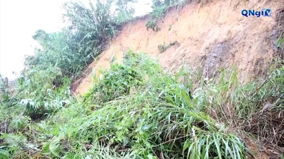
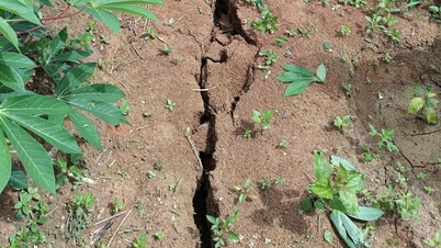
According to forecasts, in the coming days, the provinces in the Central region will have very heavy rain with rainfall up to 500-700mm, even higher in some places. Heavy rain will be concentrated in Quang Tri, Hue, Da Nang, Quang Ngai. The Central region is likely to experience a large-scale flood, especially in the river basin from South Quang Tri to Quang Ngai, exceeding the level 3 warning, equivalent to or even higher than the large flood in November 2017.
This flood, the rain appears with high intensity of 200-300mm/3 hours, very high risk of urban flooding, flash floods and landslides. The rain does not stop for 1-2 days but lasts for many days so the risk of flooding and widespread flooding is something to note.
Source: https://quangngaitv.vn/tu-22-23-10-mien-trung-co-the-xuat-hien-lu-lon-tuong-duong-nam-2017-6508999.html
![[Photo] Prime Minister Pham Minh Chinh chairs meeting on nuclear power plant construction](https://vphoto.vietnam.vn/thumb/1200x675/vietnam/resource/IMAGE/2025/10/22/1761137852450_dsc-9299-jpg.webp)
![[Photo] Da Nang: Shock forces protect people's lives and property from natural disasters](https://vphoto.vietnam.vn/thumb/1200x675/vietnam/resource/IMAGE/2025/10/22/1761145662726_ndo_tr_z7144555003331-7912dd3d47479764c3df11043a705f22-3095-jpg.webp)


![[Photo] Award Ceremony of the Political Contest on Protecting the Party's Ideological Foundation](https://vphoto.vietnam.vn/thumb/1200x675/vietnam/resource/IMAGE/2025/10/22/1761151665557_giaia-jpg.webp)


Comment (0)