
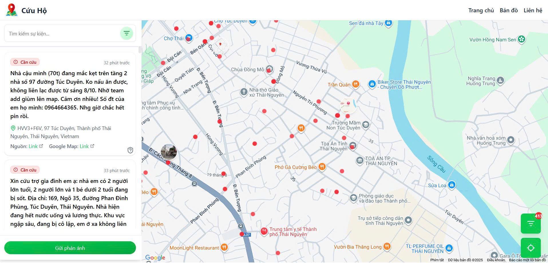
Heatmap website interface to clearly show areas with many people needing emergency assistance - Screenshot
People and authorities can click on the link: https://thongtincuuho.org/ to request rescue support and functional units and rescue teams can refer to the information to coordinate timely response.
From traffic app to rescue map
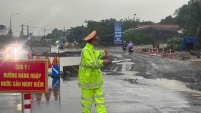
The recent severe flooding paralyzed many major roads in Hanoi , causing traffic jams for hours, making Tat Huan, a programmer with nearly 10 years of experience in the technology field, ponder about solutions for the people.

Tu Tat Huan (left) and Nguyen Thi Mai Anh (right) are co-founders of a website that collects and compiles rescue requests from people in the flood zone - Photo: NVCC
“When I was stuck in traffic for 5 hours on Tran Duy Hung Street (Hanoi), I sat in my car and thought: why not make a tool to visualize the traffic situation so that people know where to go and where to avoid?”, Tat Huan shared.
While sitting in the car, helpless in the face of traffic jams due to flooding, Huan turned on his computer and began programming the first version of an application called vntraffic.app, an interactive map that shows traffic conditions in real time, for 5 hours during a traffic jam.
Before, whenever Tat Huan encountered traffic jams while driving, his wife often turned on the radio to listen to the news. But the time of broadcasting information about the area he was passing through was not always right. This made him think of creating an application that could synthesize and display the latest traffic events, right when the user needed it.
“We understand that rescue work is not as simple as reading a message and rushing to help. Therefore, our goal is to build a HeatMap to clearly show areas with many people in need of emergency assistance. This will help authorities and rescue teams easily identify large affected areas and coordinate rescue efforts more effectively,” Huan shared.
--- Advertisement ---
People in need of relief leave comments on reputable fanpages and groups.
At 11pm on October 7, Mai Anh (Huan's friend) who is currently working in the field of artificial intelligence applications texted Huan to inform him that Thai Nguyen was being seriously flooded, hundreds of people were calling for help because of rising floodwaters.
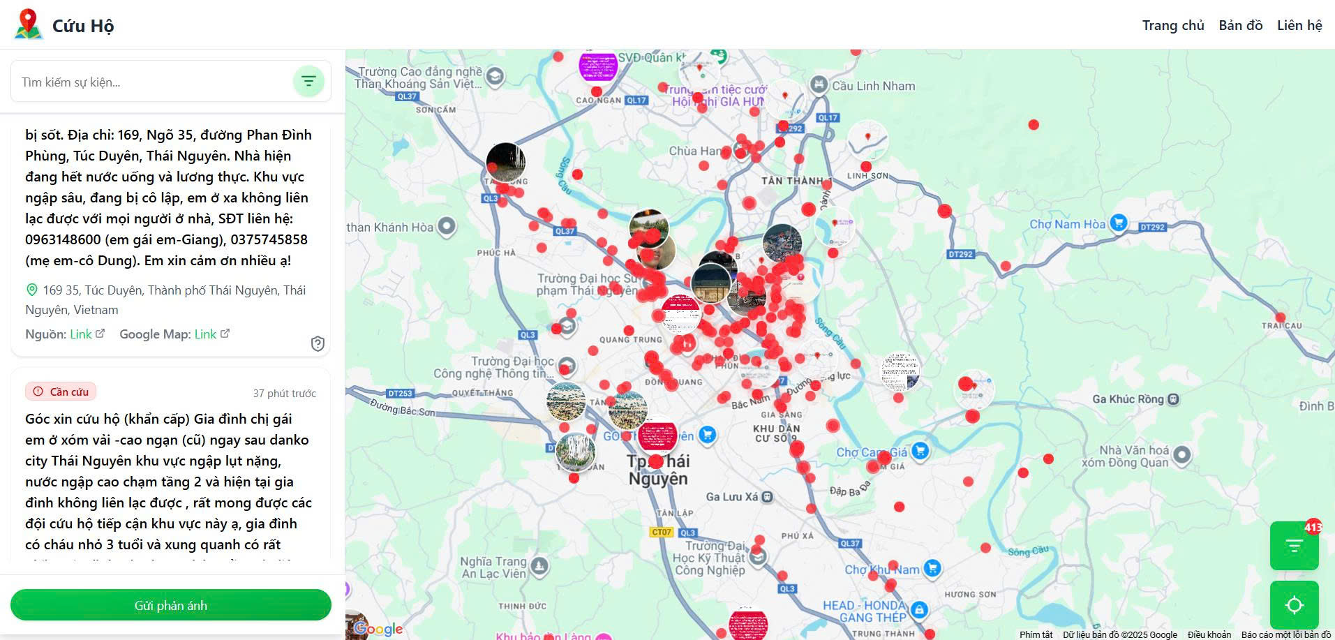
The red dots are SOS messages commented by Thai Nguyen province residents on fanpages and groups displayed on the website - Screenshot
Sympathizing with the people, both of you decided to change the purpose of vntraffic.app from traffic monitoring to rescue support until 3am (October 8).
“We decided to redesign the app into a visual map of the places in need of emergency relief. The important thing is to help people easily visualize where supplies or timely rescue are needed,” Huan said.
Due to social media laws, Huan cannot let people post relief information directly on the website. Instead, Huan's team set up an automatic system to scan comments and related posts from people on reputable fanpages, information pages, and groups where people commented on needing support to rescue on social networks, then synthesize, classify, and display on an online map, marked in red.
Here, the rescue team just needs to access, click on the link source or location, Google Maps coordinates attached in the article to determine the exact location that needs support.
The system is also integrated with artificial intelligence (AI) by Huan to automatically identify locations in article content, determine specific coordinates and attach that point to the relief map in real time.
Source: https://tuoitre.vn/sau-dem-lu-kinh-hoang-hai-ban-tre-am-tham-xay-ban-do-cuu-ho-cuu-nan-cho-nguoi-dan-thai-nguyen-20251008152801823.htm


Comment (0)