
Archaeological surveys and excavations from the late 20th to early 21st centuries have unearthed numerous architectural foundations and artifacts at sites such as Cam Mit (Hoa Phong), Qua Giang (Hoa Khuong), and Phong Le (Hoa Tho Dong)... Traces of Champa architectural ruins and artifacts have also been found scattered in Hoa Que, Khue Trung, Ngu Hanh Son, Xuan Duong, and An Son...
The Hoa Que and Khue Trung inscriptions - traces of "Rudrapura"
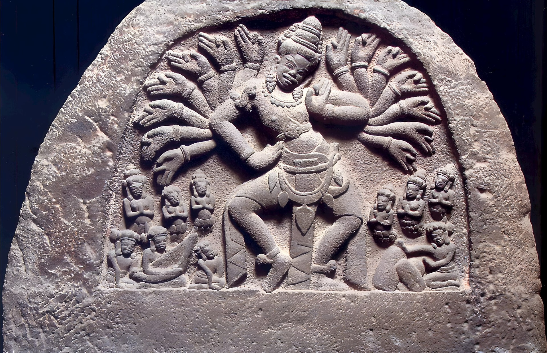
In Hoa Que village (also known as Hoa Khue) in Hoa Vang district, at the beginning of the 20th century, French archaeologists discovered a sandstone stele, marked C142. According to the inscription on the Hoa Que stele, this area was the homeland of a royal family closely associated with the Indrapura court. The woman in the stele, named Pu Po Ku Rudrapura, had a title associated with Rudra; researchers determined the Hoa Que stele to date back to 909-910.
Not far east of Hoa Que, in Khue Trung ward, another inscription was discovered in 1985, dating back to 899; both inscriptions belong to the Sri Jaya Simhavarman dynasty, and both praise the deity Rudra.
Notably, the Hoa Que stele indicates that this family built many temples dedicated to Shiva-Rudra. Thus, Da Nang , with sites such as Hoa Que, Khue Trung, Phong Le, and Qua Giang, was likely once a center of Shivaism within a network of Rudra-Siva worship spanning central Vietnam.
In the Vedic mythological system, Rudra is the god of storms, disease, and transformation/rebirth, and is one of the incarnations of Shiva. Rud—in Sanskrit meaning "to roar, to shake, to frighten," and "Pura" meaning city or dwelling place—Rudrapura means "the city of Rudra," or "the place where the god of storms resides."
From ancient place names to the region's meteorology - the imprint of the storm god.
In Vietnam's natural history, Quang Nam - Da Nang is the area most severely affected by typhoons from the East Sea. In the article "Typhoons and Floods in Quang Nam in the First Half of the 19th Century: The Nguyen Dynasty's Response Policy," researcher Nguyen Van Thinh, citing the Nguyen Dynasty's Imperial Records, Dai Nam Thuc Luc, and the work "Research on Floods in Central Vietnam in the 19th-20th Centuries" (edited by Dr. Do Bang, published in 2002), states that during the period from the reign of Emperor Minh Mang to Emperor Tu Duc, typhoons and floods occurred frequently, causing significant damage to people and property in many provinces and cities of Central Vietnam.
This includes many major storms and floods in Quang Nam - Da Nang. In the 21st century alone, major storms such as Xangsane (2006), Chanchu (2006), Kesana (2009), and Molave (2020) all caused serious damage to people and homes.
Geographically and meteorologically, Da Nang Bay is a semi-enclosed bay, surrounded by the Bach Ma - Hai Van mountain range to the northwest and Son Tra mountain to the southeast, forming a three-sided enclosed arc, with the bay's entrance facing east-southeast. This topography ensures the bay is generally sheltered from wind and calm, experiencing little impact from large waves and strong winds for most of the year, making it favorable for ships to anchor. Therefore, it became a trading port very early in history.
However, when the storm moves directly towards the bay's opening, that is, east or southeast, the cyclonic winds will converge directly into the bay, creating a wind funnel effect: Wind is compressed between two mountain ranges, causing local wind intensity to increase significantly, sea waves to rise dramatically, and wave energy to surge against the shore, increasing the destructive power in the Tien Sa, Thuan Phuoc areas and other bayside regions; if encountering large and solid obstacles such as the Nhu Nguyet road embankment, the destructive force of the waves becomes even more intense.
Even in the absence of storms, large waves can still occur. According to Jack Shulimson's 1965 document, "US Marines in Vietnam: The Landing and the Buildup," a US historian, on the morning of March 8, 1965, when US Marines landed on Xuan Thieu beach in Da Nang, the waves reached 8-10 feet (2.4-3 meters), delaying the landing by about an hour.
This phenomenon demonstrates the complex interaction between topography, wind direction, and air pressure in Da Nang's climate structure. It explains why this area is both an ideal natural port and a region heavily impacted by extreme weather – a natural paradox that the people of Da Nang have learned to adapt to over generations.
If we compare it to modern geography, the Da Nang area is a place where strong winds, storms, and floods frequently occur; this coincidence makes the hypothesis that Rudrapura - the city of the Storm God - was the predecessor of Da Nang city plausible, not only semantically but also in terms of the natural environment.
Rudrapura - a symbol of the sacred land of Central Vietnam
In the cultural flow of Champa, Rudrapura is not only a religious site but also a metaphor for the survival energy of this land – a place where people annually endure storms as a natural part of the world, where destruction is always accompanied by rebirth and reconstruction, where people must learn to live in harmony with nature to survive and thrive instead of resisting or violently interfering with nature…
From a cultural perspective, these intense storms can be seen as a continuation of the "Rudra divinity"—a kind of "geographical sacredness" that has existed throughout time. For the ancient Cham people, the deification of storms was a way to transform fear of nature into sacred energy. For the people of Da Nang today, this is manifested in modern humanistic values imbued with the "Rudra essence" in the depth of their cultural consciousness: unwavering will, solidarity, and the ability to adapt and recover after natural disasters.
Source: https://baodanang.vn/tu-rudrapura-den-thanh-pho-da-nang-3311967.html


![[Photo] Prime Minister Pham Minh Chinh receives the Chinese Ambassador to Vietnam](https://vphoto.vietnam.vn/thumb/1200x675/vietnam/resource/IMAGE/2026/04/05/1775397481797_ndo_br_dsc-5512-jpg.webp)


![[INFOGRAPHICS] Exploiting children's personal images for profit can result in fines of up to 50 million VND.](https://vphoto.vietnam.vn/thumb/402x226/vietnam/resource/IMAGE/2026/04/06/1775442200854_1775442148.webp)


Comment (0)