

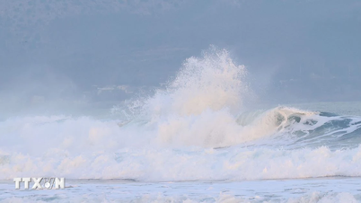
On July 16, a magnitude 7.3 earthquake struck off the coast of Alaska, about 55 miles south of Sand Point. As aftershocks rippled across the Alaska Peninsula, advanced tsunami warning systems were quickly activated, highlighting the increasingly important role technology plays in disaster preparedness.
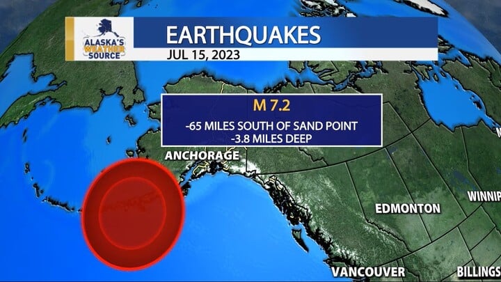
Location of earthquake off Sand Point, Alaska, USA (Source: Livemint)
Immediately after the seismic event occurred at 12:37, the seismic sensor system of the United States Geological Survey (USGS) automatically recorded data and determined the epicenter at a depth of 20.1 km below the seabed.
By integrating artificial intelligence (AI) technology and distributed sensor networks, the system enables real-time analysis and minimizes bias in risk assessment.
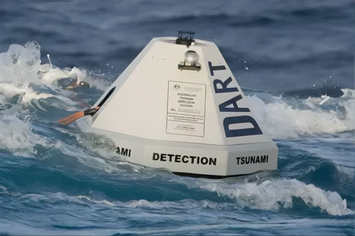
Dart buoy records pressure changes on the seabed (Source: Herakdsun)
Almost immediately, the National Tsunami Warning Center (NTWC) in Palmer, Alaska issued a tsunami warning for the coastal area from Kennedy Entrance to Unimak Pass, including the cities of Cold Bay, Sand Point, and Kodiak. Data from the Deep-ocean Assessment and Reporting of Tsunamis (DART) buoys were processed to assess the risk of tsunami generation following the earthquake.
Digital terrain maps, combined with 3D simulations, are shared with local rescuers to predict the potential spread of tsunamis. This GIS system is updated in real time, facilitating the identification of dangerous areas and more accurate evacuation planning.
People in affected areas receive information via mobile apps, social media and digital radio, helping to optimize response times.
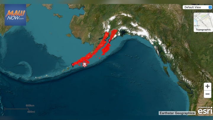
Tsunami warning area from Kennedy Entrance to Unimak Pass (Source: Livemint)
One notable feature is the ability to link emergency response forces – from the Coast Guard to relief agencies like FEMA – through a shared data platform. This allows for the consolidation of information, reduces duplication, and increases coordination during emergencies.
Alaska sits on the Pacific Ring of Fire – the world's most seismically active region – making technological solutions for early warning more urgent than ever.
The July 16 event did not cause major damage, but it was a wake-up call for investing in disaster prevention technology. From AI seismic analysis to real-time simulation, technology is becoming the front line in helping humans respond quickly and accurately to the forces of nature.
Minh Hoan
Source: https://vtcnews.vn/ai-canh-bao-tham-hoa-cong-nghe-dan-dau-trong-ung-pho-dong-dat-tai-my-ar954798.html
![[Photo] Ho Chi Minh City residents show their affection to celebrate the 80th anniversary of the August Revolution and National Day September 2](https://vphoto.vietnam.vn/thumb/1200x675/vietnam/resource/IMAGE/2025/9/3/55d860cbb63a40808e1e74ad9289b132)

![[Photo] Special art program "Da Nang - Connecting the future"](https://vphoto.vietnam.vn/thumb/1200x675/vietnam/resource/IMAGE/2025/9/2/efdd7e7142fd45fabc2b751d238f2f08)
![[Photo] Lao President Thongloun Sisoulith and President of the Cambodian People's Party and President of the Cambodian Senate Hun Sen visit the 95th Anniversary Exhibition of the Party Flag Lighting the Way](https://vphoto.vietnam.vn/thumb/1200x675/vietnam/resource/IMAGE/2025/9/2/3c1a640aa3c3495db1654d937d1471c8)
![[Photo] National Assembly Chairman Tran Thanh Man meets with First Secretary and President of Cuba Miguel Diaz-Canel Bermudez](https://vphoto.vietnam.vn/thumb/1200x675/vietnam/resource/IMAGE/2025/9/2/c6a0120a426e415b897096f1112fac5a)


Comment (0)