
Where potentials converge
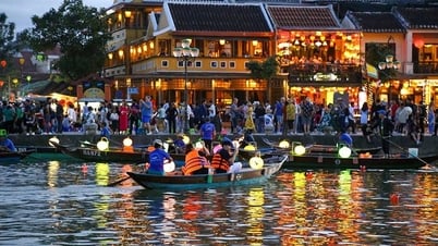
An Giang has a natural area of nearly 9,890 km2, a population of over 3.69 million people, is the province with the largest area and population in the Mekong Delta. With a large administrative unit scale, open development space, creating favorable conditions for An Giang to promote its potential and advantages in natural conditions and human resources, creating new momentum for development, becoming an important growth pole in the Mekong Delta.
After the merger, An Giang province (An Giang (old) and Kien Giang ) has diverse natural conditions in terms of ecological types such as plains, rivers, seas, islands, forests, mountains with rich and diverse resources; along with nearly 150 km of land border with the Kingdom of Cambodia, it is a place where potential and advantages converge in the development of agriculture, industry, construction, marine economy, services, tourism and border gate economy... In which, the role of An Giang as a tourism center and high-tech agricultural center is increasingly evident.
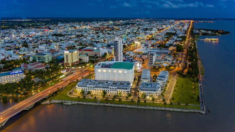 |
| An Giang is the province with the largest population and area in the Mekong Delta. In the photo: Center of Rach Gia ward, An Giang province. Source: KITRA |
Speaking about the potential and advantages of the new An Giang province, at the working session with the Standing Committee of the Kien Giang Provincial Party Committee and the Standing Committee of the An Giang Provincial Party Committee on June 4, 2025 in Kien Giang, General Secretary To Lam emphasized: “The merger of Kien Giang and An Giang provinces is not only an administrative solution but also a strategic decision to create a new development entity with a larger economic scale, a more diverse economic ecosystem and the ability to coordinate regional linkages more effectively. The combination of an An Giang with a rich tradition of high-tech agricultural production, the Mekong River upstream region, a center for aquatic breeds and crops, and a Kien Giang with outstanding strengths in islands, tourism, renewable energy and seaport services, will create a development axis of “mountains - plains - borders - islands”, integrating border economy and marine economy”.
New space - new opportunities
With open space, stretching along the corridors along Tien River - Hau River; An Phu - Tan Chau - Chau Doc - Tinh Bien - Tri Ton - Giang Thanh - Ha Tien border corridor; Western coastal economic corridor and island areas, An Giang province has many advantages in organizing, arranging, and creating new development spaces, ensuring the promotion of the province's potential and strategic position with the Mekong Delta and the whole country, closely and effectively connecting with Ho Chi Minh City, localities in the Southeast region and cooperating with neighboring Cambodia.
The Planning of Kien Giang province for the period 2021 - 2025, with a vision to 2050 (Planning) and the Planning of An Giang province (old) have oriented the organization of socio-economic activities according to sub-regions and economic corridors to effectively exploit the advantages of resources and natural characteristics of each region.
Accordingly, for Kien Giang province (old), the Plan organizes socio-economic activities according to 4 sub-regions including: Long Xuyen Quadrangle, West Hau River Region, Upper U Minh Region and Island Region.
Specifically, the Long Xuyen Quadrangle includes Rach Gia City, Ha Tien City, Kien Luong District, Giang Thanh District, Hon Dat District and part of Tan Hiep and Chau Thanh Districts (old) focusing on urban development, border gate economy and trade activities, high-value-added, high-quality services; focusing on mineral exploitation, construction material production, mechanical engineering serving agriculture and fisheries, energy industry; the province's foreign trade and transportation hub; agricultural production area, marine aquaculture area and marine ecological environment protection.
The West Hau River region includes part of Tan Hiep and Chau Thanh districts and the entire Giong Rieng and Go Quao districts (old) focusing on developing diverse agricultural and aquatic product processing industries, labor-intensive manufacturing industries; is a region with strong development in high-tech agriculture, specializing in high-quality rice production, fruit trees, and aquaculture.
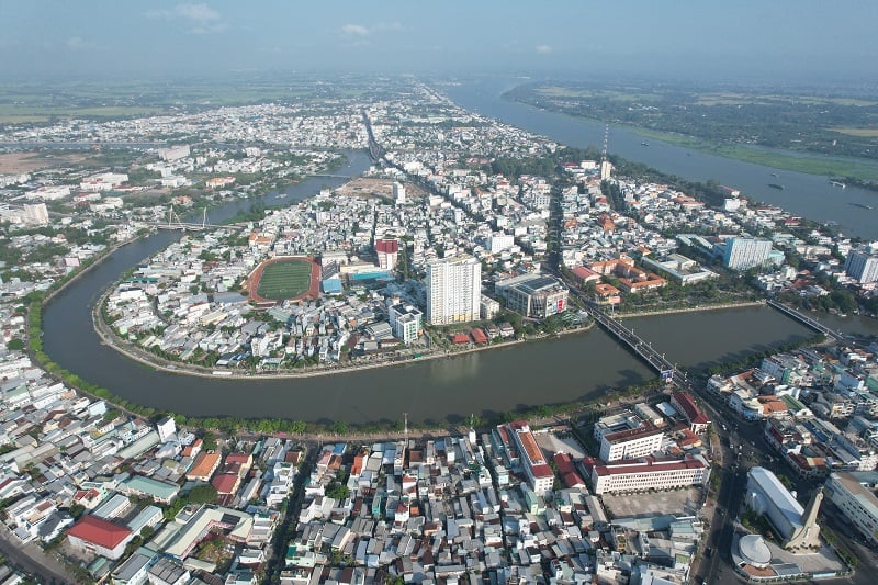 |
| Long Xuyen city, the capital of An Giang province (old). Photo: The Linh |
The U Minh Thuong region includes An Minh, An Bien, U Minh Thuong and Vinh Thuan districts (old) focusing on developing combined agricultural - forestry - fishery models, providing raw materials for the development of agricultural - forestry - fishery processing industries, fishery logistics, combining the development of agricultural tourism, ecology, and typical cultural tourism; landscape conservation area, biodiversity of U Minh Thuong National Park.
The island region includes Phu Quoc City (now Phu Quoc special zone and Tho Chau special zone) and Kien Hai island district (now Kien Hai special zone) focusing on strong development of marine economy, with many commercial activities, services, sea and island tourism, with many different values, high quality, international standards; developing the island region in an ecological direction combined with protecting national parks and marine ecosystems.
In the old An Giang province, 3 socio-economic regions were formed, namely: Dynamic economic region including Long Xuyen city, Chau Thanh district and Thoai Son district (old); focusing on developing advantageous industries and fields such as: trade, services, tourism, application, technology transfer; general, specialized center, focal point for agriculture, industry, services, logistics; industrial development concentrated in Thoai Son district and Chau Thanh district.
The Eastern socio-economic zone includes: Tan Chau town and An Phu, Phu Tan, Cho Moi (old) districts, focusing on developing large-scale agricultural production and aquaculture; trade, service, tourism, logistics, processing and manufacturing industry, and transit of goods with the market of the Kingdom of Cambodia (through Vinh Xuong and Khanh Binh border gates).
The Western socio-economic region includes: Chau Doc city as the center and Tinh Bien town, Tri Ton and Chau Phu districts (old) as the national center for tourism, spiritual culture, river tourism, landscape; services, processing and manufacturing industry; the border economic center of the province; a hub for trade and transit of goods with the market of the Kingdom of Cambodia (through Tinh Bien border gate); closely linked with urban areas along the Chau Doc - Can Tho - Soc Trang expressway corridor and urban areas on the border economic corridor.
Along with the development planning according to socio-economic sub-regions, the economic spatial structure of An Giang is also organized in the direction of forming economic corridors with the definition of specific functions and development fields.
In particular, in the old Kien Giang province, 3 economic corridors will be formed, namely: The Western coastal economic corridor includes the Ha Tien - Rach Gia economic corridor based on the Ha Tien - Rach Gia - Bac Lieu expressway, National Highway 80 and coastal roads; focusing on developing key marine economic sectors, in line with the potential and advantages of the coastal localities of Ha Tien, Kien Luong, Hon Dat and Rach Gia; and the coastal economic corridor in the An Minh - An Bien - Chau Thanh - Rach Gia area based on the coastal road axis and the southern coastal corridor, focusing on developing marine economic sectors such as: renewable energy, clusters of fisheries, marine occupations, tourism and coastal urban areas.
North-South economic corridor: Based on the Lo Te - Rach Soi expressway and National Highway 80; this corridor plays an important role in trade between the province and localities in the region.
Giang Thanh - Ha Tien border corridor (belonging to the border corridor from Long An to Kien Giang): Based on National Highway N1; focusing on developing border gate economy, border trade economy associated with the formation of border urban areas, ensuring national defense and security.
Similarly, the economic space in An Giang province (old) is also organized according to 3 corridors including: Chau Doc - Long Xuyen economic corridor (belonging to Chau Doc - Can Tho - Soc Trang economic corridor), located along Chau Doc - Can Tho - Soc Trang highway, is the corridor connecting An Giang province's border gate economic zone with Tran De seaport and provinces and cities in the region; developing a focal center for agriculture, industry, services, and logistics in Long Xuyen urban area.
Tinh Bien - Chau Doc - An Phu - Tan Chau border corridor: Developing border gate economy associated with forming border urban areas, ensuring national defense and security.
Corridor along Tien River - Hau River: Is a space located along the traffic axis of National Highway 91, National Highway 80B and the waterway transport route (Mekong River route) connecting with the border corridor; is an economic corridor, cultural space, biodiversity, river landscape; oriented to develop clusters of rice, seafood and fruit production associated with ecological urban areas on both sides of the river; develop eco-tourism associated with preserving and promoting unique local cultural heritages.
Organizing socio-economic activities according to sub-regions and economic corridors not only promotes the strengths of each region but also opens up opportunities to restructure the infrastructure system, especially transport infrastructure, forming more closely linked value chains from production, processing, logistics and export; at the same time, creating conditions for the formation of new key economic zones, attracting strategic investment, enhancing internal strength and competitiveness for the new An Giang province as well as the entire Mekong Delta region.
According to the direction of General Secretary To Lam at the working session with the Standing Committee of Kien Giang Provincial Party Committee and the Standing Committee of An Giang Provincial Party Committee on June 4, 2025, the new An Giang province needs to clearly define its vision to become a dynamic, comprehensive and sustainable development center of the Mekong Delta region, playing a strategic role in connecting East - West, sea - border, urban - rural, service - production - tourism. In particular, aiming to become a national marine economic center, in which Phu Quoc is an international-class eco-tourism resort center, while the Long Xuyen - Chau Doc - Rach Gia - Ha Tien Quadrangle will be the driving force for industrial, logistics and cultural development of the whole region, contributing to reshaping the role of the new An Giang in the national economic structure and regional value chain.
Source: https://baodautu.vn/an-giang-khong-gian-moi-kien-tao-dong-luc-tang-truong-moi-d360496.html


![[Photo] Party and State leaders visit President Ho Chi Minh's Mausoleum and offer incense to commemorate Heroes and Martyrs](https://vphoto.vietnam.vn/thumb/402x226/vietnam/resource/IMAGE/2025/8/17/ca4f4b61522f4945b3715b12ee1ac46c)


Comment (0)