
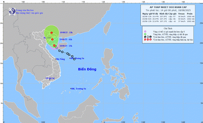
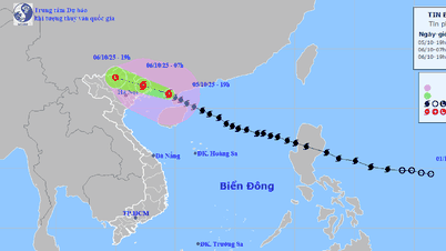
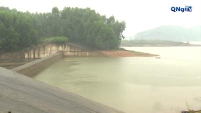
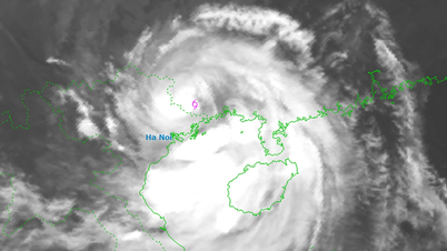
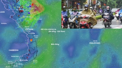
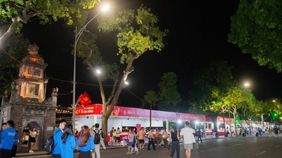
Currently, the tropical depression has entered the Gulf of Tonkin. According to the National Center for Hydro-Meteorological Forecasting, at 3:00 p.m. this afternoon, the center of the tropical depression was at about 19.6 degrees North latitude; 107.7 degrees East longitude, about 55km south of Bach Long Vi special zone. It is forecasted that tonight, the tropical depression will make landfall in Quang Ninh province with winds of 45 km/h.
Due to the influence of the tropical depression, at sea, the Gulf of Tonkin area (including the special zones of Bach Long Vi, Cat Hai, Co To and Van Don) has thunderstorms and strong winds of level 6-7, gusts of level 9, waves 2-3.5m high, rough seas. Ships operating in the above-mentioned dangerous areas are likely to be affected by thunderstorms, whirlwinds, strong winds, and big waves.
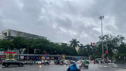
On land, from the afternoon of August 18, coastal areas from Quang Ninh and Hai Phong will have strong winds of level 6, gusting to level 8. From August 18 to the night of August 19, the Northeast and Thanh Hoa will have moderate rain, heavy rain and thunderstorms with common rainfall of 50-150mm, locally very heavy rain over 300mm.
On the day and night of August 18, Nghe An and Ha Tinh areas will have moderate rain, heavy rain and thunderstorms with common rainfall of 30-60mm, locally very heavy rain over 150mm.
Source: https://quangngaitv.vn/ap-thap-nhiet-doi-vao-vinh-bac-bo-nhieu-noi-mua-lon-6506257.html


![[Photo] Prime Minister Pham Minh Chinh chairs the Government's online conference with localities](https://vphoto.vietnam.vn/thumb/1200x675/vietnam/resource/IMAGE/2025/10/5/264793cfb4404c63a701d235ff43e1bd)

![[Photo] Prime Minister Pham Minh Chinh launched a peak emulation campaign to achieve achievements in celebration of the 14th National Party Congress](https://vphoto.vietnam.vn/thumb/1200x675/vietnam/resource/IMAGE/2025/10/5/8869ec5cdbc740f58fbf2ae73f065076)


![[VIDEO] Summary of Petrovietnam's 50th Anniversary Ceremony](https://vphoto.vietnam.vn/thumb/402x226/vietnam/resource/IMAGE/2025/10/4/abe133bdb8114793a16d4fe3e5bd0f12)

![[VIDEO] GENERAL SECRETARY TO LAM AWARDS PETROVIETNAM 8 GOLDEN WORDS: "PIONEER - EXCELLENT - SUSTAINABLE - GLOBAL"](https://vphoto.vietnam.vn/thumb/402x226/vietnam/resource/IMAGE/2025/7/23/c2fdb48863e846cfa9fb8e6ea9cf44e7)


Comment (0)