
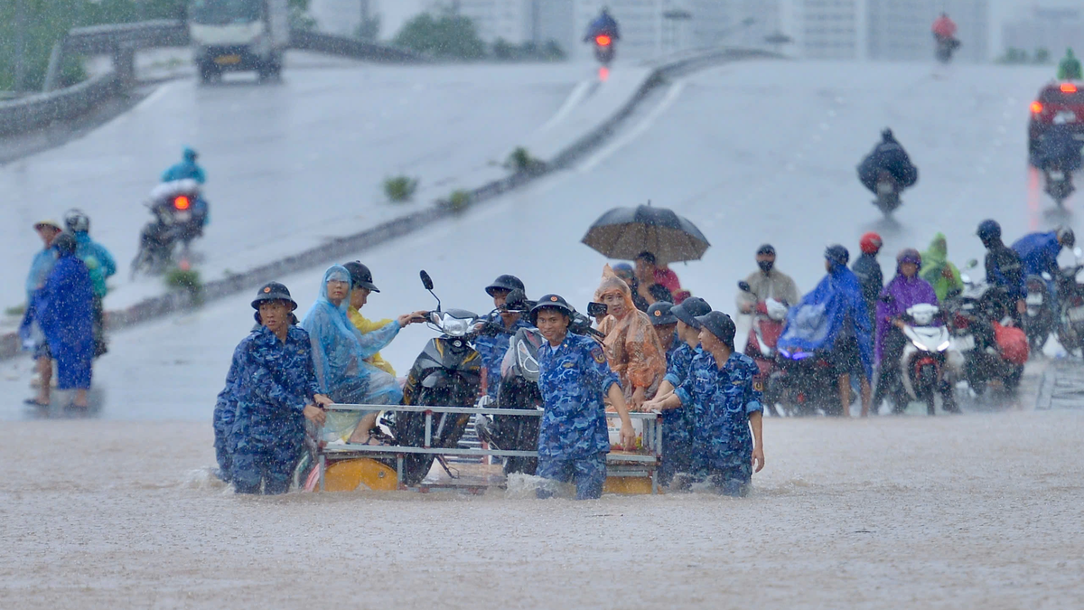
In the highland communes located in areas with high risk of flash floods and landslides such as Son Dong, Tuan Dao, Dai Son, An Lac, Tay Yen Tu, Duong Huu, etc., the work of inspecting and closely monitoring the developments of locations at risk of landslides has been strengthened. At the same time, local authorities urgently coordinated with functional agencies to overcome landslides of traffic infrastructure and irrigation works that occurred from previous storms.
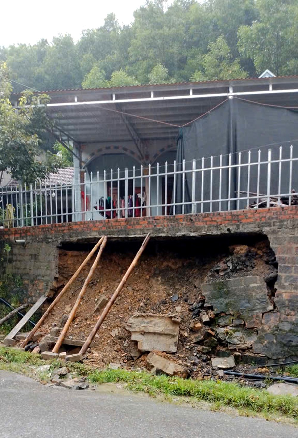 |
Mr. Nong Van Hoi's family, Chao village, Son Dong commune, suffered a landslide due to the impact of storm No. 10. |
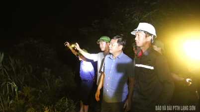
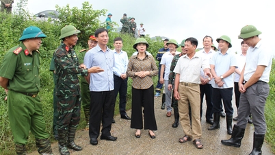
According to comrade Luc Xuan An, Chairman of Son Dong Commune People's Committee, after reviewing the area, 12/33 villages have high risk of landslides; 10/33 villages have locations at risk of flooding. To ensure the safety of the people, in these places, the commune focuses on informing about the developments of storms and floods, and at the same time sends working groups to each household to propagate and mobilize people to be ready to coordinate with the functional forces to deploy plans to evacuate people and property to a safe place.
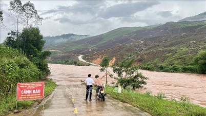
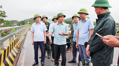
The entire commune still has many landslides on village and commune roads caused by the floods caused by the circulation of storm No. 10. These locations have been roped off and warning signs have been placed to prevent people from approaching the dangerous areas. The commune has also requested relevant levels, sectors and units to urgently coordinate to overcome the above incident.
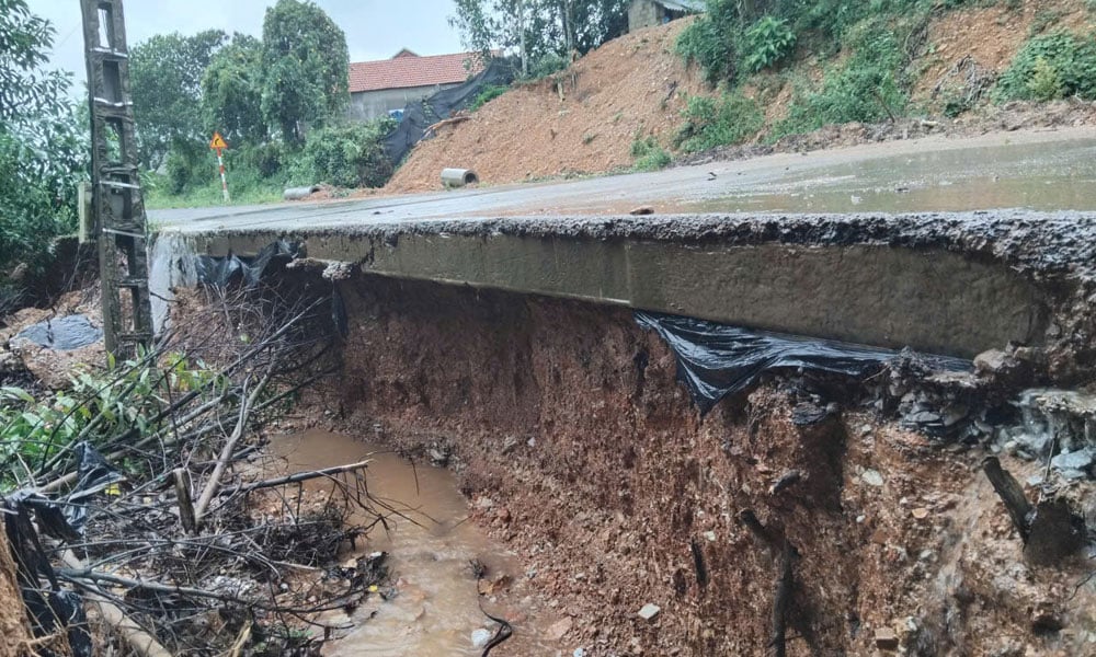 |
A landslide point on the traffic road in Luong Doan village, Son Dong commune. |
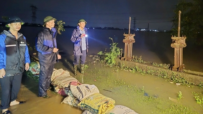
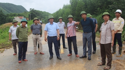
In Duong Huu commune, on the morning of October 6, local leaders inspected locations at risk of landslides, continued to urge villages to deploy plans for natural disaster prevention and control; and prepared materials and equipment to be ready to participate in troubleshooting when incidents arise.
Immediately after the weather showed signs of decreasing rain, the Provincial Civil Defense Command withdrew the first alert on Cau River and Thuong River, and directed the Department of Agriculture and Environment to establish working groups to inspect the dyke system, dams, pumping stations and key points in communes and wards to guide and urge response work.
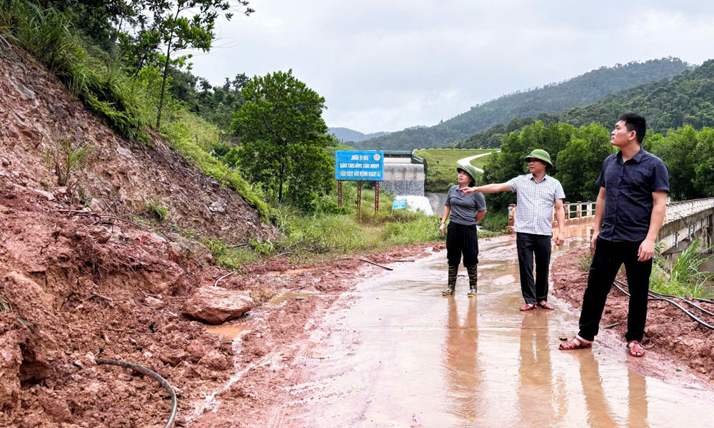 |
Leaders of Duong Huu commune inspected the landslide site on the road to Khe Chao lake. |
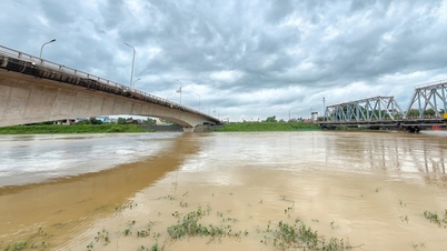
By the afternoon of October 6, the whole province had no new incidents related to dykes and irrigation works. Residential areas outside the river banks in the communes and wards of Hop Thinh, Xuan Cam, Tam Giang and Nenh and Van Ha wards had stopped being flooded. People were urgently cleaning, disinfecting, and preventing epidemics. On the Cau and Thuong rivers, forces continued to be deployed to strictly maintain the patrol and guard regime of the dykes according to regulations, ready to respond to any unusual developments. The whole province currently has 71 pumping units operating to drain water and ensure timely drainage.
It is forecasted that in the next 24 hours, the circulation after storm No. 11 may continue to cause widespread rain, and the water level of rivers may rise again, reaching alert level II to alert level III. The Provincial Civil Defense Command requests departments, branches, and localities to regularly update weather developments and absolutely not be subjective in disaster prevention and control. Continue to strictly implement the "4 on-site" motto, monitor weather forecast warning information, and be prepared to respond to heavy rain, strong winds, and the risk of localized flooding in the coming days.
Source: https://baobacninhtv.vn/bac-ninh-chu-dong-ung-pho-tiep-tuc-khac-phuc-thiet-hai-do-mua-lu-postid428229.bbg
![[Photo] Prime Minister Pham Minh Chinh chairs the 16th meeting of the National Steering Committee on combating illegal fishing.](https://vphoto.vietnam.vn/thumb/1200x675/vietnam/resource/IMAGE/2025/10/07/1759848378556_dsc-9253-jpg.webp)


![[Photo] Super harvest moon shines brightly on Mid-Autumn Festival night around the world](https://vphoto.vietnam.vn/thumb/1200x675/vietnam/resource/IMAGE/2025/10/07/1759816565798_1759814567021-jpg.webp)


Comment (0)