
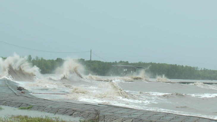
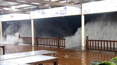
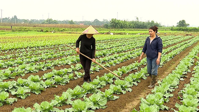
The sea area from Lam Dong to Ca Mau will have high waves today, boats and people living along the coast need to pay attention - Photo: TL
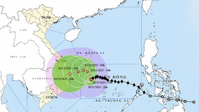
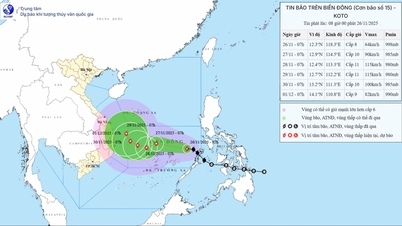
The Southern Hydrometeorological Station said that at 4am this morning, Phu Quy special zone had northeast wind level 5, gusting to level 8, wave height from 1.75-2.25m. Con Dao special zone had northeast wind level 3-4, gusting to level 7, wave height from 0.25-1.25m. At Huyen Tran station, northeast wind level 6, gusting to level 8, wave height from 2.25-2.75m.
During the day and tonight (November 26), in the coastal areas from Lam Dong to Ca Mau, Ca Mau to An Giang and the Gulf of Thailand, there will be scattered showers and thunderstorms. There is a possibility of tornadoes and strong gusts of wind during thunderstorms.
The sea area from Lam Dong to Ca Mau has strong northeast wind level 6, sometimes level 7, gusting to level 8-9. Waves are 3-5m high. The sea is rough.
The sea area from Ca Mau to An Giang (including Phu Quoc) and the Gulf of Thailand has northeast wind level 4-5, wave height from 1.5-2.5m, slightly rough sea.
Ships and other activities in the waters of the South are at high risk of being affected by bad weather with potential dangerous weather phenomena such as tornadoes and strong gusts of wind in thunderstorms.
In the sea area of Ho Chi Minh City when storm No. 15 approaches, in the sea area off the coast of Ho Chi Minh City, the northeast wind continues to strengthen to level 6, sometimes level 7, gusting to level 8-9, large waves from 3-6m, rough seas. The risk level of natural disasters due to strong winds in the sea area of Ho Chi Minh City is at level 2.
On land, because the storm is still far away, the weather will be cloudy and changeable, mostly sunny during the day, with showers and thunderstorms in some places in the evening and at night. During thunderstorms, be on guard against tornadoes, lightning and strong gusts of wind.
Source: https://tuoitre.vn/bao-so-15-co-the-gay-gio-giat-cap-9-song-cao-den-6m-tren-bien-tp-hcm-canh-bao-thien-tai-cap-2-20251126062232355.htm
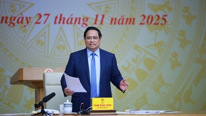
![[Photo] Prime Minister Pham Minh Chinh chairs the 15th meeting of the Central Emulation and Reward Council](/_next/image?url=https%3A%2F%2Fvphoto.vietnam.vn%2Fthumb%2F1200x675%2Fvietnam%2Fresource%2FIMAGE%2F2025%2F11%2F27%2F1764245150205_dsc-1922-jpg.webp&w=3840&q=75)


![[Photo] President Luong Cuong attends the 50th Anniversary of Laos National Day](/_next/image?url=https%3A%2F%2Fvphoto.vietnam.vn%2Fthumb%2F1200x675%2Fvietnam%2Fresource%2FIMAGE%2F2025%2F11%2F27%2F1764225638930_ndo_br_1-jpg.webp&w=3840&q=75)


Comment (0)