
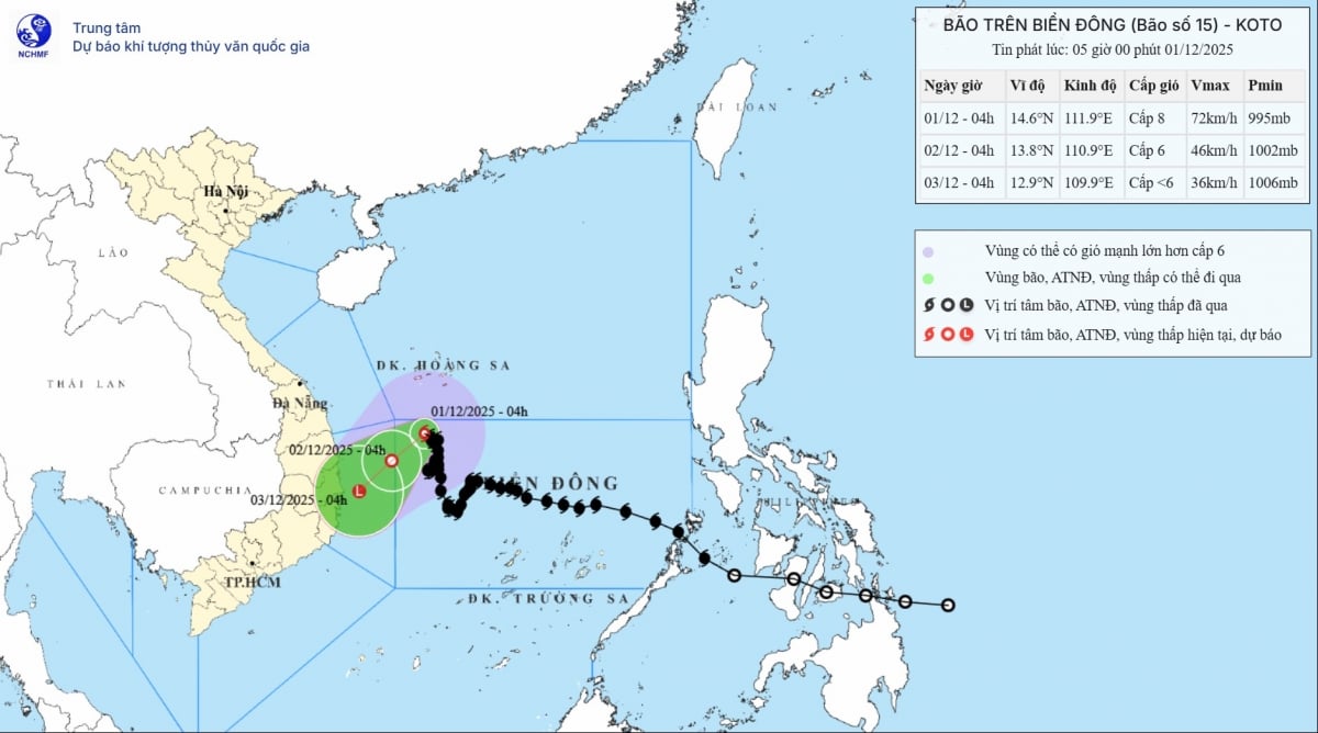
Early morning of December 1, storm number 15 had gusts of level 10, the strongest wind near the storm's center was level 8.
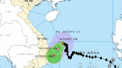
According to the National Center for Hydro-Meteorological Forecasting, at 4:00 a.m. on December 1, the eye of the storm was located at approximately 14.6 degrees North latitude; 111.9 degrees East longitude, in the northwest sea area of the Central East Sea. The strongest wind near the eye of the storm was level 8 (62-74 km/h), gusting to level 10. Storm No. 15 has little movement.
 |
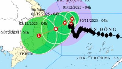
| Image of the movement direction of storm number 15. |
Due to the storm's influence, the northwest sea area of the Central East Sea has strong winds of level 6; the area near the storm's eye has strong winds of level 7-8, gusting to level 10; waves 2.0-4.0m high, the area near the storm's eye 4.0-6.0m; rough seas. Ships operating in the above-mentioned dangerous areas are likely to be affected by storms, whirlwinds, strong winds, and large waves.
It is forecasted that in the next 24 hours, storm No. 15 will move to the Southwest, at a speed of about 5km/h. The storm will gradually weaken, down to level 6, gusting to level 8. Due to the storm's influence, the Northwest sea area of the central East Sea, the sea area from Gia Lai to Khanh Hoa will be very rough.
It is forecasted that by 4am on December 3, storm No. 15 will weaken into a tropical depression in the sea from Gia Lai to Khanh Hoa .
According to vov.vn
Source: https://baovinhlong.com.vn/thoi-su/202512/bao-so-15-giat-cap-10-di-chuyen-cham-tren-bien-4bf0fa0/


![[Photo] Dan Mountain Ginseng, a precious gift from nature to Kinh Bac land](/_next/image?url=https%3A%2F%2Fvphoto.vietnam.vn%2Fthumb%2F1200x675%2Fvietnam%2Fresource%2FIMAGE%2F2025%2F11%2F30%2F1764493588163_ndo_br_anh-longform-jpg.webp&w=3840&q=75)


Comment (0)