
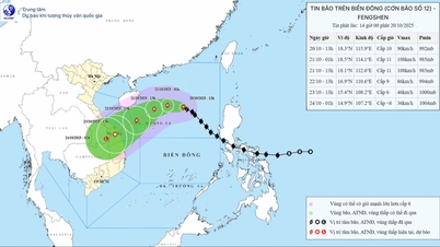
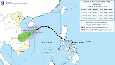
According to the Center for Hydro-Meteorological Forecasting, at 10:00 a.m. on July 20, the center of the storm was at about 21.8°N; 114.2°E, in the northern sea area of the North East Sea, about 680km east of Quang Ninh - Hai Phong . The strongest wind near the center of the storm was level 11-12 (103-133km/h), gusting to level 15. The storm moved west at a speed of 20-25km/h.
Storm No. 3 will continue to move west, then turn west southwest at a speed of 20-25km/h.

It is expected that by 10:00 on July 21, storm No. 3 will be in the eastern sea of the Northern Gulf of Tonkin, level 11, gusts of level 14; by 10:00 on July 22, the storm will be in the coastal area of Quang Ninh - Thanh Hoa, level 10-11, gusts of level 14; by 10:00 on July 23, the storm will be in the mainland of Upper Laos, weakening into a low pressure area, < level 6.
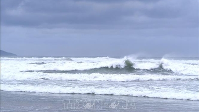
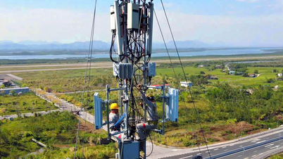
Due to the influence of storm No. 3, the North East Sea area has winds of level 8-10, near the storm center of level 11-12, gusting to level 15; waves 5.0-7.0m high. The sea is very rough.
From the night of July 20, in the North of Bac Bo Gulf (Co To, Bach Long Vi, Cat Hai, Hon Dau): wind level 6-7, then increasing to level 10-11, gusting to level 14; waves 2.0-5.0m high. South of Bac Bo Gulf (Hon Ngu): wind level 6-7, near the storm center level 8-9, gusting to level 11; waves 2.0-4.0m high.
Warning for vessels in danger zones at high risk of thunderstorms, tornadoes, strong winds and large waves.
In Hai Phong – Quang Ninh: storm surge from 0.5-1.0m, total water level from 4.0-5.0m. High risk of flooding in low-lying areas at noon – afternoon of July 22.
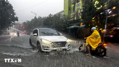
From July 21-23, the Northeast region, the Northern Delta, Thanh Hoa, Nghe An will have very heavy rain of 200-350mm, locally >600mm. Other places in the North, Ha Tinh will have rain of 100-200mm, locally >300mm.
Source: https://baolaocai.vn/bao-so-3-cach-quang-ninh-hai-phong-680km-giat-cap-15-post649266.html
![[Photo] Prime Minister Pham Minh Chinh received Mr. Yamamoto Ichita, Governor of Gunma Province (Japan)](https://vphoto.vietnam.vn/thumb/1200x675/vietnam/resource/IMAGE/2025/10/21/1761032833411_dsc-8867-jpg.webp)
![[Photo] Da Nang residents "hunt for photos" of big waves at the mouth of the Han River](https://vphoto.vietnam.vn/thumb/1200x675/vietnam/resource/IMAGE/2025/10/21/1761043632309_ndo_br_11-jpg.webp)

![[Photo] Prime Minister Pham Minh Chinh meets with Speaker of the Hungarian National Assembly Kover Laszlo](https://vphoto.vietnam.vn/thumb/1200x675/vietnam/resource/IMAGE/2025/10/20/1760970413415_dsc-8111-jpg.webp)


Comment (0)