
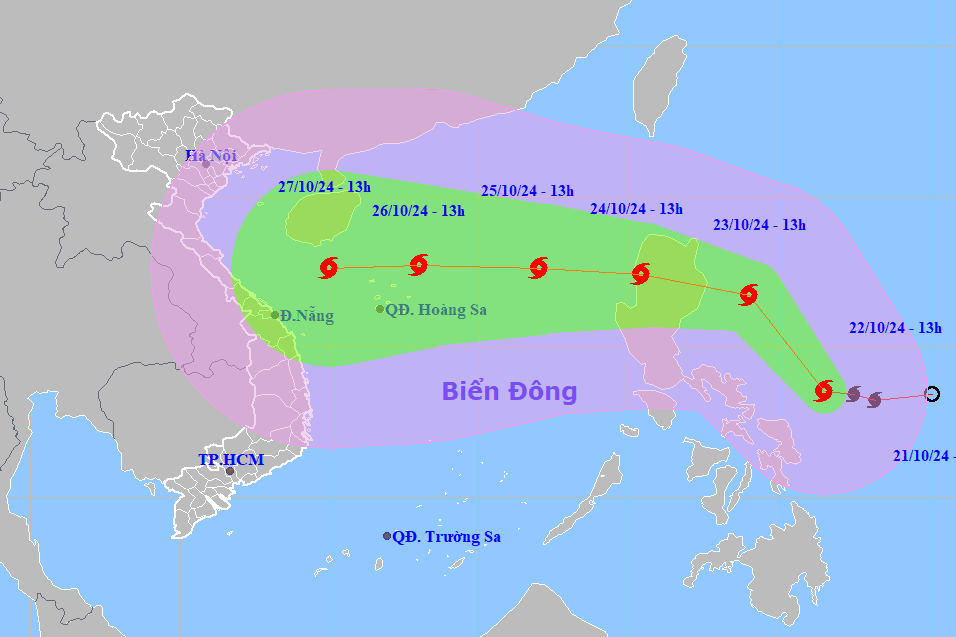
It is forecasted that around October 24, storm Trami will enter the East Sea, becoming storm number 6. According to experts, the storm is likely to head towards the central coast, causing widespread heavy rain in the area.
WATCH VIDEO :
This afternoon (October 22), Mr. Vu Anh Tuan, Deputy Head of Weather Forecast Department, National Center for Hydro-Meteorological Forecasting, has just given initial comments on the developments of the storm with the international name Trami.
Accordingly, at 1 p.m., the eye of the storm was located in the sea east of the central Philippines. The strongest wind near the eye of the storm was level 8 (62-74 km/h), gusting to level 10. Moving northwest at a speed of 15-20 km/h.
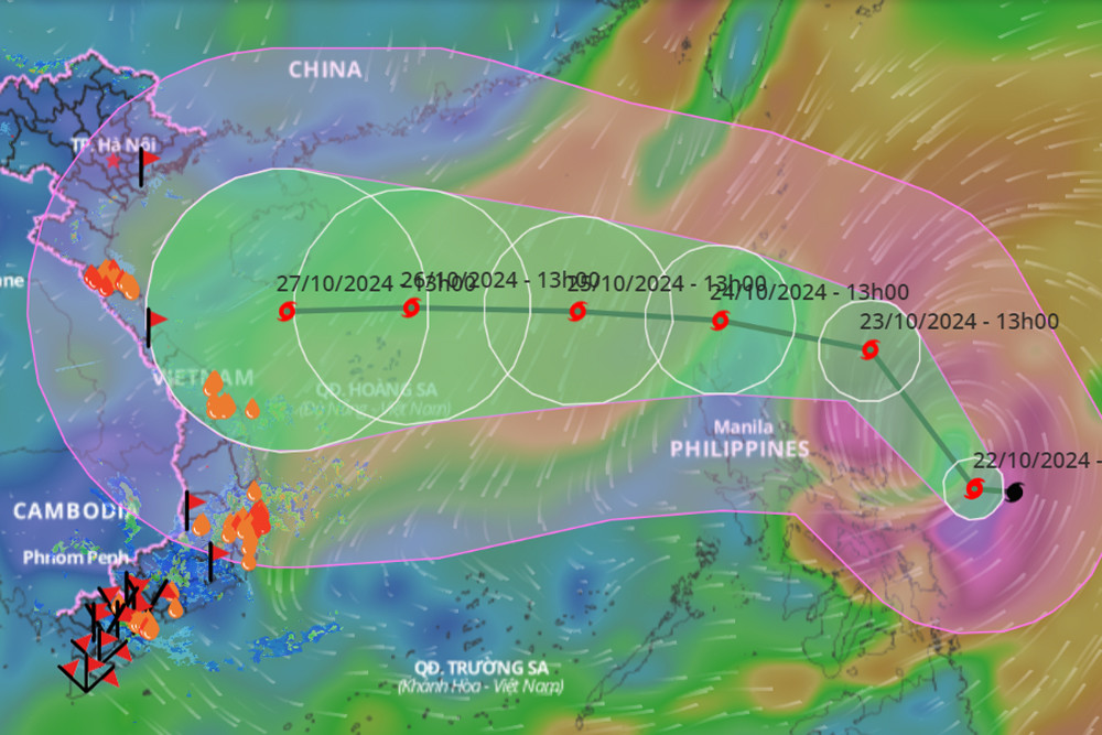
It is forecasted that around October 24, storm Trami will move into the East Sea, becoming storm number 6 in this year's rainy and stormy season.
Mr. Tuan said that after entering the East Sea, the storm is likely to change direction, move west and continue to strengthen.
"According to initial assessment, when passing Hoang Sa archipelago, the storm reached level 12, gusted to level 15 and continued towards the coast of the Central provinces," Mr. Tuan informed.
Mr. Tuan also said that due to the impact of this storm, on October 26-28, there is a possibility of widespread heavy rain in the Central provinces.
This is initial information about storm Trami. Due to the complicated developments of late-season storms, people need to regularly update information from the Center's bulletins.
Source: https://vietnamnet.vn/bao-tra-mi-kha-nang-huong-vao-mien-trung-gay-mua-lon-dien-rong-2334454.html


![[Photo] National Assembly Chairman attends the seminar "Building and operating an international financial center and recommendations for Vietnam"](https://vphoto.vietnam.vn/thumb/1200x675/vietnam/resource/IMAGE/2025/7/28/76393436936e457db31ec84433289f72)


Comment (0)