
 |
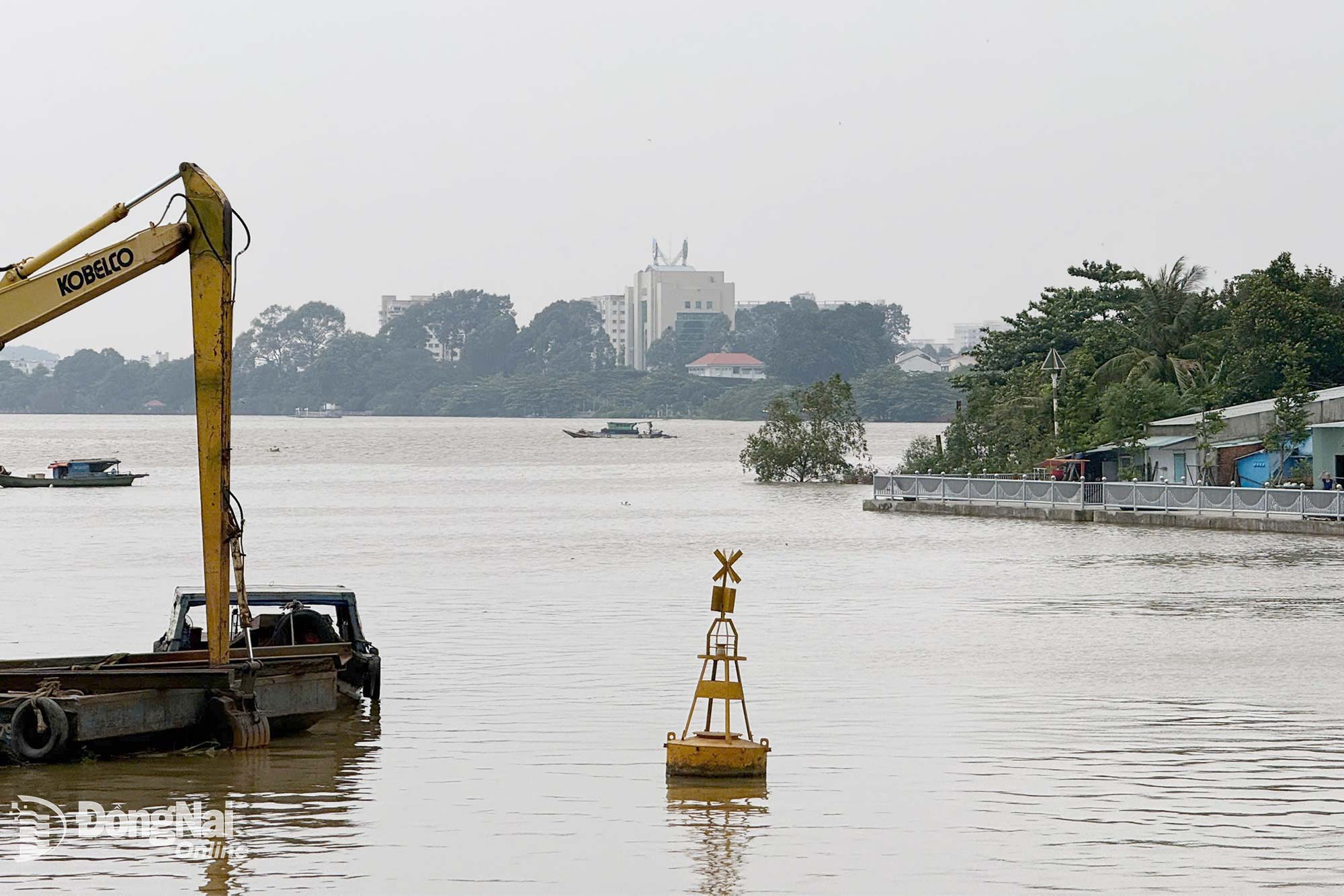
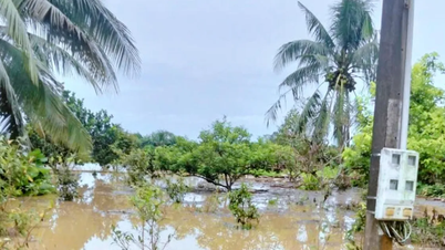
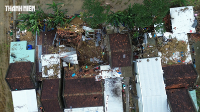
| Water levels in the lower reaches of the Dong Nai River are high. Illustration photo: Dang Tung |
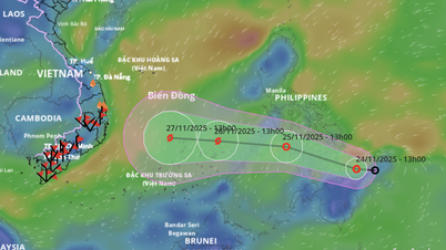
Warning of flood risk and possibility of other natural disasters. Low-lying areas along the river in the lower reaches of the Dong Nai River, in the wards and communes of Tri An, Tan An, Trang Dai, Long Hung, Phuoc Tan, Tam Phuoc, An Phuoc, Nhon Trach, Phuoc An and neighboring areas are at risk of flooding due to high tides.
It is necessary to guard against the possibility of heavy rain combined with floods causing inundation and landslides on river banks, streams, and low-lying areas in the above wards and communes. The level of natural disaster risk due to floods is level 2.
Kim Lieu
Source: https://baodongnai.com.vn/ban-doc/202510/canh-bao-trieu-cuong-o-ha-luu-song-dong-nai-5302180/

![[Photo] National Assembly Chairman Tran Thanh Man receives a business delegation from the Europe-ASEAN Business Council](/_next/image?url=https%3A%2F%2Fvphoto.vietnam.vn%2Fthumb%2F1200x675%2Fvietnam%2Fresource%2FIMAGE%2F2025%2F11%2F24%2F1763989198212_ndo_br_bnd-7394-jpg.webp&w=3840&q=75)


![[Photo] Prime Minister Pham Minh Chinh attends the patriotic emulation congress of the banking sector](/_next/image?url=https%3A%2F%2Fvphoto.vietnam.vn%2Fthumb%2F1200x675%2Fvietnam%2Fresource%2FIMAGE%2F2025%2F11%2F24%2F1763981997729_tt-nhnn-jpg.webp&w=3840&q=75)


![[Photo] Next to the "mountain of trash" after the flood, Tuy Hoa residents strive to rebuild their lives](/_next/image?url=https%3A%2F%2Fvphoto.vietnam.vn%2Fthumb%2F1200x675%2Fvietnam%2Fresource%2FIMAGE%2F2025%2F11%2F24%2F1763951389752_image-1-jpg.webp&w=3840&q=75)


Comment (0)