

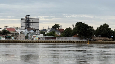
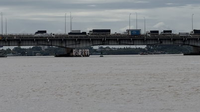
Specifically, at Ta Lai station ( Dong Nai river), the water level rose quite quickly, exceeding alarm level 2 (112.5m); at Phu Hiep station (La Nga river), the water level fell slowly, below alarm level 2 (105.5m); at Bien Hoa station (downstream of Dong Nai river), the peak tide water level rose gradually, at near alarm level 2 (2m).
It is forecasted that in the next 6-12 hours, the water level at Ta Lai station will continue to rise slowly, between alarm level 2 and alarm level 3 (113m), then slowly fall. At Phu Hiep station, the water level will change slowly, below alarm level 2. At Bien Hoa station, the peak tide level will continue to rise, the peak tide will be above alarm level 1.
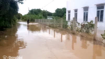
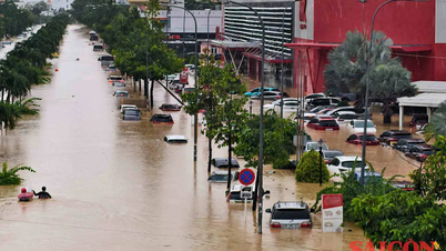
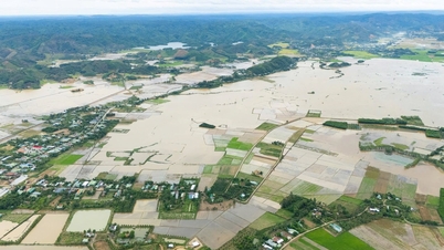
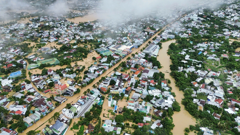
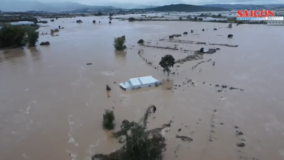
Warning: Low-lying areas along the Dong Nai and La Nga rivers in the communes of Dak Lua, Nam Cat Tien, Ta Lai, Thanh Son, Phu Vinh, Phu Lam, Tan Phu, Phu Hoa, Dinh Quan in Dong Nai province are flooded; low-lying areas along the river in the lower reaches of the Dong Nai river, in the wards and communes of Tri An, Tan An, Trang Dai, Tan Trieu, Bien Hoa, Tran Bien, Tam Hiep, Long Hung, Phuoc Tan, Tam Phuoc, An Phuoc, Nhon Trach, Dai Phuoc, Phuoc An in Dong Nai province and neighboring areas are at risk of flooding due to floods (high tides).
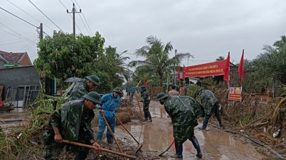
On the same day, the Dinh Quan Power Management Team (Dong Nai Power Company) urgently deployed response measures and isolated the power grid in flooded areas in Dak Lua commune (Dong Nai province) to ensure absolute safety for people. On the morning of November 21, the water rose about 1 meter above the base of the power pole at the deepest points in Hamlet 2 and Hamlet 6, Dak Lua commune; although the power grid has not been directly affected, to prevent danger, the Dinh Quan Power Management Team proactively cut off power in many areas.
Source: https://www.sggp.org.vn/muc-nuoc-song-dong-nai-dang-cao-nhieu-noi-co-nguy-co-ngap-lut-post824689.html


Comment (0)