
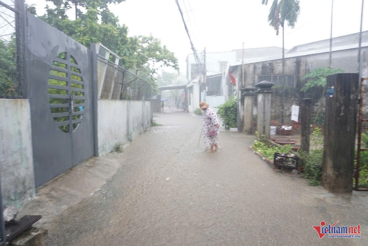
On September 18th, due to the influence of a tropical depression, Da Nang City experienced heavy rain, and some residential areas along Me Suot Street (Hoa Khanh Nam Ward, Lien Chieu District) - considered the "flood epicenter" of Da Nang - showed signs of flooding.
The area around Me Suot Street has experienced severe flooding on several occasions, with water levels rising to approximately 1.5 meters. During the flooding in October 2023, Hoa Khanh Nam ward evacuated more than 4,000 households in the flooded Me Suot Street area.
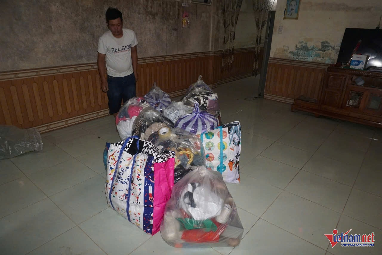
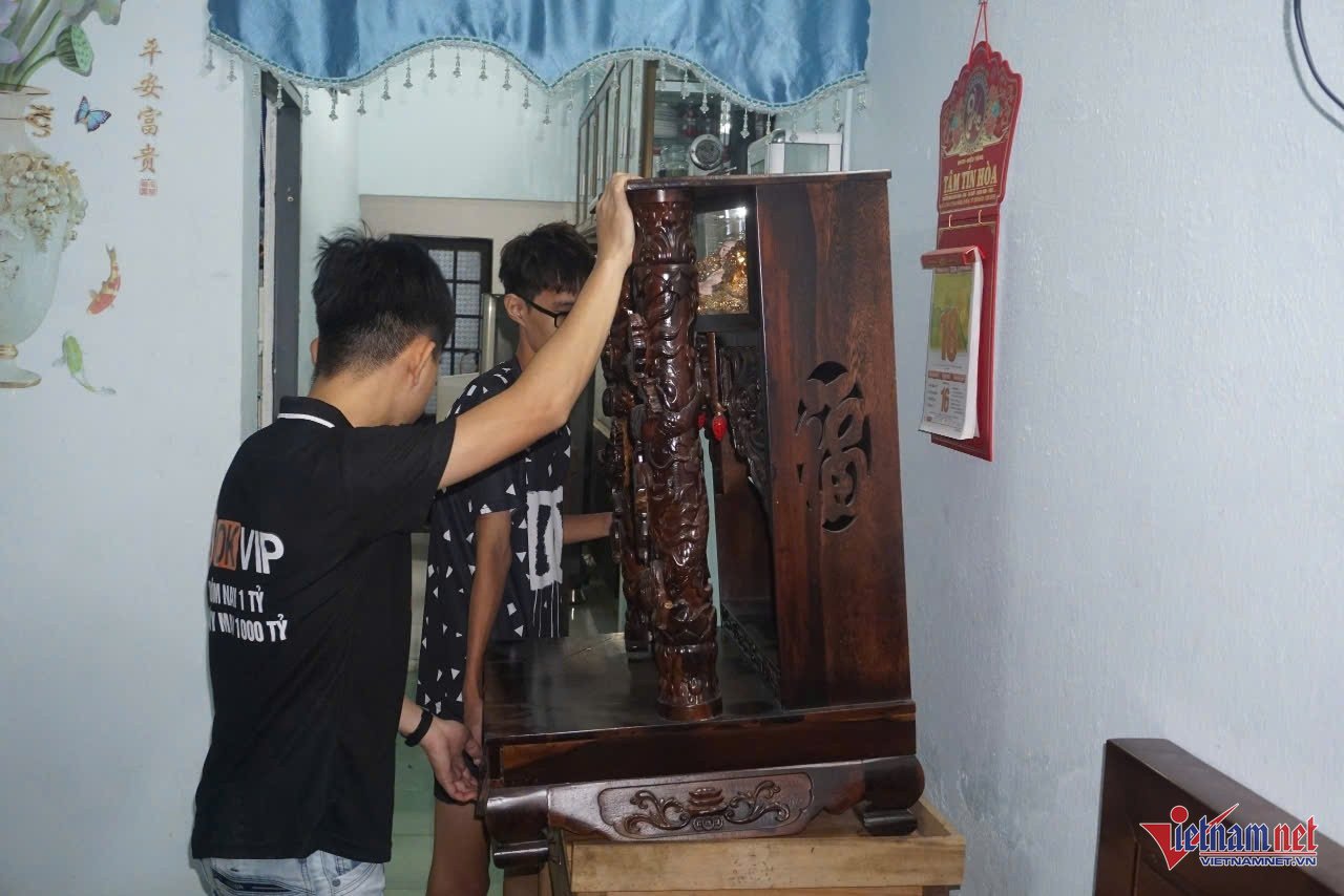
At noon on September 18th, many households in the Me Suot street area temporarily put aside their work to stay home and move their belongings to higher ground in case of deep flooding.
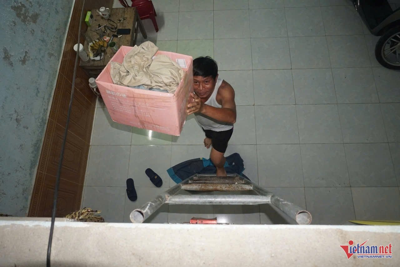
Mr. Hanh (residing at Group 37, Me Suot Street) said he had taken time off work to gather all his clothes and belongings and move them to a relative's house. His wife and children will go to his relative's house after school and work to avoid the rain and storm.

According to the National Center for Hydro-Meteorological Forecasting, as of 10:00 AM today (September 18th), the center of the tropical depression is located approximately 180km east of the Hoang Sa archipelago. The strongest winds near the center of the tropical depression are at level 7 (50-61km/h), with gusts up to level 9; it is moving mainly westward at a speed of about 15km/h.
Forecast for the next 24 hours: The tropical depression is likely to strengthen into a storm, reaching level 8 intensity with gusts up to level 10. From today until tomorrow night (September 19th), the area from Ha Tinh to Quang Ngai is forecast to experience heavy to very heavy rain and scattered thunderstorms, with rainfall amounts generally ranging from 100-300mm, and locally exceeding 500mm.
Source: https://vietnamnet.vn/dan-vung-ron-lu-o-da-nang-nghi-lam-don-do-tranh-ngap-lut-2323433.html

![[Photo] Prime Minister Pham Minh Chinh receives the Governor of Tochigi Province (Japan)](/_next/image?url=https%3A%2F%2Fvphoto.vietnam.vn%2Fthumb%2F1200x675%2Fvietnam%2Fresource%2FIMAGE%2F2025%2F12%2F16%2F1765892133176_dsc-8082-6425-jpg.webp&w=3840&q=75)
![[Photo] Prime Minister Pham Minh Chinh receives Lao Minister of Education and Sports Thongsalith Mangnormek](/_next/image?url=https%3A%2F%2Fvphoto.vietnam.vn%2Fthumb%2F1200x675%2Fvietnam%2Fresource%2FIMAGE%2F2025%2F12%2F16%2F1765876834721_dsc-7519-jpg.webp&w=3840&q=75)
![[Live] 2025 Community Action Awards Gala](/_next/image?url=https%3A%2F%2Fvphoto.vietnam.vn%2Fthumb%2F1200x675%2Fvietnam%2Fresource%2FIMAGE%2F2025%2F12%2F16%2F1765899631650_ndo_tr_z7334013144784-9f9fe10a6d63584c85aff40f2957c250-jpg.webp&w=3840&q=75)
![[Image] The tenacious fighting spirit of Vietnamese women's football](/_next/image?url=https%3A%2F%2Fvphoto.vietnam.vn%2Fthumb%2F1200x675%2Fvietnam%2Fresource%2FIMAGE%2F2025%2F12%2F17%2F1765990260956_ndo_br_4224760955870434771-copy-jpg.webp&w=3840&q=75)
![[Image] Leaked images ahead of the 2025 Community Action Awards gala.](/_next/image?url=https%3A%2F%2Fvphoto.vietnam.vn%2Fthumb%2F1200x675%2Fvietnam%2Fresource%2FIMAGE%2F2025%2F12%2F16%2F1765882828720_ndo_br_thiet-ke-chua-co-ten-45-png.webp&w=3840&q=75)


![[Live] Closing Ceremony and Award Presentation for the "Impressive Vietnam Tourism" Video/Clip Creation Contest 2025](https://vphoto.vietnam.vn/thumb/402x226/vietnam/resource/IMAGE/2025/12/17/1765974650260_z7273498850699-00d2fd6b0972cb39494cfa2559bf85ac-1765959338756946072104-627-0-1338-1138-crop-1765959347256801551121.jpeg)


Comment (0)