
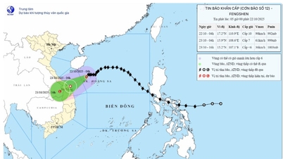
According to the Provincial Hydrometeorological Station, the highest daily peak water level on river banks and canals in the province will gradually rise from October 22-23, rise slowly and change little on October 24, and gradually decrease from October 25-27.
 |
| High tides can also pollute water sources, affecting people's lives. |
The highest peak water level at stations during this high tide occurred on October 23-24 (September 3-4, lunar calendar). My Thuan station was 35cm higher than alert level III (BĐIII), Cho Lach station was 16cm higher than BĐIII, Tra Vinh station was 12cm higher than BĐIII, the remaining stations were 3cm lower than BĐIII to 7cm higher than BĐIII.
During this period, the peak tide is expected to appear in the early morning and late afternoon of October 23-24, specifically: around 4-6:30 am and 5-8:30 pm at My Thuan and Cho Lach stations; around 3:30 am to 5:00 am and 4:30 pm to 7:00 pm at My Hoa, Tra Vinh and Cau Quan stations; around 2-3:30 am and 3-6 pm at An Thuan, Binh Dai and Ben Trai stations.
The highest tide that can be reached is: My Thuan: 215cm, 35cm higher than alarm level III; Cho Lach: 206cm, 16cm higher than alarm level III; Tra Vinh: 202cm, 12cm higher than alarm level III.
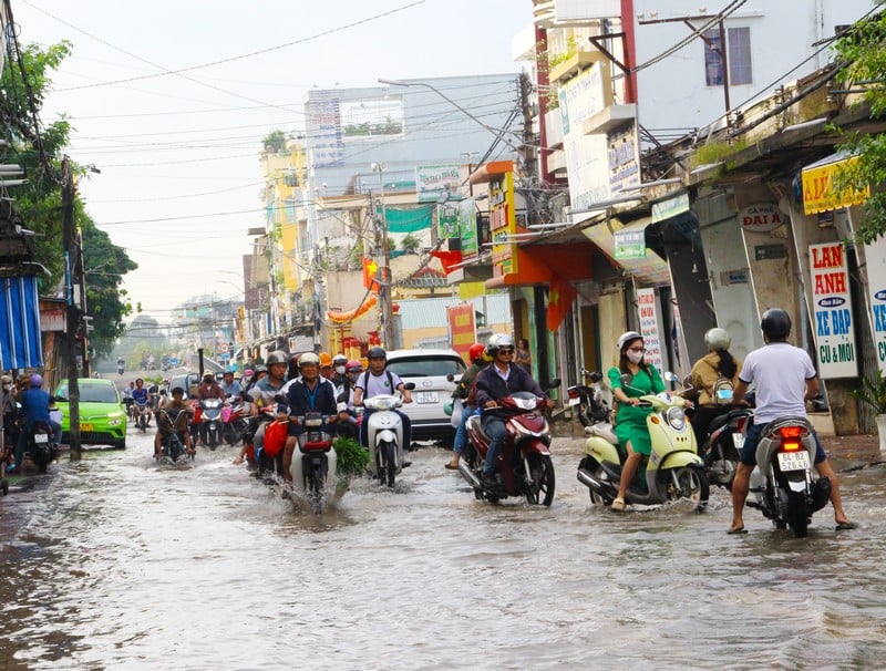
The possibility of flooding from today until October 25 is from 5-45cm, the depth of flooding will gradually increase according to the rising water level with the tide. Some areas that are vulnerable include: Phu Tuc commune (Tien river), Tien Thuy, Vinh Thanh, Phuoc My Trung commune (Ham Luong river); Thanh Thoi, Nhi Long commune, Long Duc ward (Co Chien river); Tan Hoa commune (Hau river) and areas along Mang Thit river.
Many roads in Long Chau and Phuoc Hau wards and the night market in An Hoi ward are often flooded when the tide rises. National highways are also likely to be affected by rapidly rising tides.
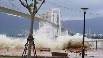
High tides can also pollute water sources, affect fruit growing, aquaculture, livestock farming, and cause minor erosion on river banks.
Recommendation: Localities need to have plans to protect and reinforce the dike system, raise furniture and belongings, and proactively deal with flooding and landslides caused by high tides combined with upstream floods, rain and other factors.
News and photos: THAO LY
Source: https://baovinhlong.com.vn/thoi-su/202510/dinh-trieu-cuong-23-2410-kha-nang-gay-ngap-tu-nay-den-2510-tu-5-45cm-b352b26/

![[Photo] Award Ceremony of the Political Contest on Protecting the Party's Ideological Foundation](https://vphoto.vietnam.vn/thumb/1200x675/vietnam/resource/IMAGE/2025/10/22/1761151665557_giaia-jpg.webp)
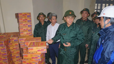
![[Photo] Da Nang: Shock forces protect people's lives and property from natural disasters](https://vphoto.vietnam.vn/thumb/1200x675/vietnam/resource/IMAGE/2025/10/22/1761145662726_ndo_tr_z7144555003331-7912dd3d47479764c3df11043a705f22-3095-jpg.webp)
![[Photo] Prime Minister Pham Minh Chinh chairs meeting on nuclear power plant construction](https://vphoto.vietnam.vn/thumb/1200x675/vietnam/resource/IMAGE/2025/10/22/1761137852450_dsc-9299-jpg.webp)


Comment (0)