
Planning vision: Overall review, spatial articulation
Identifying infrastructure as the "blood vessel" of the economy, the Resolution of the 1st Provincial Party Congress, term 2025-2030 clearly stated: "Mobilizing and concentrating resources, completing a synchronous and modern infrastructure system, prioritizing key traffic works, inter-regional connection projects, especially the traffic system connecting the urban areas of Phu Ly - Hoa Lu - Nam Dinh , the province's economic driving forces with national routes; planning and developing urban areas associated with the orientation of public transport development (TOD) and areas adjacent to high-speed railway stations, economic zones - industrial parks, tourist areas...".
In addition, focus on implementing well the work of planning and planning management; research and plan urban development areas, expand space and room to create breakthroughs in socio-economic development.
Analyzing from the perspective of regional planning, Mr. Nguyen Huy Hoang, Head of Strategy and Policy Department, Academy of Strategy, training of construction staff, pointed out the reality: Although localities previously had their own plans, when placed in the overall new regional connection, the system revealed many shortcomings. The current infrastructure system is mainly concentrated in the North - South direction, lacking connections in the East - West direction. The main axes between urban areas are still scattered, not promoting transport connectivity. Therefore, the urgent requirement is to form a multi-center transport system, increasing the integration between transport - urban - tourism and logistics.
Agreeing with the assessment of this "lack of synchronization", Comrade Nguyen Van Luong, Member of the Provincial Party Standing Committee, Director of the Department of Construction, said that the rivers or old administrative boundaries had previously created natural geographical distances. Therefore, the urgent action of the Construction industry now is to review and "reconnect" the entire development space. We focus on consulting on investment in key traffic axes to erase geographical distances, ensuring smooth traffic from the Phu Ly urban area, through Nam Dinh, Hoa Lu down to the marine economic zone. The goal is to put traffic infrastructure one step ahead, creating a lever to lead urban and economic development in accordance with the general planning orientation of the new province.
Activating a series of key traffic projects
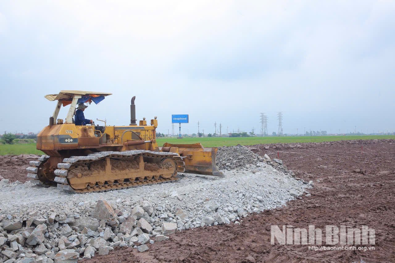
From that "coupling" strategic thinking, a series of strategic transport projects with a scale of tens of thousands of billions of VND have been proposed for investment by the Department of Construction, approved by the Provincial People's Council, directly solving the problem of regional connectivity.
A typical example of the effort to connect Phu Ly urban area with Hoa Lu is the Thanh Liem - Cao Bo road construction project (T4 axis). With a total investment of nearly 4,000 billion VND, this 16 km long road is designed with a scale of 6 lanes for motor vehicles, the starting point connecting the T4 section being invested in Thanh Liem commune, the end point intersecting with National Highway 10 in Y Yen commune. When completed, T4 will not only reduce the pressure on the North - South expressway and National Highway 1 but also become the backbone axis opening up space for urban development and commercial services along both sides of the route for the northern area of the new province.
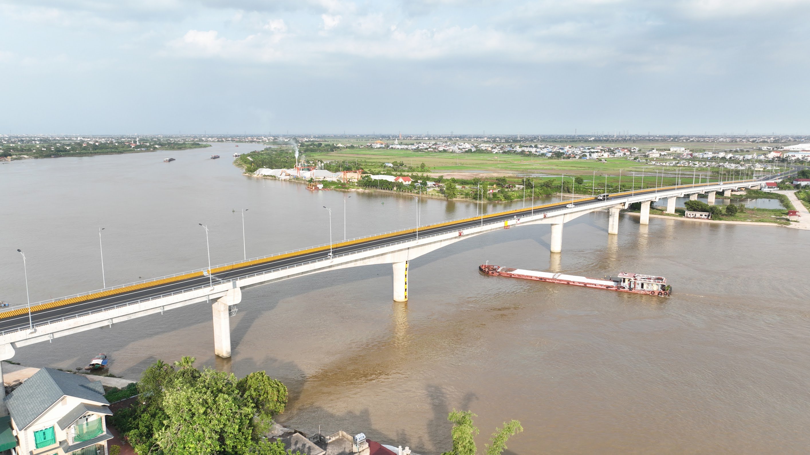
Parallel to the North-South axis, to "erase" the natural boundary in the East, the landscape axis road project connecting Nam Dinh - Hoa Lu with a total investment of up to 13,850 billion VND is the center of attention. This is a large-scale project including 4 routes with a total length of 39 km (main route, belt route 2 and connecting branch routes). In particular, the project will build a bridge over the Chau Giang River and branch routes connecting directly to 2 special National Monuments, Tran Thuong Temple and Tran Temple. This route is expected to create momentum for the development of spiritual tourism, historical culture, connecting the scenic spots of the Red River Delta.
Not only focusing on the main axes, the Construction sector also consulted on implementing projects to "unblock" potential areas. Notably, the project to build a road connecting Hoa Lu with the 07 vertical axis (TD07) with a total capital of nearly 4,400 billion VND. This project includes the construction of a bridge over the Day River and the completion of the North-South expressway interchange. This is considered a "new traffic gateway" for Hoa Lu urban area, helping to quickly connect the provincial administrative center with industrial parks and modern urban areas in the communes of Vu Duong, Van Thang, and Y Yen.
In addition, in order to awaken the potential of the area east of the Day River, the province is promoting the research of the Day River overpass and road project on National Highway 37C (total investment of about 3,000 billion VND). This project has strategic significance in connecting the Gian Khau Industrial Urban Area with the area east of the Day River, connecting the center of Hoa Lu with the area east of Phong Doanh and Tan Minh communes, opening a smooth connection to National Highway 1A, the expressway and the Ring Road 5 in the future.
In addition to major traffic projects, urban infrastructure improvement work is also focused on. The Department of Construction is urgently completing procedures for the lighting system project on National Highway 1A (from Phu Ly ward to Hoa Lu ward) and National Highway 10 (from Truong Thi ward to Hoa Lu ward) with a budget of about 160 billion VND. "Lighting up" these arterial routes not only ensures traffic safety at night but also creates an urban aesthetic highlight.
The idea of a “riverside city” is also gradually taking shape with the Landscape Road Project combined with the embankment for urban development and services on both sides of the Day River. At the same time, closely following the orientation of urban development associated with public transport (TOD), the province is also planning modern commercial and service areas at 3 high-speed railway stations (Phu Ly, Hoa Lu, Nam Dinh).
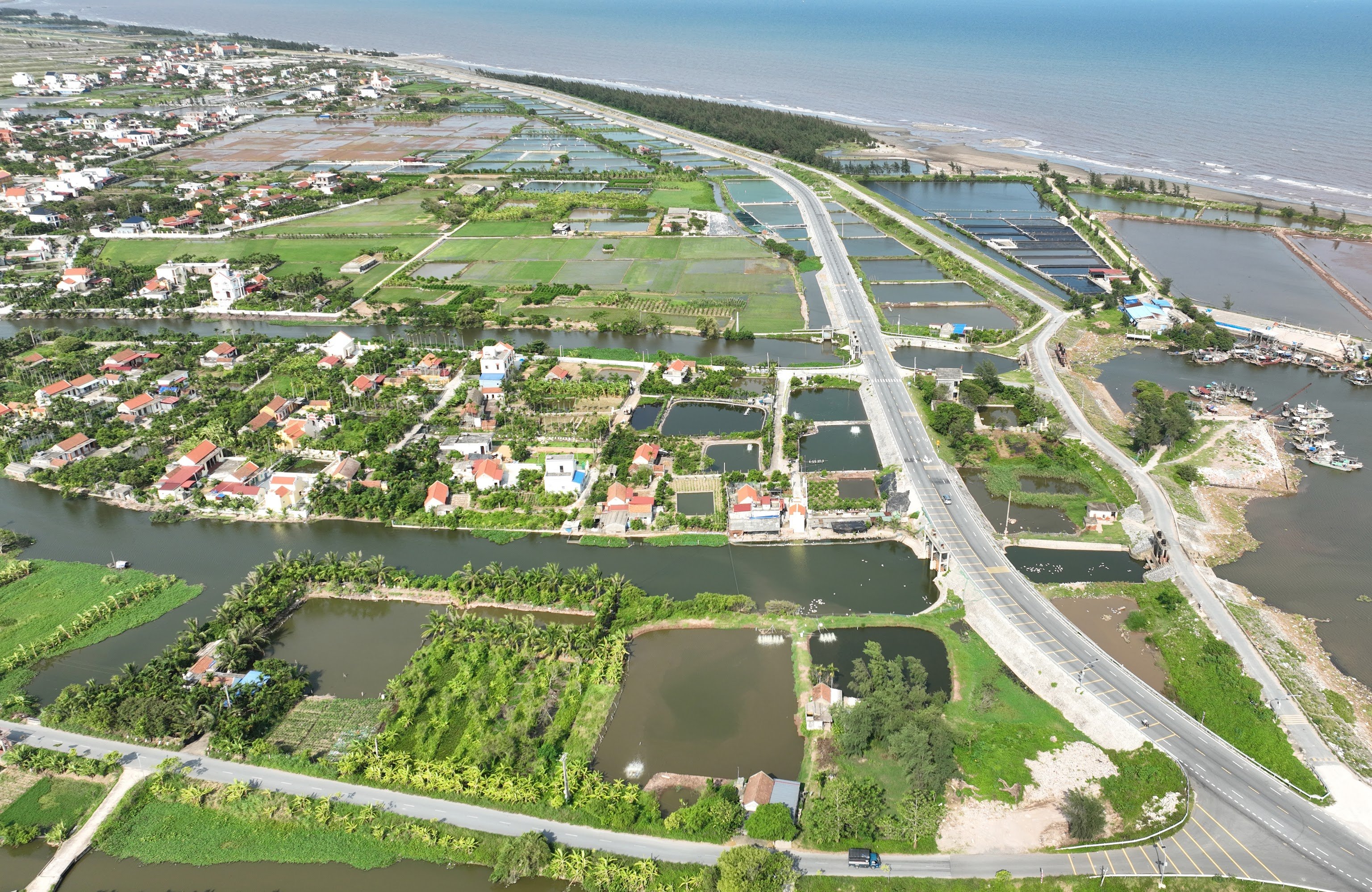
In addition, the Department of Construction is preparing a project to plan a level 4E airport and propose to add a plan for a deep-water port in Ninh Co (Rang Dong commune) to accommodate large tonnage ships.
It can be seen that by connecting key routes, planning the construction of airports and seaports, Ninh Binh is gradually completing its comprehensive infrastructure picture.
Marks on the construction site
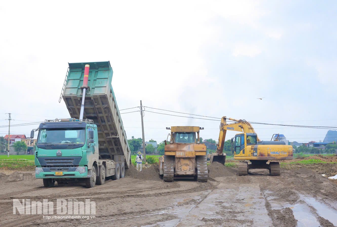
Not stopping at planning on paper, the spirit of the Resolution of the 1st Provincial Party Congress, term 2025-2030 is being strongly concretized by the progress of implementing works and projects.
The first highlight was the completion and operation of Phu Thu Interchange (Ha Nam Ward) with a total investment of nearly 1,400 billion VND at the end of September. As a modern 3-level interchange directly connecting with Ring Road 4, Ring Road 5 and local traffic routes, the project marks the great efforts and determination of the entire political system in concretizing urban, traffic and socio-economic development planning. The formation of the interchange helps strengthen inter-regional connectivity, shorten travel time between Ninh Binh and neighboring provinces, and at the same time open up new development space for the northern region of the province. This is also an important "push" to promote key economic sectors such as education - training, high-tech industry, logistics services, eco-tourism and spiritual culture.
Along with that, the East-West Regional Link Road Project is also reaching important milestones. Of which, Route 1 has a length of 32km, connecting National Highway 1A in Thanh Lam commune to the intersection between the two expressways Cau Gie - Ninh Binh and Hanoi - Hai Phong, and has basically completed the road section. Route 2 connecting two special national relics, Tran Thuong Temple and Tran Temple Historical - Cultural Relic Site, starting point in Tran Thuong commune, ending point in Nam Ly commune, has also reached over 90% of the volume, ready to open to traffic.
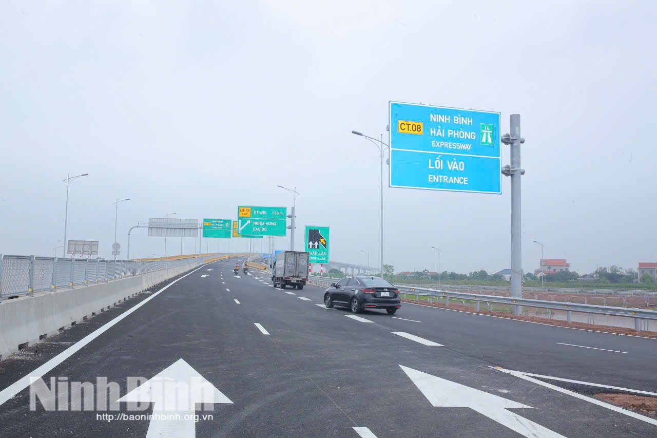
The construction atmosphere is taking place urgently on the Ninh Binh - Hai Phong Expressway (CT.08), a "strategic connection" for the marine economy, nearly 55 km long. This route includes three component projects: Ninh Binh - Hai Phong Expressway Project under the form of public investment (length 25.3 km); Day River Overpass Construction Project (length 2 km); Ninh Binh - Hai Phong Expressway Project under the form of public-private partnership (length 27.6 km).
To date, the Day River Overpass has been completed. The site clearance work for the public investment project has reached over 80%. In addition, all 10 resettlement areas serving the project are also being urgently completed.
At the construction site, contractors are maintaining a "3-shift, 4-team" construction pace. The public investment project is implementing 7 simultaneous construction fronts at key items such as Mai Son, Khanh Thuong, Khanh Trung bridges, Highway 10 overpass, Tien Hoang bridge, Vac river bridge... The public-private partnership project is implementing 12 construction fronts (11 road fronts, 1 bridge front).
When completed in 2026, this expressway will shorten the travel time between Ninh Binh - Hai Phong to more than 1 hour, directly connecting the province's raw material areas and industrial parks with the international seaport system.
These practical movements are clear evidence of Ninh Binh province's determination in implementing infrastructure breakthroughs: Doing real work, with real efficiency, creating momentum for socio-economic takeoff.
Source: https://baoninhbinh.org.vn/hien-thuc-hoa-khau-dot-pha-ha-tang-di-truoc-mo-khong-giant-phat-trien-cho-ninh-b-251125122810130.html

![[Photo] VinUni students' emotions are sublimated with "Homeland in the Heart: The Concert Film"](/_next/image?url=https%3A%2F%2Fvphoto.vietnam.vn%2Fthumb%2F1200x675%2Fvietnam%2Fresource%2FIMAGE%2F2025%2F11%2F26%2F1764174931822_10-3878-jpg.webp&w=3840&q=75)

![[Photo] Close-up of heavy damage at the school located on the banks of the Ban Thach River](/_next/image?url=https%3A%2F%2Fvphoto.vietnam.vn%2Fthumb%2F1200x675%2Fvietnam%2Fresource%2FIMAGE%2F2025%2F11%2F26%2F1764152130492_ndo_bl_img-8188-8805-jpg.webp&w=3840&q=75)


![[Photo] Opening of the 28th Session of the Hanoi People's Council](https://vphoto.vietnam.vn/thumb/402x226/vietnam/resource/IMAGE/2025/11/26/1764155991133_image.jpeg)


Comment (0)