

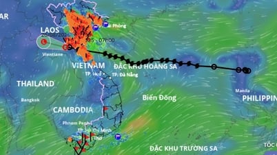
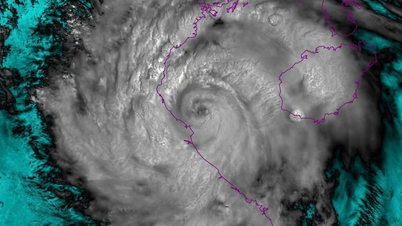
Current status of tropical depression
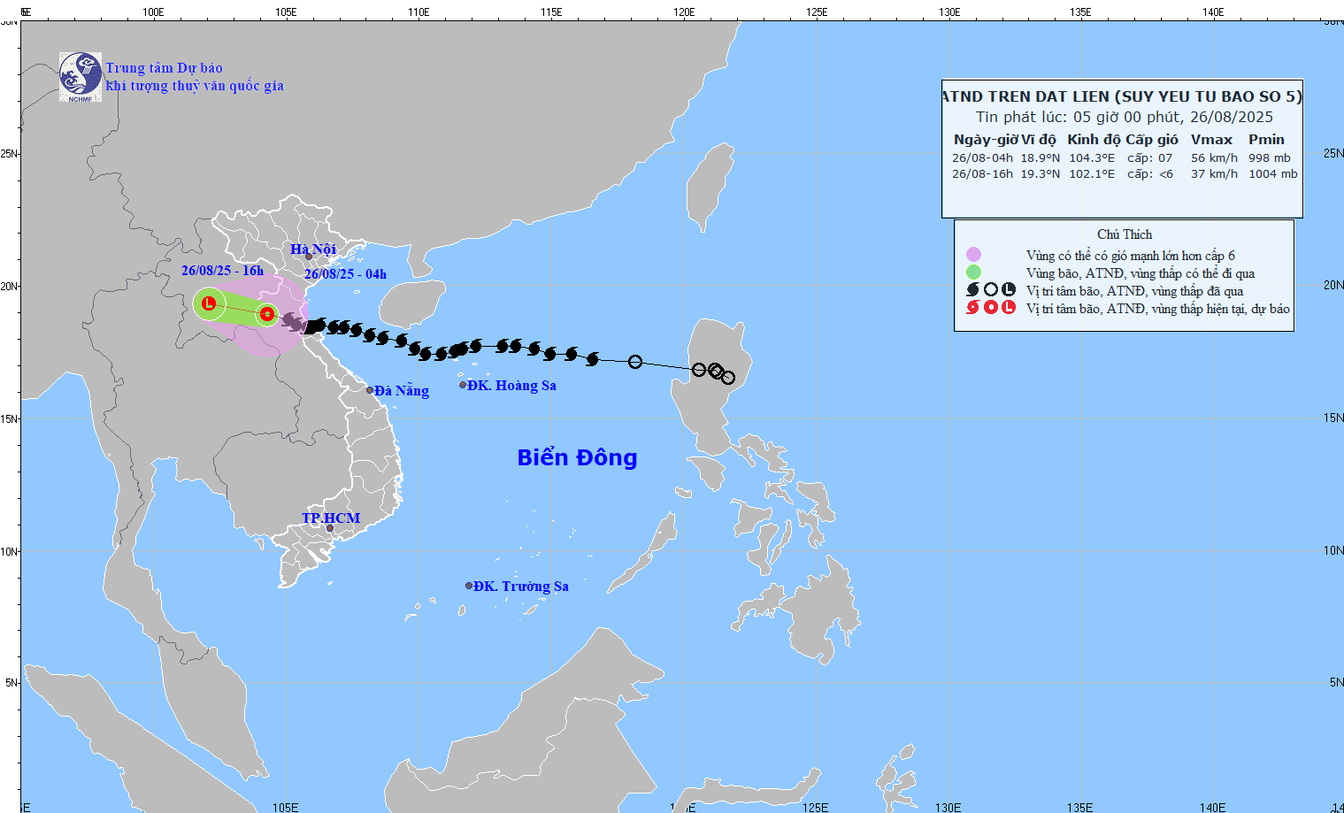
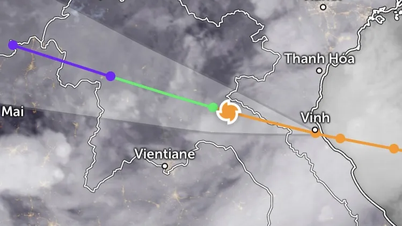
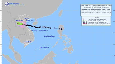
04:00 August 26: center at 18.9°N - 104.5°E (Central Laos) .
Strongest wind level 7 (50–61km/h), gust level 9 ; moving West Northwest 15–20km/h .
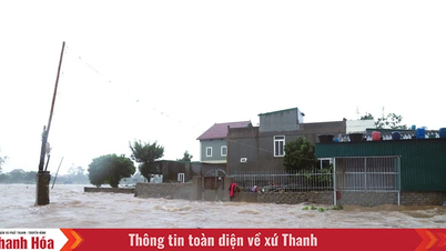
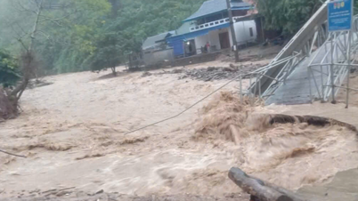
Previously, many coastal stations in Nghe An - Ha Tinh recorded strong winds of level 8-10, gusts of 12-15 ; water levels rose 1.66m at Hon Ngu and 1.01m at Sam Son.
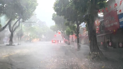
In the Northern Delta provinces, from Thanh Hoa to Quang Tri, there has been moderate to heavy rain, and in some places very heavy rain over 600mm.
Forecast:
4:00 p.m. August 26: position 19.3°N – 102.1°E (Central Laos), weakened into a low pressure area < level 6 .
Danger zone: 17.0 - 20.5°N; West 108.5°E.
Risk: Level 3 (Gulf of Tonkin).
Impact forecast:
At sea: This morning (August 26), in Bac Bo Gulf (Bach Long Vi, Cat Hai, Co To, Van Don, Hon Ngu): wind level 6-7, gust 8 , waves 2-5m, rough sea.
On land: Thanh Hoa - Nghe An , coastal Ninh Binh: wind level 6-7, gust 9 .
Heavy rain: From early morning of August 26 to the end of August 26: Northern Midlands & Delta, Lao Cai , Son La, Thanh Hoa - Ha Tinh: 50-100mm, some places >200mm , risk of heavy rain with intensity >100mm/3 hours.
Hanoi: heavy rain with thunderstorms; Da Nang: no rain; Ho Chi Minh City: showers, thunderstorms in the evening.
Early morning of August 26-27: Upper & Central Laos: 100–250mm, locally >500mm .
Source: https://baonghean.vn/tin-ap-thap-nhiet-doi-tren-dat-lien-suy-yeu-tu-con-bao-so-5-nghe-an-mua-lon-tu-sang-som-26-8-den-het-ngay-26-8-10305226.html


![[Photo] Multi-colored cultural space at the Exhibition "80 years of the journey of Independence - Freedom - Happiness"](https://vphoto.vietnam.vn/thumb/1200x675/vietnam/resource/IMAGE/2025/8/26/fe69de34803e4ac1bf88ce49813d95d8)


![[Photo] Hanoi: Authorities work hard to overcome the effects of heavy rain](https://vphoto.vietnam.vn/thumb/1200x675/vietnam/resource/IMAGE/2025/8/26/380f98ee36a34e62a9b7894b020112a8)


Comment (0)