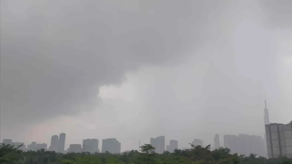
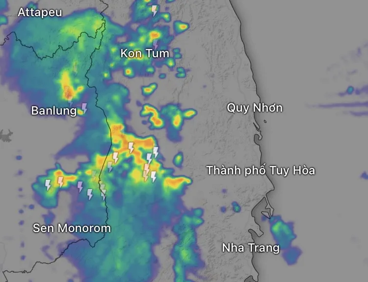
On the afternoon of May 22, a strong convective cloud system caused widespread rain to heavy rain in many localities in the South. Meanwhile, large thunderstorm clouds have also formed in the South of mainland China and are moving towards the mountainous areas in the North of our country, signaling widespread heavy rain from tonight to tomorrow, May 23.

Heavy rain and strong winds in the South and Central Highlands
According to meteorological experts, from early afternoon until 5 p.m. today, many areas in the South and Central Highlands have had prolonged heavy rain.
According to data from the Vrain automatic rain gauge system as of the afternoon of May 22, Ho Chi Minh City recorded 82.6mm of rain at Le Minh Xuan 1 (Binh Chanh), classified as heavy rain.
In Dak Nong, rainfall in Dak Wer (Dak R'lap district) reached 143.4mm (classified as very heavy rain). Binh Phuoc (Bu Dop) recorded 81.4mm and Lam Dong (Da Kho) 69.2mm.

The rains and thunderstorms caused localized flooding in some low-lying areas in Ho Chi Minh City, making traffic difficult in the evening. Rain also appeared in the southwestern provinces.
The cause of the widespread rain is the activity of a low pressure trough with an axis in the South, combined with the southwest monsoon which, although still weak, has begun to increase humidity and form thunderstorms in the afternoon.
However, according to the meteorological agency, the main dominant factor is still the low pressure trough, while the southwest monsoon only plays a supporting role.
Forecast for May 23, Hanoi and the North will have heavy rain
As of 5:30 p.m. on May 22, Hanoi and most of the northern provinces still had no heavy rain, the weather was generally mildly hot, with temperatures of 33-35 degrees Celsius.
However, according to the forecast of the National Center for Hydro-Meteorological Forecasting and international weather forecasting agencies, from tonight, May 22, the North will have heavy rain.
In Ha Giang , the Vrain rain gauge system recorded extremely heavy rainfall (227.8mm at Tan Lap 2 station) from the afternoon of May 22.
On May 23, the North, including Hanoi, will have moderate rain, heavy rain, and some places will have very heavy rain, with common rainfall of 60-120mm, and some places exceeding 180mm.
In particular, the northern mountainous areas such as Ha Giang, Lao Cai, Yen Bai, Lai Chau, etc. may face a high risk of landslides, flash floods and flooding, especially in streams, steep slopes and weak ground. In large cities such as Hanoi, the risk of localized flooding is very high.
The main cause of rain in the North is also due to the compression of low pressure troughs combined with high-altitude wind convergence zones, creating favorable conditions for the formation of large-scale thunderstorms.
In Ho Chi Minh City and the Southern region, rain will continue in the afternoon and evening of tomorrow, May 23. The region is forecast to have scattered showers and thunderstorms, with some places still experiencing heavy rain, but the overall intensity will be slightly lower than today. The highest temperature will range from 32-34 degrees Celsius.
Source: https://www.sggp.org.vn/vi-sao-mien-bac-va-mien-nam-deu-co-mua-to-gio-manh-post796394.html


![[Photo] T&T 1 and Ho Chi Minh City 1 People's Police Teams won the men's and women's team championships](https://vphoto.vietnam.vn/thumb/1200x675/vietnam/resource/IMAGE/2025/5/22/39db06ae67cb4001b7a556e8d9a56d07)

![[Photo] Press delegation meeting to visit Truong Sa and DK1 Platform](https://vphoto.vietnam.vn/thumb/1200x675/vietnam/resource/IMAGE/2025/5/22/6b8d232877ec421a9e8187d83b9f8006)

![[Photo] Prime Minister Pham Minh Chinh chairs meeting on draft Resolution of National Assembly on International Financial Center in Vietnam](https://vphoto.vietnam.vn/thumb/1200x675/vietnam/resource/IMAGE/2025/5/22/d398664ff1a140629169ea5a24e1b4d0)
![[Photo] General Secretary To Lam chairs a working session with the Central Internal Affairs Commission](https://vphoto.vietnam.vn/thumb/1200x675/vietnam/resource/IMAGE/2025/5/22/3b7790f499da45b2803d8ae253207ef1)


![[Photo] Prime Minister Pham Minh Chinh chairs the Government's special meeting on law-making in May](https://vphoto.vietnam.vn/thumb/1200x675/vietnam/resource/IMAGE/2025/5/22/1c880aae96fd4e0894abc47a46fe19ba)


![[Podcast] Week introducing more than 500 OCOP products in Hanoi](https://vphoto.vietnam.vn/thumb/402x226/vietnam/resource/IMAGE/2025/5/22/d144aac2416744718388dbae3260e7fd)


Comment (0)