Weather forecast areas adjusted according to new administrative names include the Northwest, Northeast, Thanh Hoa-Hue area, South Central Coast; Central Highlands; South; Hanoi area; Ho Chi Minh City area.
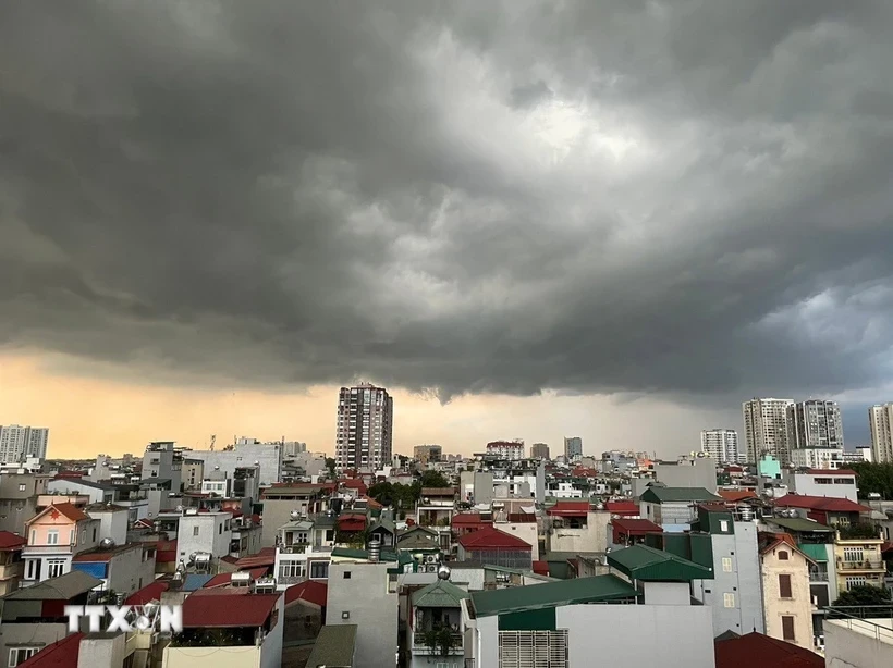
Regarding forecasting work for the implementation of a two-level government starting from July 1, 2025, Director of the Department of Hydrometeorology ( Ministry of Agriculture and Environment ) Nguyen Thuong Hien said that the Department has conducted a comprehensive review and assessment of forecasting, warning of hydrometeorology and natural disasters.
Specifically, the Department of Hydrometeorology coordinates with the Department of Surveying, Mapping and Geographic Information of Vietnam and relevant agencies to develop a new forecast plan suitable to the actual situation so that people can easily grasp information, and management agencies can promptly update and provide timely response plans.
According to Mr. Nguyen Thuong Hien, the National Center for Hydro-Meteorological Forecasting is currently implementing 14 types of hydro-meteorological forecast and warning bulletins under normal conditions and 14 types of forecast and warning bulletins for dangerous hydro-meteorological phenomena.
According to current regulations, the National Center for Hydro-Meteorological Forecasting provides detailed forecasts to regions and provinces and some detailed bulletins to district and point levels; Hydro-Meteorological Stations provide detailed forecasts to district and commune levels (if qualified) in the locality where the Hydro-Meteorological Station is located, ensuring the principle of consistency and non-overlap in issuing bulletins between levels.
The Department of Hydrometeorology is directing the development of weather forecast bulletins on land and at sea, natural disaster warnings, etc. in the direction of updating new administrative units. The subdivisions and regions are also adjusted to show the current status of new place names in an easy-to-understand and detailed manner, helping the recipients, the people and leaders of the new administrative area, to clearly understand the information and respond appropriately.
For land-based forecasts, the National Center for Hydro-Meteorological Forecasting will forecast for typical climate zones for the whole country; including 7 old zones and adding the Ho Chi Minh City zone.
The areas adjusted according to the new administrative names include: Northwest region: Lai Chau, Dien Bien, Son La, Lao Cai, the western area of Phu Tho province (former Hoa Binh province). Northeast region: Tuyen Quang, Cao Bang, Thai Nguyen, Lang Son, Bac Ninh, Bac Giang, Hai Phong, Hung Yen, Ninh Binh, Hanoi; the northern area of Phu Tho province (former Vinh Phuc and Phu Tho provinces). Thanh Hoa-Hue region; South Central Coast region (Da Nang, Khanh Hoa and coastal areas of Quang Ngai, Gia Lai, Dak Lak, Lam Dong); Central Highlands region: The western area of Quang Ngai, Gia Lai, Dak Lak, Lam Dong provinces; Southern region; Hanoi region; Ho Chi Minh City region.
After arranging administrative units according to the two-level government model, weather forecasting and natural disaster warning work will be adjusted and detailed to each new commune/ward level.
For sea forecasts, the National Center for Hydro-Meteorological Forecasting forecasts for the Northern Gulf of Tonkin (sea area from Quang Ninh-Ninh Binh); Southern Gulf of Tonkin (sea area from Thanh Hoa-North Quang Tri (sea area of old Quang Binh province); Southern Quang Tri-Quang Ngai sea area (sea area of old Quang Tri-Quang Ngai).
Gia Lai-Khanh Hoa sea area (former Binh Dinh-Ninh Thuan sea area); Lam Dong-Ca Mau sea area (former Binh Thuan-Ca Mau sea area); Ca Mau-An Giang sea area (former Ca Mau-Kien Giang sea area). Northern area of the East Sea (sea area north of 15 degrees North latitude); Central area of the East Sea (sea area from 10-15 degrees North latitude); Southern area of the East Sea (sea area from 5-10 degrees North latitude); Gulf of Thailand area; Hoang Sa Special Zone (is the sea area of Hoang Sa archipelago); Truong Sa Special Zone (is the sea area of Truong Sa archipelago).
Associate Professor, Doctor, Director of the National Center for Hydro-Meteorological Forecasting Mai Van Khiem also emphasized that the Center will develop detailed weather forecasts for each location, updated 24/7 and forecast up to 10 days in advance.
Previously, the Center for Detailed Forecasting provided 63 forecast points (corresponding to the previous 63 provinces and cities) and now the forecast locations have been renamed according to the commune and ward names in accordance with the new commune and ward administrative units.
In addition, the web system will upload 10-day weather forecast information in 3,321 new communes/wards. People can access it for free to update the weather situation 24/7.
For the convenience of the people, the Center is building a weather application for people to use on their phones, computers, etc.
Target detailed information down to the commune and ward level, updated 24/7 and forecast 10 days in advance.
It is expected that the Center will complete the development of this application in August 2025. In addition to weather information, this application has information on natural disaster warnings such as flash floods, landslides, storms, tropical depressions, heavy rain, thunderstorms, tornadoes, lightning, etc. People can access it completely free of charge.
For forecasts and warnings of storms and tropical depressions, the National Center for Hydro-Meteorological Forecasting will provide detailed forecasts to provinces/cities. For merged provinces with different terrain characteristics, wide geographical distribution and different climate characteristics, specific details will be provided for geographical areas with similar climate characteristics; at sea, the level of detail will be provided to sea areas adjacent to the mainland of Vietnam.
When referring to island districts and island communes in the newsletter, they are all changed to special zones. Coastal sea areas are adjusted according to provincial place names, provincial sea areas are adjusted according to new provincial place names and provincial sea areas.
Forecasts and warnings of heavy rain; cold air; frost, frost; heat will be forecasted for the regions. In case of differences in the impact of natural disasters, details will be given for clusters of provinces; within the forecasted province, if there are still differences, details will be given by province.
Forecast bulletins and warnings of strong winds at sea; high waves, rising water and high tides; and fog will be forecast for coastal provinces/cities and sea areas.
Particularly, rising water and high tides are forecast for 6 coastal areas. Flood forecast and warning bulletins will provide detailed forecasts for points in river basins nationwide; detailed flooding for areas/regions of river basins; Thunderstorm, tornado, lightning warning bulletins; flash floods, landslides will be warned for areas of provinces and cities nationwide, listing a few typical communes (according to new) and accompanying illustrations.
It is expected to update all provincial and commune level maps into the software system. The bulletin will be described in detail down to the commune level (in case of warnings in few provinces and not too many communes); listed down to the provincial level areas by direction and accompanied by illustrative images (in case of widespread warnings with many provinces and communes).
The saltwater intrusion forecast and warning bulletins will forecast key points in river basins affected by saltwater intrusion nationwide. The drought forecast and warning bulletins will forecast total rainfall in detail to the provincial/municipal level; and total surface water volume in detail to forecast and warning points in river basins./.
Source: https://baolangson.vn/xay-dung-phuong-an-du-bao-thoi-tiet-moi-phu-hop-voi-chinh-quyen-2-cap-5051467.html





















Comment (0)