
 |
| Illustration photo: VNA. |
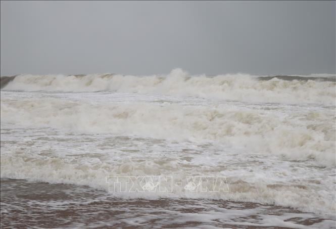
According to Ms. Le Thi Loan, Deputy Head of Weather Forecast Department, National Center for Hydro-Meteorological Forecasting, currently, the low pressure trough has an axis at about 15 - 18 degrees North latitude connecting with a low pressure area in the North East Sea. At 7:00 a.m., the center of this low pressure area was at about 17.0 - 18.0 degrees North latitude; 117.2 - 118.2 degrees East longitude.
The North East Sea (including the Hoang Sa archipelago), the Central and South East Sea (including the Truong Sa archipelago), the sea from Binh Thuan to Ca Mau, Ca Mau to Kien Giang and the Gulf of Thailand will have showers and thunderstorms. At Huyen Tran station, there are strong gusts of wind at level 8 - 9.
The meteorological agency forecasts that during the day and night of June 9, this low pressure area will move slowly to the West and is likely to strengthen into a tropical depression.
According to Mr. Mai Van Khiem, Director of the National Center for Hydro-Meteorological Forecasting, the probability of the low pressure strengthening into a tropical depression is about 90%. Around June 11-12, this tropical depression can strengthen into a storm with a probability of about 60-70%.
Due to the influence of the low pressure area, on the day and night of June 9, the North East Sea area (including the waters of Hoang Sa archipelago), the central and South East Sea area (including the waters of Truong Sa archipelago), the waters from Binh Dinh to Ca Mau , Ca Mau to Kien Giang and the Gulf of Thailand will have heavy rain and thunderstorms.
On the night of June 9, there will be scattered showers and thunderstorms in the northern Gulf of Tonkin. During the thunderstorms, there is a possibility of tornadoes, strong winds of level 6-7 and waves over 2 meters high.
In addition, the sea area from Ninh Thuan to Ca Mau, the Central and Southern East Sea area (including the sea area of Truong Sa archipelago) has strong southwest winds of level 5, sometimes level 6, gusting to level 7 - 8, rough seas. Waves are 1.5 - 3 m high.
Meteorological experts warn that all ships operating in the above areas are at risk of being affected by tornadoes, strong winds and high waves.
Previously, the National Center for Hydro-Meteorological Forecasting assessed that this year the ENSO phenomenon is in neutral conditions; from June to August 2025, ENSO will continue to maintain a neutral state with a probability of 70 - 90%.
Under such conditions, from June to August 2025, storms and tropical depressions are likely to operate in the East Sea and affect our country at a level approximately equal to the average of many years, with about 5 storms in the East Sea, of which about 2 storms will affect our mainland.
According to News and People Newspaper
Source: https://baodanang.vn/xa-hoi/202506/ap-thap-tren-bien-dong-co-nguy-co-manh-len-thanh-bao-4008401/


Comment (0)