
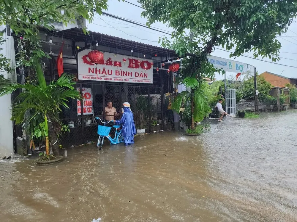
Risk of flash floods on small rivers and streams, landslides on steep slopes in the above provinces and cities, especially in the districts: Ba Thuoc, Cam Thuy, Muong Lat, Ngoc Lac, Nhu Xuan, Quan Hoa, Quan Son, Thuong Xuan (Thanh Hoa province); A Luoi, Phu Loc, Huong Tra town, Phong Dien town (Hue city); Ba To, Minh Long, Son Ha, Son Tay, Tra Bong ( Quang Ngai province). Warning level of natural disaster risk due to flash floods, landslides, land subsidence due to heavy rain or level 1 flow.
Heavy rains are likely to cause flooding in low-lying areas, urban and industrial areas; flash floods on small rivers and streams, landslides on steep slopes (real-time warning information on areas at risk of flash floods and landslides is provided online on the website of the Department of Hydrometeorology at: https://luquetsatlo.nchmf.gov.vn and in separate bulletins warning of flash floods and landslides).
Flash floods and landslides can have very negative impacts on the environment, threaten people's lives; cause local traffic congestion, affect the movement of vehicles; destroy civil and economic works, causing damage to production and socio-economic activities.
To prevent flash floods and landslides, disaster prevention experts say that provinces and cities need to use structural and non-structural solutions.
Regarding engineering measures, provinces and cities need to plant and protect upstream protective forests, especially in areas that often cause flash floods, to protect the ecological environment, protect the vegetation cover, increase the water retention capacity of the basin, and limit the ability to concentrate flood flows. At the same time, build flood-regulating reservoirs in areas where flash floods often occur, clear flood drainage routes, build dykes, flash flood walls, divide flood flows, build additional spillways in reservoirs, etc.
For non-structural measures, localities need to create flash flood risk zoning maps (high risk; medium risk and areas with low risk of flash floods). This map is one of the important bases for localities to propose measures to prevent flash floods; land use planning to limit development in areas with high risk of flash floods. For residential areas that have developed without planning in the past, localities need to re-plan and resettle, moving people out of areas with high risk of flash floods, landslides, etc.
From 3:00 p.m. to 5:00 p.m. on June 6, Thanh Hoa province, Hue city and Quang Ngai province had rain, some places had moderate to heavy rain such as: Na Meo (Thanh Hoa) 67.2 mm; Huong Nguyen (Hue) 80.2 mm; Gia Vuc (Quang Ngai) 59.2 mm...
Source: https://www.sggp.org.vn/ba-tinh-thanh-pho-khu-vuc-mien-trung-co-nguy-co-xay-lu-quet-sat-lo-dat-post798481.html


![[Photo] Nearly 104,000 candidates in Hanoi complete procedures to take the 10th grade entrance exam](https://vphoto.vietnam.vn/thumb/1200x675/vietnam/resource/IMAGE/2025/6/7/7dbf58fd77224eb583ea5c819ebf5a4e)


![[OCOP REVIEW] Tu Duyen Syrup - The essence of herbs from the mountains and forests of Nhu Thanh](https://vphoto.vietnam.vn/thumb/402x226/vietnam/resource/IMAGE/2025/6/5/58ca32fce4ec44039e444fbfae7e75ec)


Comment (0)