
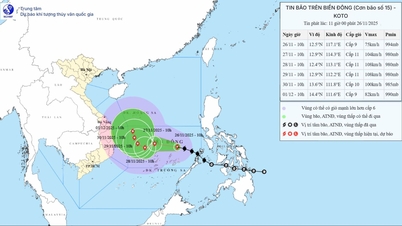
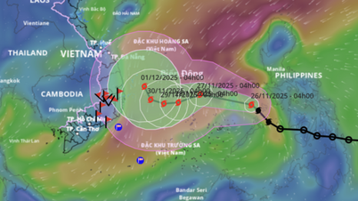
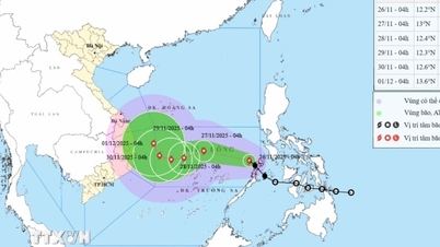
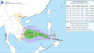
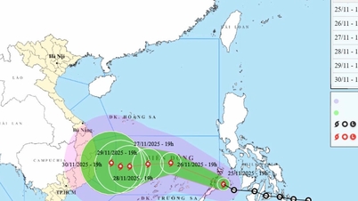
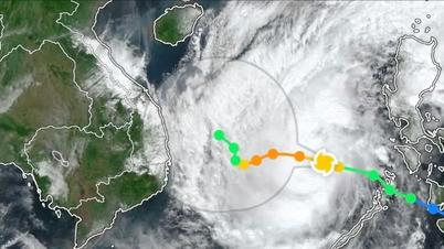
The National Center for Hydro-Meteorological Forecasting informed: On the evening of November 25, a tropical depression moved into the western sea of the central Philippines and strengthened into a storm.

At 7:00 p.m. on November 25, the center of the storm was at about 10.9 degrees North latitude - 120.4 degrees East longitude, in the sea west of the central Philippines. At this time, the storm was at level 8 (62-74 km/h), gusting to level 10 and moving west-northwest at a speed of 20-25 km/h.
According to the National Center for Hydro-Meteorological Forecasting, from the evening of November 25 to November 26, the storm will continue to move in a West-Northwest direction at a speed of 20-25km/hour, entering the East Sea and is likely to strengthen to level 9, gusting to level 11.
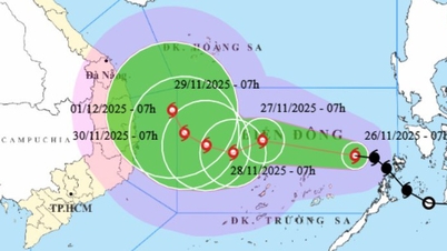
From the evening of November 26 to 27, the storm will move westward, with a speed of 5-10km/hour and is likely to strengthen to level 10-11, gusting to level 13. From the evening of November 27 to 28, the storm will continue to move westward with a speed of 5-10km/hour and is likely to strengthen to level 11, gusting to level 13.
The National Center for Hydro-Meteorological Forecasting warns that between November 27 and 28, the central area of the East Sea (including the sea area north of Truong Sa special zone) may be affected by strong winds of level 10-11, gusts of level 14, waves of 7-9m high, and rough seas. Ships operating in the above-mentioned dangerous areas may be affected by storms, whirlwinds, strong winds, and large waves.
According to the model updated on the evening of November 25 by the National Center for Hydro-Meteorological Forecasting, storm No. 15 may directly affect the weather in the South Central region on November 29 and 30.
Source: https://www.sggp.org.vn/bao-koto-dang-vao-bien-dong-post825441.html


Comment (0)