
According to the National Center for Hydro-Meteorological Forecasting, at 7:00 a.m. on June 12, storm No. 1 was at about 17.0 degrees North latitude, 110.4 degrees East longitude, just west of the Hoang Sa archipelago.

Storm No. 1 is forecast to cause heavy rain in the Central and Central Highlands regions.
Wind force level 8-9, gust level 11. Storm moving in West Northwest direction, speed 10-15 km/hour.
By the morning of June 13, the storm will approach the south of Hainan Island (China), strengthening to level 10, gusting to level 13.
On the morning of June 14, the storm moved to Leizhou, China with winds reduced to level 9, gusting to level 11.
By the morning of June 15, the storm moved northeast, gradually weakening into a low pressure area over southern China.
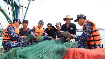
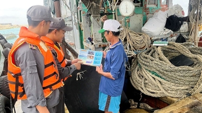
Dangerous areas in the next 2 days include: Northwest of the East Sea (including Hoang Sa archipelago), offshore waters from Quang Tri to Quang Ngai , and Bac Bo Gulf. Disaster risk level is at level 3.
At sea, the area near the eye of the storm has strong winds of level 9-10, gusts of level 13, waves 4-6 m high, very rough seas. From the night of June 12, the wind in Bac Bo Gulf gradually increases to level 6-7, near the eye of the storm level 8-9, gusts of level 11, waves 2-4 m high.
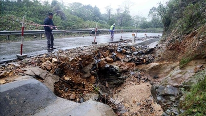
From June 12 to 13, the Central Central region will have very heavy rain, with average rainfall of 100-200 mm, and in some places over 350 mm.
Ha Tinh and the Northern Central Highlands have moderate to heavy rain, over 150 mm in some places. Warning of flash floods, landslides and inundation in low-lying areas.
Source: https://nld.com.vn/bao-so-1-manh-len-giat-toi-cap-13-mien-trung-mua-rat-to-196250612083629492.htm

![[Photo] The Standing Committee of the Organizing Subcommittee serving the 14th National Party Congress meets on information and propaganda work for the Congress.](https://vphoto.vietnam.vn/thumb/1200x675/vietnam/resource/IMAGE/2025/11/19/1763531906775_tieu-ban-phuc-vu-dh-19-11-9302-614-jpg.webp)


![[Photo] Prime Minister Pham Minh Chinh and his wife meet the Vietnamese community in Algeria](https://vphoto.vietnam.vn/thumb/1200x675/vietnam/resource/IMAGE/2025/11/19/1763510299099_1763510015166-jpg.webp)
![[Photo] General Secretary To Lam receives Slovakian Deputy Prime Minister and Minister of Defense Robert Kalinak](https://vphoto.vietnam.vn/thumb/1200x675/vietnam/resource/IMAGE/2025/11/18/1763467091441_a1-bnd-8261-6981-jpg.webp)


Comment (0)