
Accordingly, the total rainfall in the North of Quang Tri province is forecasted to be from 100 - 200mm, locally over 250mm; in the South of the province 150 - 300mm, in some places over 450mm. Especially in the communes of Gio Linh, Cua Viet, Dong Ha, Cam Lo, Quang Tri, Hai Lang, Khe Sanh and Dakrong, the rainfall is from 200 - 300mm, in some places over 400mm. Warning of heavy rain over 100mm/3 hours in the coastal communes/wards of the South of Quang Tri province.
In addition, the communes of Minh Hoa, Dong Le, Phu Trach, Ba Don, Phong Nha, Hoan Lao, Dong Hoi, Truong Son, Le Thuy, and Kim Ngan have average rainfall of 100-200 mm, with some places receiving over 250 mm; the communes of Vinh Linh, Con Tien, and Con Co have average rainfall of 150-200 mm, with some places receiving over 350 mm.
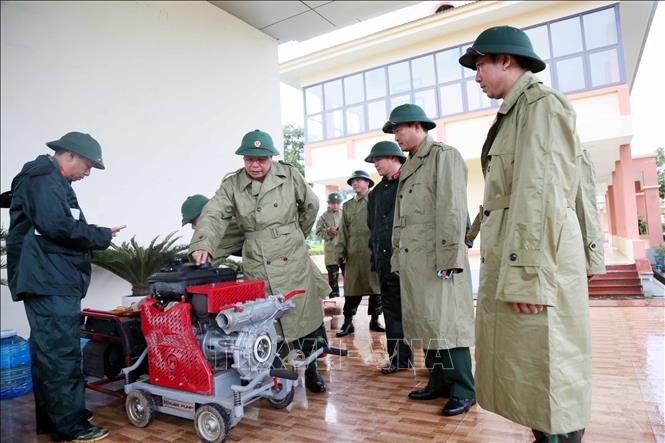
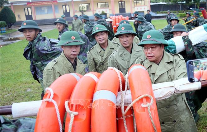
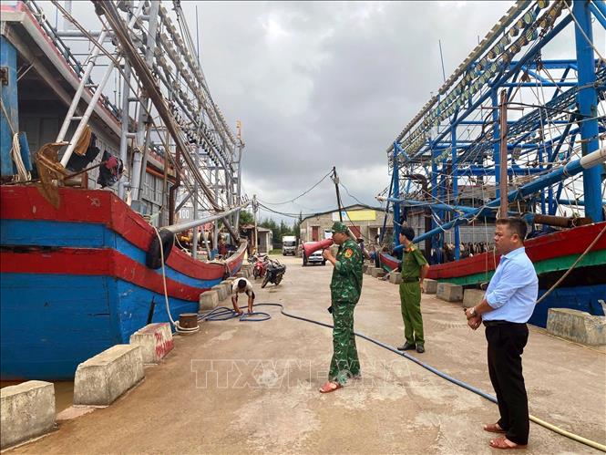
To cope with heavy rains, Quang Tri province directed units and localities to proactively deploy guards and arrange barriers and warning signs at underground locations, flooded spillways, isolated areas, landslide risk points, dangerous areas... to ensure safety for people and vehicles; at the same time, be ready to deploy plans to evacuate people from dangerous areas when bad situations occur.
According to data at 4:00 a.m. on October 23, the water level on Kien Giang River (Le Thuy Commune) was 1.53m, 0.33m above alert level 1; Nhat Le River in Dong Hoi was 1.52m, 0.02m above alert level 2; Ben Hai River (Hien Luong) was 1.35m, 0.35m above alert level 1; Thach Han River (Cua Viet) was 1.29m, 0.21m below alert level 2. The remaining rivers are below alert level 1.
The Hydrometeorological Agency warns that from the night of October 22 to 28, there is a possibility of a flood on the rivers of Quang Tri province. During this flood, the flood peak on the rivers is likely to reach alert level 2 to alert level 3, Thach Han river is at alert level 3, Kien Giang river is above alert level 3.
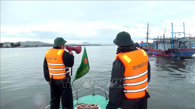
Quang Tri province directed units and localities to closely monitor the development of floods and rains, regularly update information, and promptly direct responses. Localities in downstream areas, riverside areas, and low-lying areas proactively evacuate people from dangerous areas, ensuring the safety of people's lives and property. In addition, relevant sectors and units inspected and reviewed the dam system, irrigation works, flood discharge operation plans, and prepared rescue forces and vehicles when situations arise.
In Quang Tri, due to the influence of storm No. 12, in the past 12 hours, Quang Tri province has had moderate to heavy rain ranging from 30-70mm, with the highest in some places such as: La To Hydropower Plant (Ta Rut) 129mm, Song Thai (Phu Trach) 97.6mm, Dong Lam (Tuyen Phu) 71.6mm, Ta Long (Dakrong) 71.6mm.
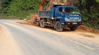
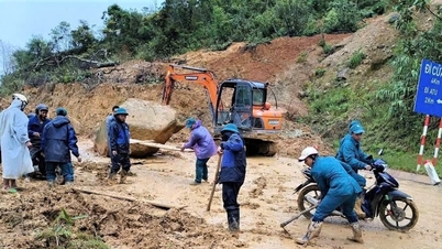
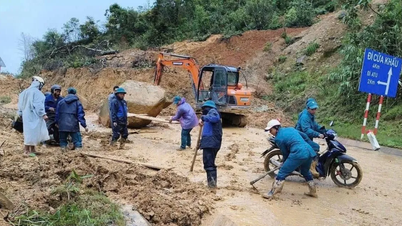
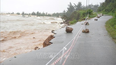
Due to heavy rain, at Km 77+800 National Highway 9B (section through Quang Tri province), about 1,000 m3 of rock and soil has collapsed. Currently, only motorbikes can pass, but cars cannot. Authorities have put up landslide warning signs and mobilized forces to urgently divert traffic and repair the road to ensure traffic flow on the route.
Source: https://baotintuc.vn/xa-hoi/bao-so-12-quang-tri-de-phong-mua-to-gay-ngap-lut-va-sat-lo-dat-da-20251023084458713.htm
![[Photo] Prime Minister Pham Minh Chinh chairs meeting on railway projects](https://vphoto.vietnam.vn/thumb/1200x675/vietnam/resource/IMAGE/2025/10/23/1761206277171_dsc-9703-jpg.webp)

![[Photo] Prime Minister Pham Minh Chinh meets with South African President Matamela Cyril Ramaphosa](https://vphoto.vietnam.vn/thumb/1200x675/vietnam/resource/IMAGE/2025/10/23/1761226081024_dsc-9845-jpg.webp)
![[Photo] President Luong Cuong holds talks with South African President Matamela Cyril Ramaphosa](https://vphoto.vietnam.vn/thumb/1200x675/vietnam/resource/IMAGE/2025/10/23/1761221878741_ndo_br_1-8416-jpg.webp)


Comment (0)