
 |
| Handling landslides at Km 76-050 |
Landslide threatens National Highway 49
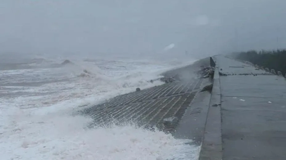
With steep terrain, divided by hillsides, rivers and streams, National Highway 49 and Ho Chi Minh Road through A Luoi area always have the potential risk of landslides and flash floods, affecting people's lives as well as infrastructure.
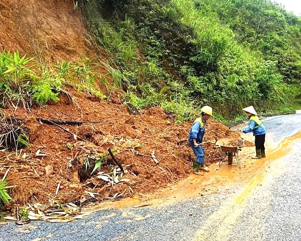
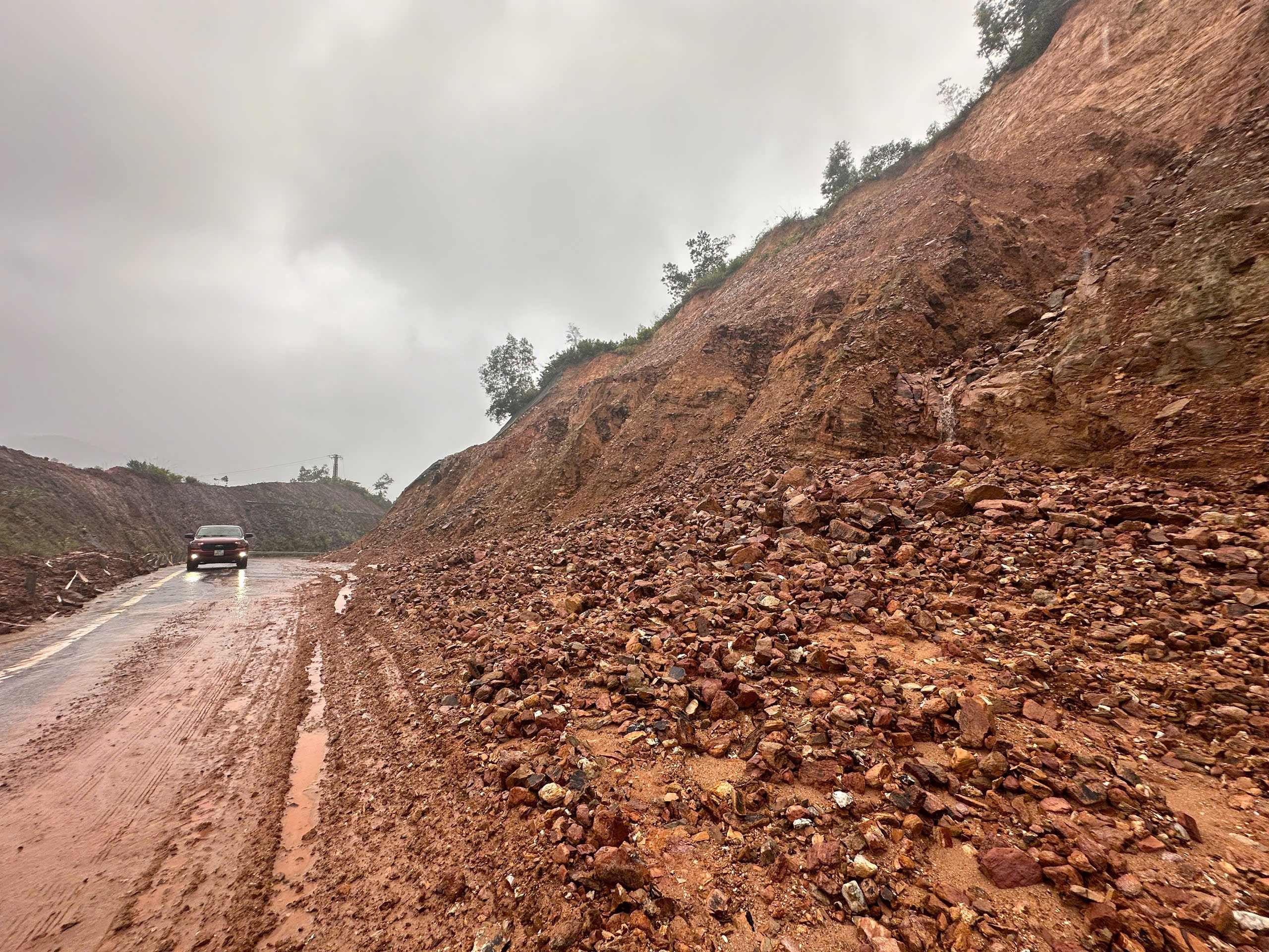
In recent days, the A Co Pass (about 15km long) on National Highway 49 passing through A Luoi 3 commune has continuously experienced 4 landslides with large amounts of soil and rock flowing onto the road surface. The A Luoi Road Management Department ( Hue City Road Management and Construction Joint Stock Company) had to deploy on-site forces to continuously handle, collect, and clear the route.
Specifically, at Km 68+200, rocks and soil from the high hillside slid down the positive slope, spilling onto the road surface, causing slippery conditions, affecting traffic on the route. For more than a week now, at Km 76+050, rocks and soil have continuously flowed down the hill and spilled onto the road surface in large volumes. According to the A Luoi Road Management Department, because people on the hill arbitrarily opened a road to exploit acacia, causing the geological layer to be affected, combined with heavy rain, landslides occurred continuously at the above location. In addition, on the A Co pass, at Km 68, Km 75, Km 66+100, heavy rains and floods caused rocks and soil to fill up the drainage ditches, causing blockages in the flow, which were promptly handled.
 |
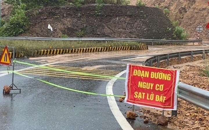
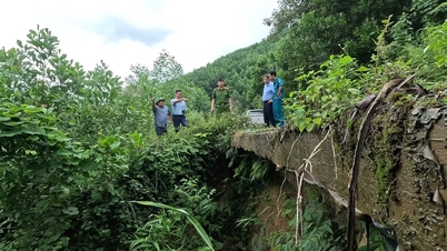
| Landslide point at Km13 +250 La Son - Tuy Loan highway, branch road 1 |
Similarly, heavy rains have been continuing for the past few days, causing a number of landslides in Khe Tre commune, specifically at the intersection of the road system from the highway to the center of Khe Tre commune, a landslide occurred on the slope of the positive slope with a large amount of soil and rock spilling onto the road surface. The scene shows that although the slope toe has been deeply leveled, the landslide still continues. With the current prolonged rain situation, this location is at risk of becoming a serious landslide, affecting traffic on the route.
According to the People's Committee of Khe Tre commune, in addition to the landslide at Km13 +250 on the highway, there are two other high-risk landslide locations in the area of Pass No. 5, Loc Hung village and between Da Phu and Ha An villages, which could isolate and affect more than 100 households. The locality has developed a plan to evacuate people to ensure safety.
K black infrastructure , bring people to safety
Mr. Le Gia Dinh, Head of A Luoi Road Department, said that to deal with landslides on traffic routes in the A Co Pass area, the unit has arranged 2 workers at each location along with supporting machinery. When landslides appear, they will be handled immediately to ensure traffic is not interrupted. These are small-scale landslides but have a high risk of affecting traffic due to the complicated situation of floods at the end of the year.
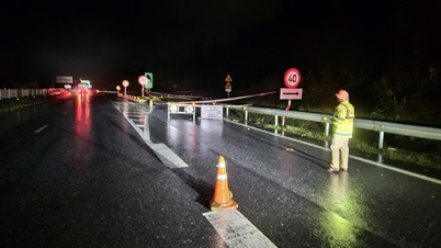
Khe Tre Commune has coordinated with the Ho Chi Minh Road Project Management Board to deploy a solution and prevent vehicles from passing through this area. Mr. Tran Duc Hiep, Director of the La Son - Hoa Lien Expressway Expansion Project (Ho Chi Minh Road Project Management Board) said that the landslide area at Km13 +250 of the La Son - Tuy Loan Expressway, branch road 1, occurred. The unit has coordinated with local authorities to organize forces to block off traffic, not allowing vehicles to pass, and at the same time put up signs and put up warning ropes to ensure traffic safety on the route.
“In the long term, the Ho Chi Minh Road Project Management Board has designed a repair, alignment and thorough treatment of this landslide site, with construction funding coming from the highway expansion project. It is expected that when the weather is sunny and dry, the contractor will immediately start the repair work,” Mr. Hiep added.
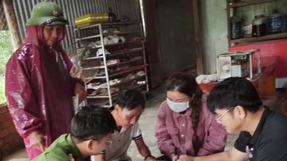
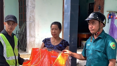
Mr. Tran Van Quang, Vice Chairman of Khe Tre Commune People's Committee informed that there had been some damages in the commune due to the impact of storm No. 12 and heavy rain. In some drainage ditches, rocks and soil from the slopes were buried, and the local forces promptly repaired them. Some drainage culverts were damaged by heavy rain causing landslides (in Ria Ho village, Cha Mang village). The Commune People's Committee has conducted a review and is monitoring the development of floods to deploy plans to evacuate households from dangerous areas according to the "four on-site" motto. The forces of the Military Command, Commune Police and the shock forces in the villages have prepared rescue vehicles to promptly deploy rescue when requested.
 |
| Landslide routes have been warned, travel is restricted. |
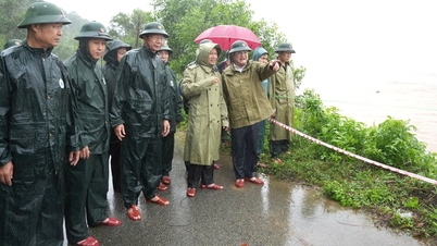
The Department of Irrigation and Climate Change requires localities to base on the location and warning areas to arrange forces to inspect and review residential areas along hills, rivers and streams to proactively organize the relocation and evacuation of people in areas at risk of flash floods and landslides. Organize forces to deploy to control and guide traffic, put up warning signs, and at the same time, inspect, review and withdraw all forces from areas at risk of flash floods and landslides to ensure safety.
According to the People's Committee of Khe Tre commune, in addition to the landslide at Km13 +250 on the highway, there are two other high-risk landslide locations in the area of Pass No. 5, Loc Hung village and between Da Phu and Ha An villages, which could isolate and affect more than 100 households. The locality has developed a plan to evacuate people to ensure safety.
Ready to evacuate 780 households affected by landslides Statistics show that the city currently has nearly 50 locations at risk of landslides, flash floods, landslides, and subsidence of mountain rocks and soil. The Department of Irrigation and Climate Change has issued warnings about high-risk dangerous areas. In particular, the main areas are landslides on mountains, traffic routes on Ho Chi Minh Road, National Highway 49 through the communes of A Luoi 1, A Luoi 2, A Luoi 3, A Luoi 4, A Luoi 5 with about 600 households at risk of being affected. Meanwhile, in the Nam Dong mountainous area, there is a risk of landslides on hills, riverbanks, and flash floods in the communes of Nam Dong, Khe Tre, and Long Quang with about 190 households affected. |
Source: https://huengaynay.vn/kinh-te/xay-dung-giao-thong/san-sang-di-doi-hang-tram-ho-dan-tai-cac-diem-sat-lo-159103.html
![[Photo] Prime Minister Pham Minh Chinh meets with South African President Matamela Cyril Ramaphosa](https://vphoto.vietnam.vn/thumb/1200x675/vietnam/resource/IMAGE/2025/10/23/1761226081024_dsc-9845-jpg.webp)


![[Photo] President Luong Cuong holds talks with South African President Matamela Cyril Ramaphosa](https://vphoto.vietnam.vn/thumb/1200x675/vietnam/resource/IMAGE/2025/10/23/1761221878741_ndo_br_1-8416-jpg.webp)

![[Photo] Prime Minister Pham Minh Chinh chairs meeting on railway projects](https://vphoto.vietnam.vn/thumb/1200x675/vietnam/resource/IMAGE/2025/10/23/1761206277171_dsc-9703-jpg.webp)


Comment (0)