
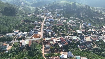
Located in the southernmost part of the country in the Mekong Delta region, with an area of over 5,300 km² and a population of about 1.2 million people, Ca Mau is the only province in the country with three sides bordering the sea.
After the country's reunification, on January 1, 1976, the two provinces of Ca Mau and Bac Lieu were merged into Ca Mau - Bac Lieu province, then renamed Minh Hai. On November 6, 1996, the National Assembly approved the separation of Minh Hai province into two provinces of Ca Mau and Bac Lieu.
According to Resolution No. 60 of the 13th Party Central Committee and just passed by the National Assembly on June 12, Ca Mau and Bac Lieu were merged and named Ca Mau. The political and administrative center of the new province is located in Ca Mau city.
Ca Mau City was established under Decree 21 of the Government in 1999, is an urban area under Ca Mau province.
This is one of the five dynamic urban areas in the key economic region of the Mekong Delta, playing a core role in promoting the development of the Southwest region. The city plays the role of the administrative and political center of the province, and is also associated with key economic sectors such as energy, oil and gas services, trade and tourism.
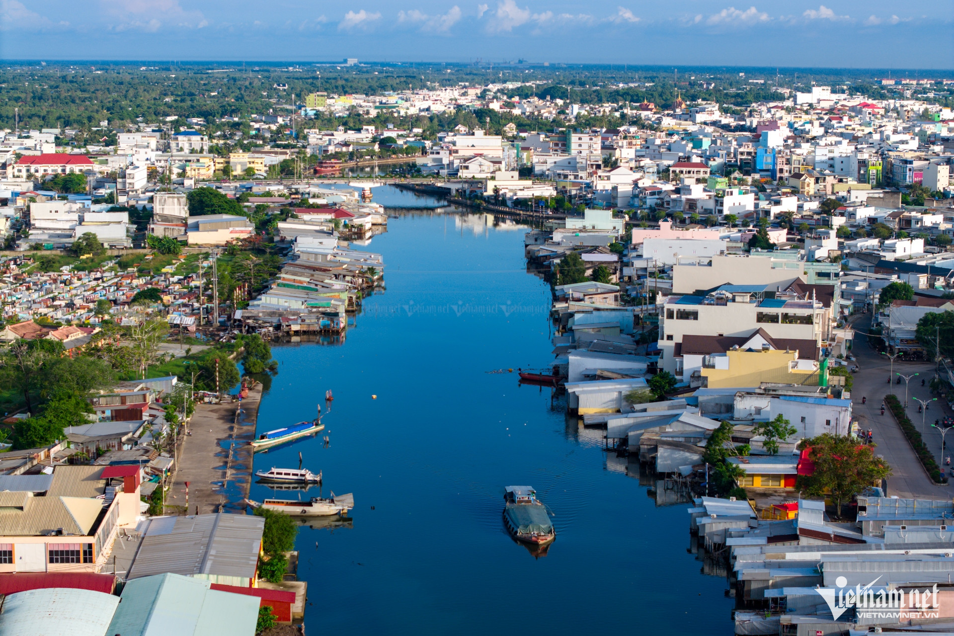
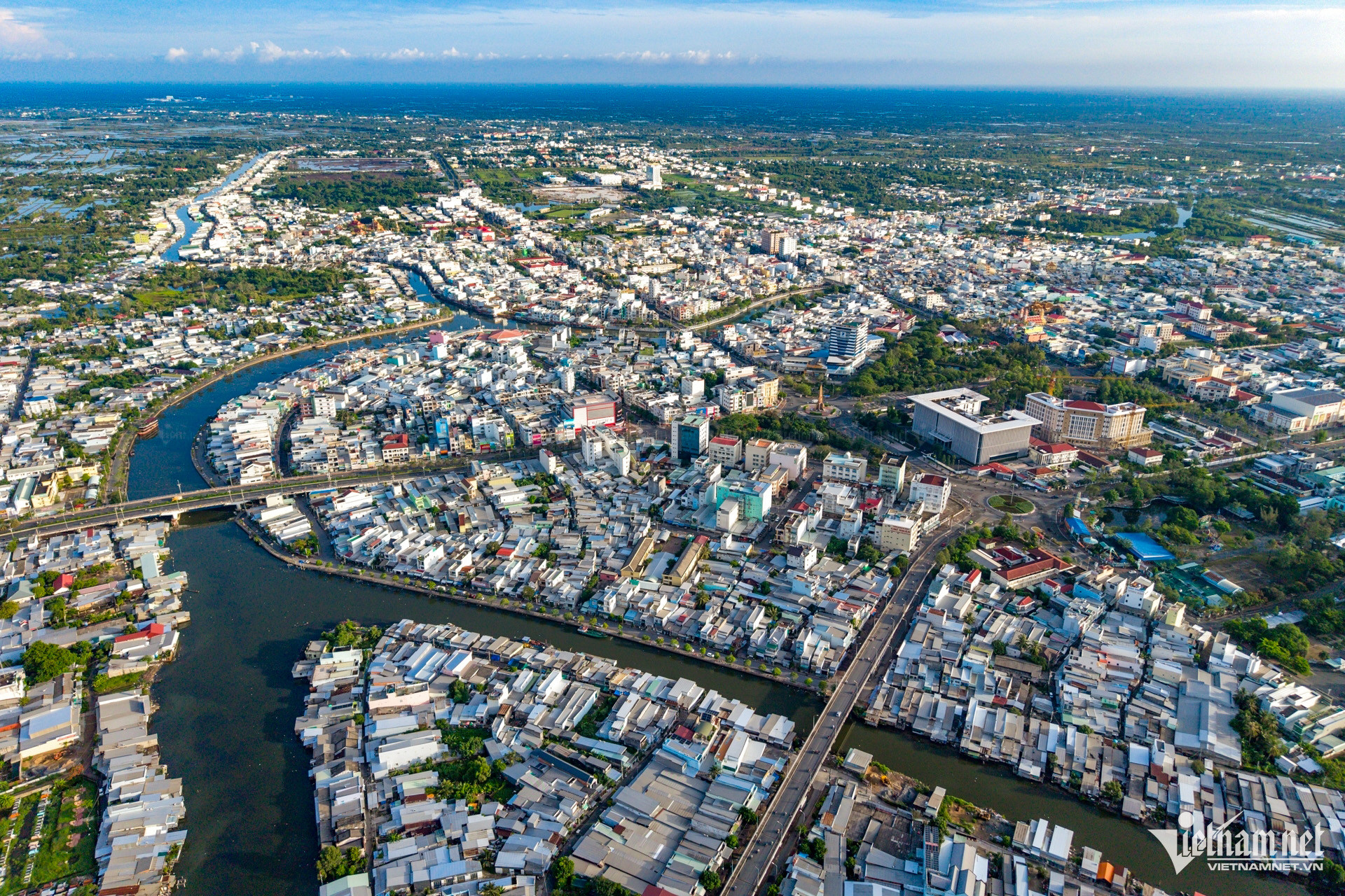
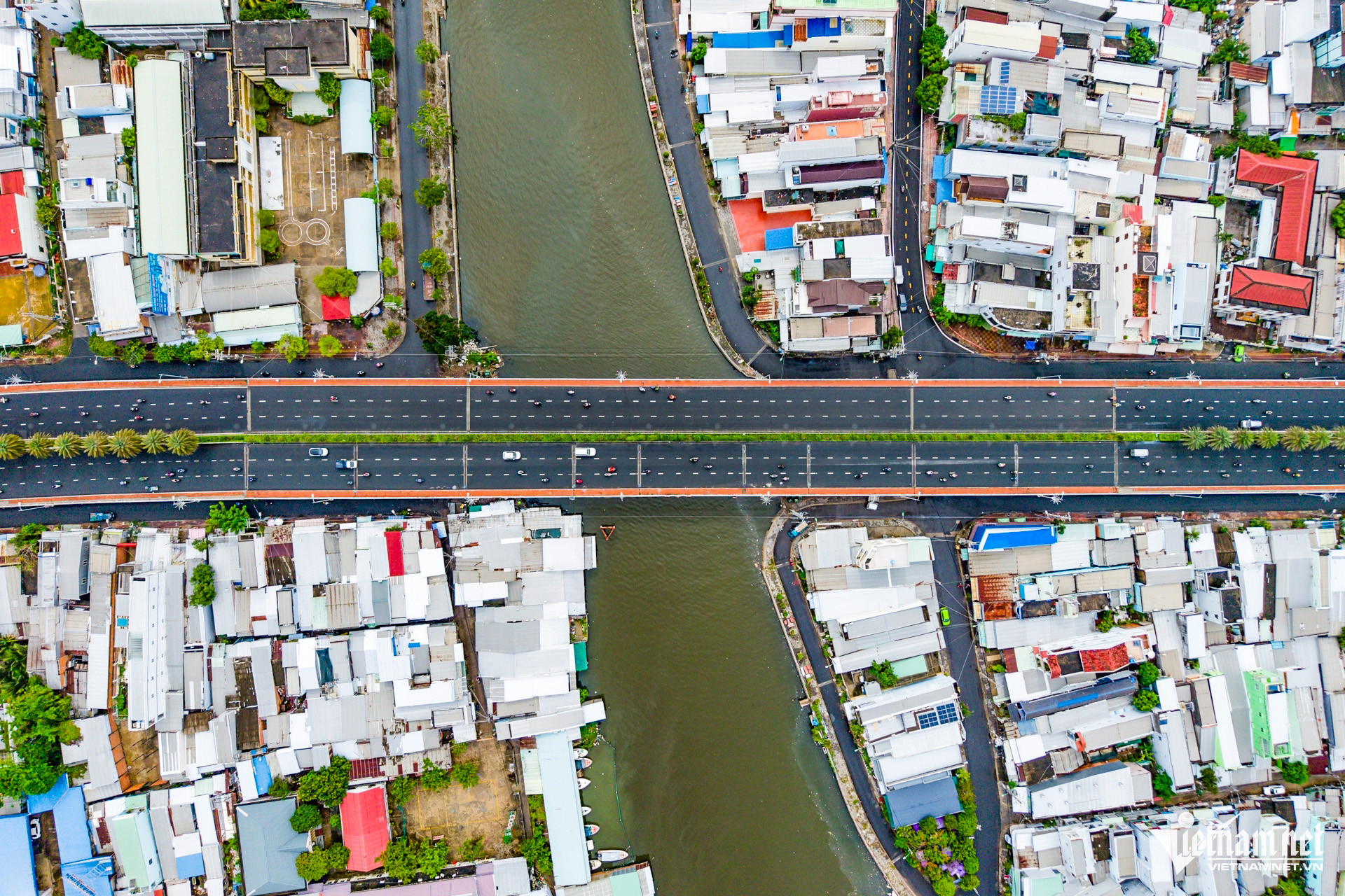
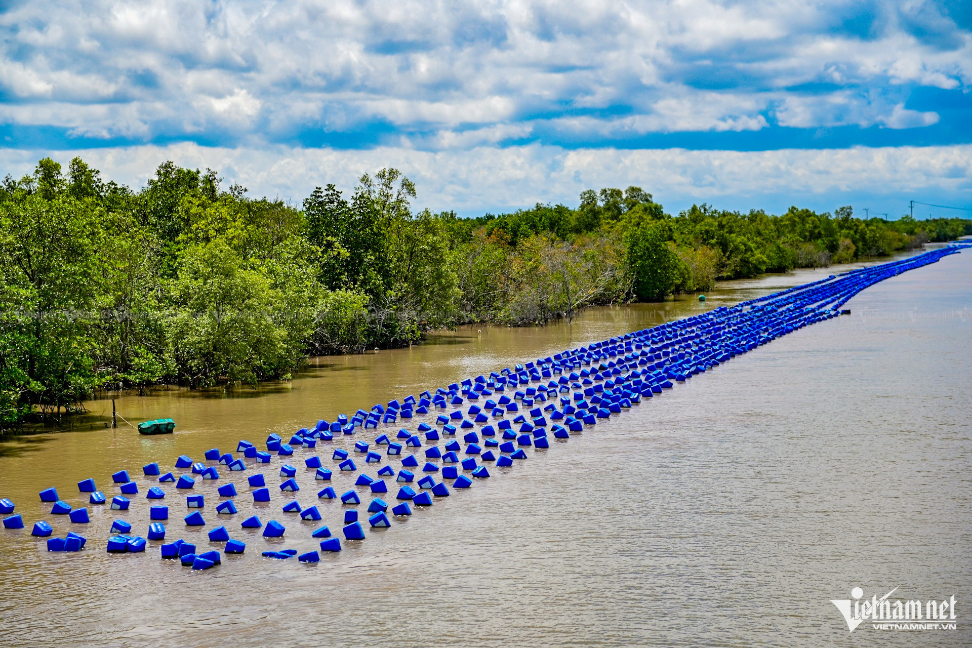
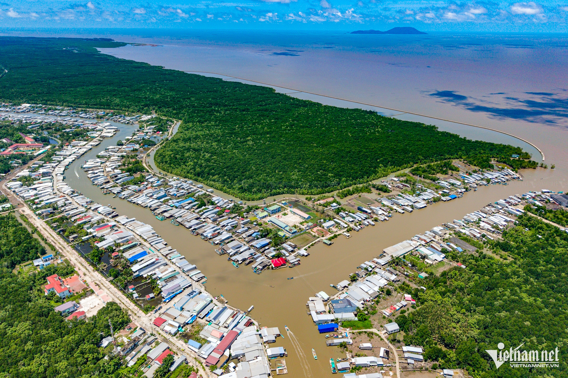
With a natural area of more than 24,580 hectares, Ca Mau City possesses a dense system of rivers and canals, with a total length of up to about 7,000 km - the largest in the Mekong Delta region.
In the photo is the Ganh Hao River flowing through the heart of the city, along with many small interwoven canals that have helped shape the daily life and commerce of the people, creating a unique cultural identity for the riverside urban area.
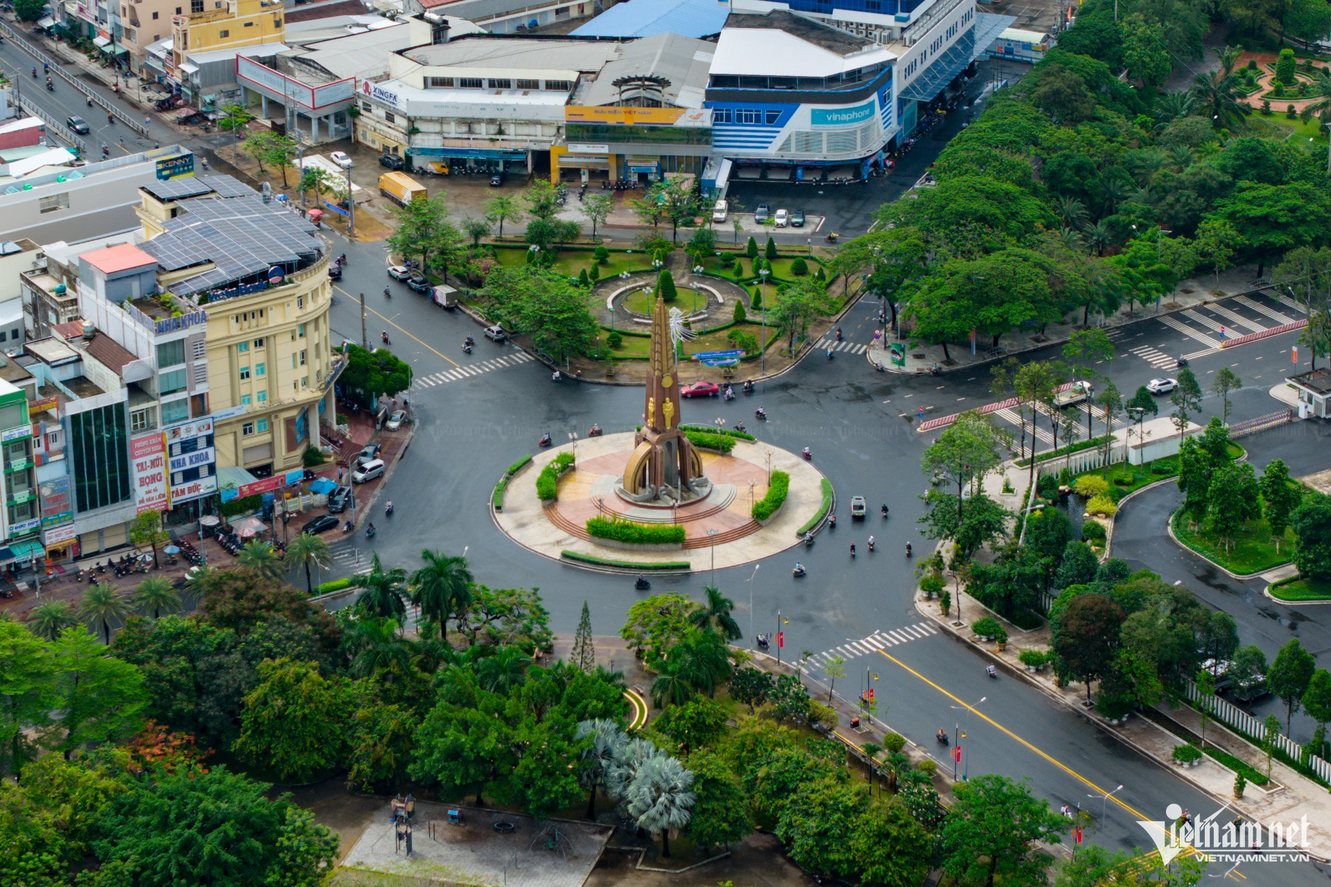
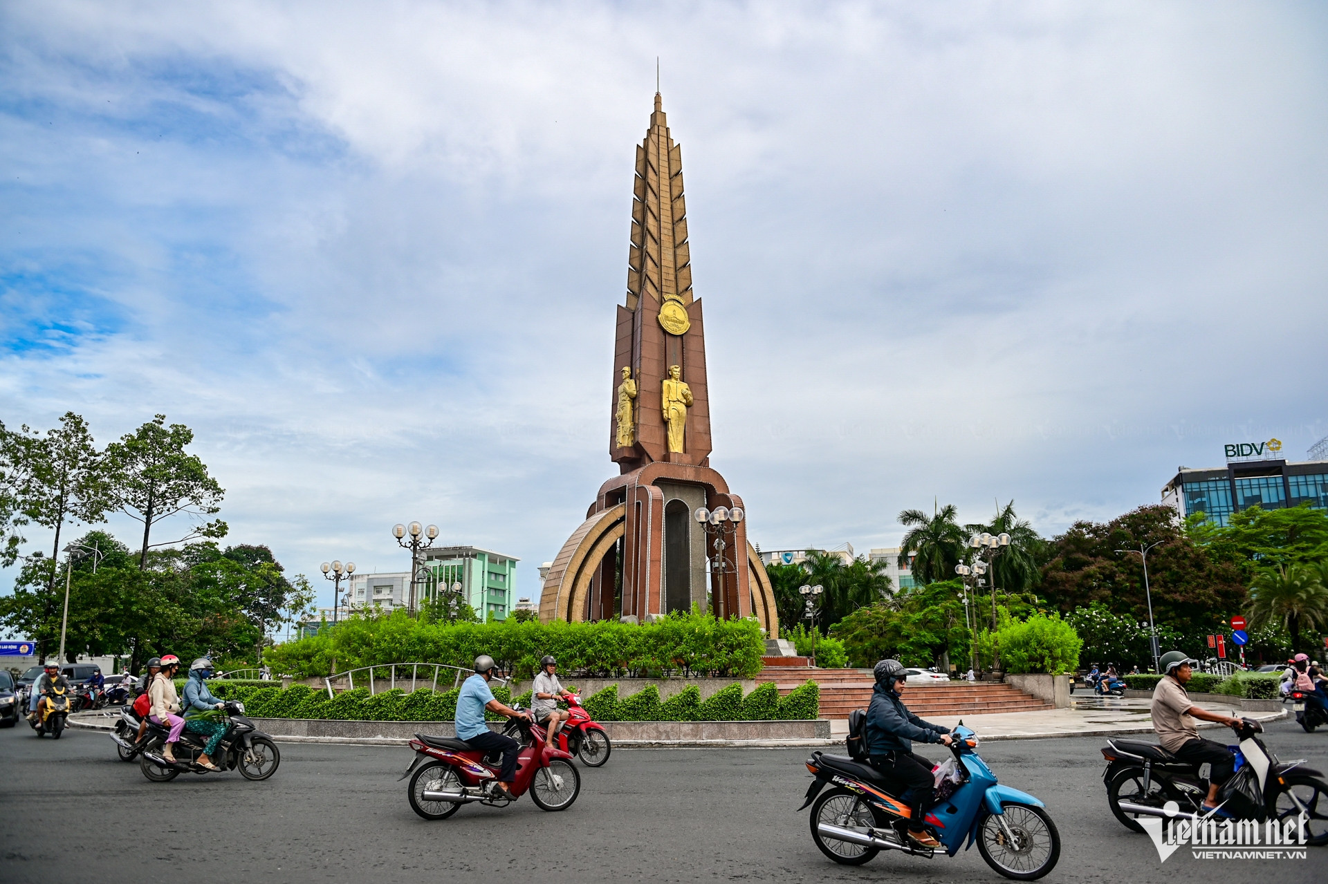
The prominent mangrove tree monument at the central intersection of Ca Mau city is a typical symbol of the locality.
Below is the image of a mangrove tree - a typical tree of the mangrove ecosystem, above is a tall rice plant symbolizing abundance and development. The four images representing the classes of Scholar - Farmer - Worker - Merchant on the monument show the spirit of solidarity and aspiration of the people of the southernmost land.
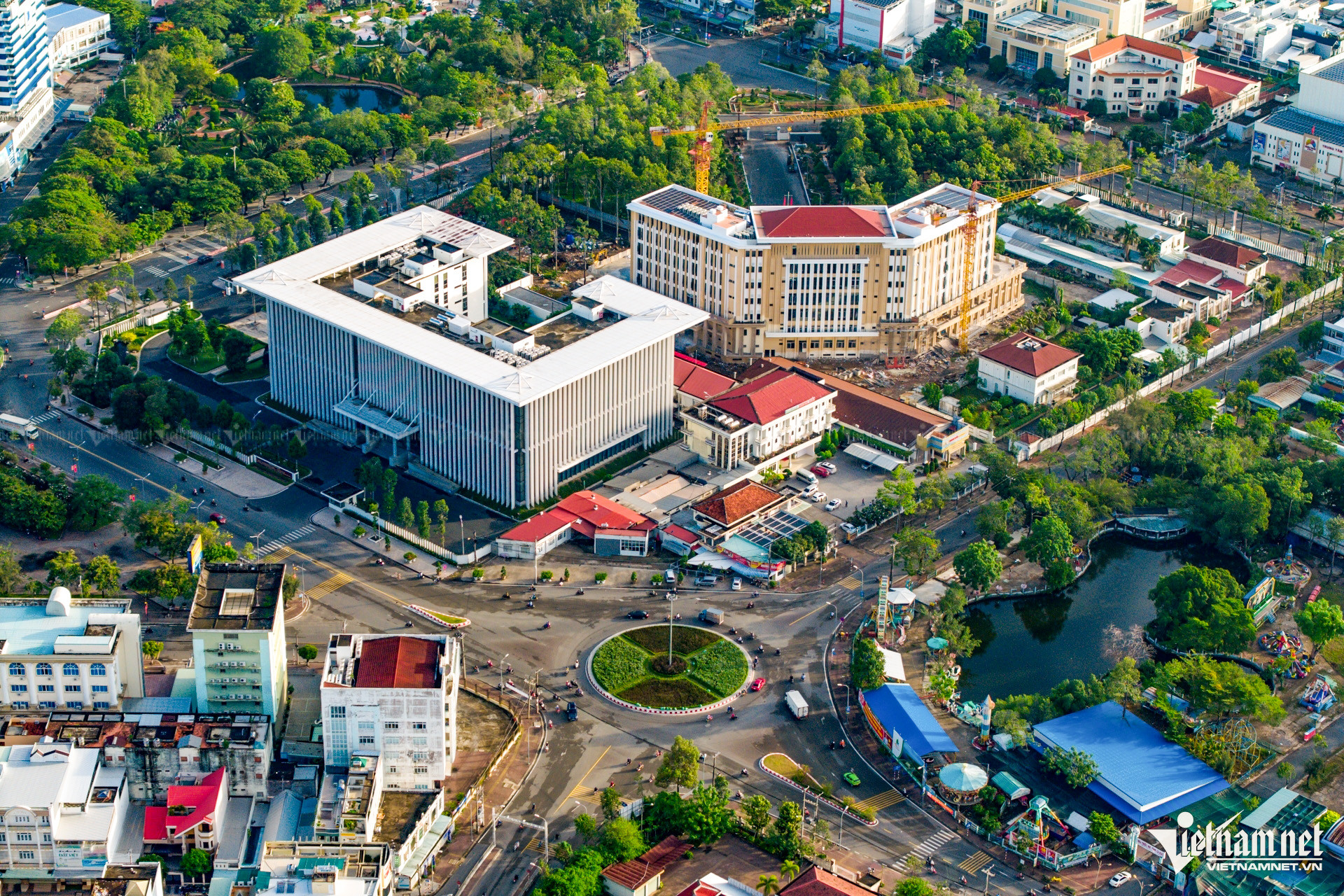
Right near the roundabout is the People's Committee of Ca Mau Province, next to it is the headquarters of the Ca Mau Provincial Party Committee under construction, nearly completed.
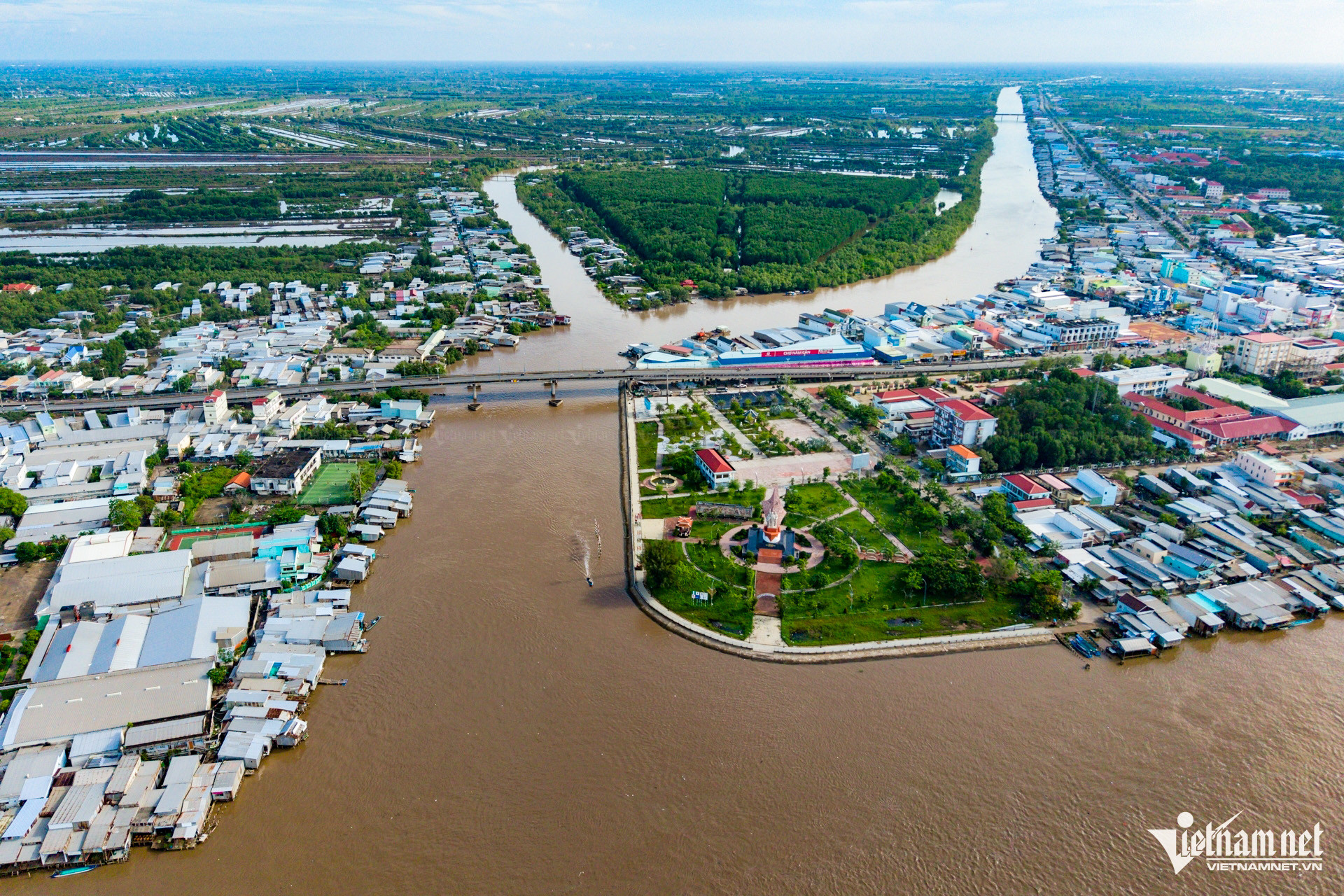
National Highway 1A, running through the center of Ca Mau City, plays an important role as a unique and vital route, playing an important role in promoting the socio-economic development of the province.
National Highway 1A connects Ca Mau City with Cai Nuoc, Nam Can, Phu Tan, Ngoc Hien districts and provinces in the Mekong Delta region.
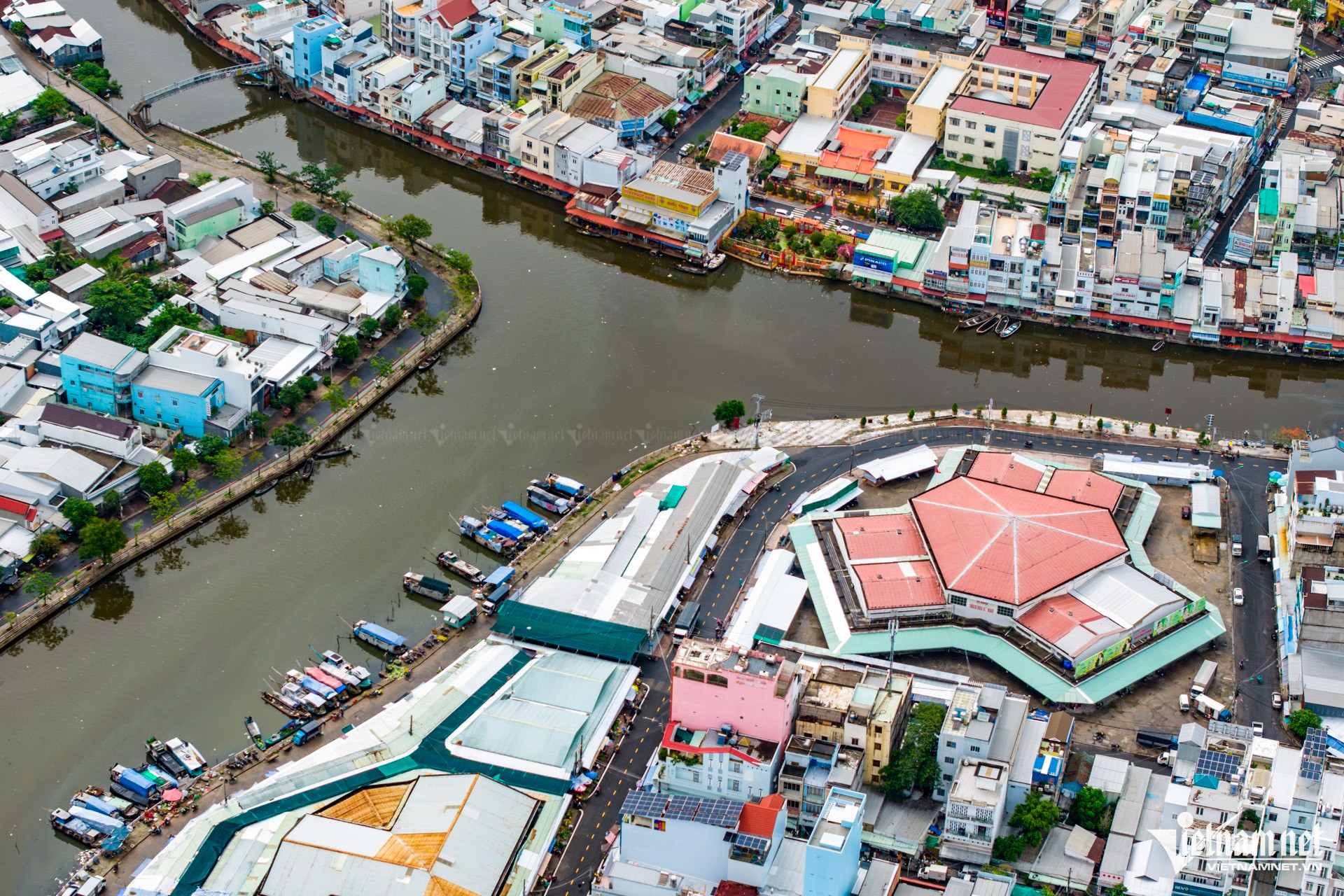
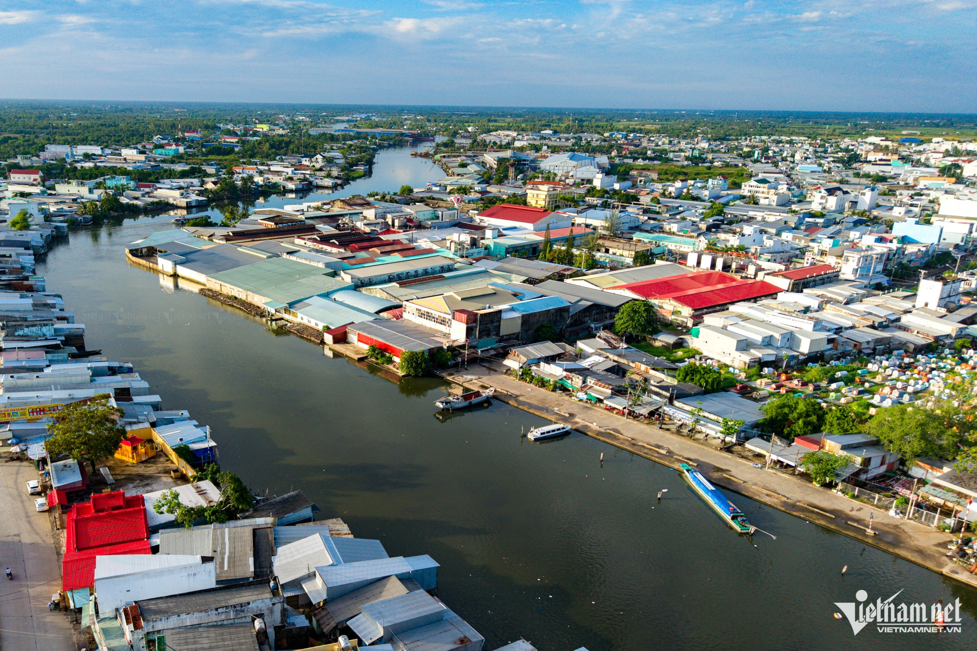
About 600 meters from the mangrove monument, Ca Mau general market located on Phung Hiep canal is the largest agricultural and food market in the city.
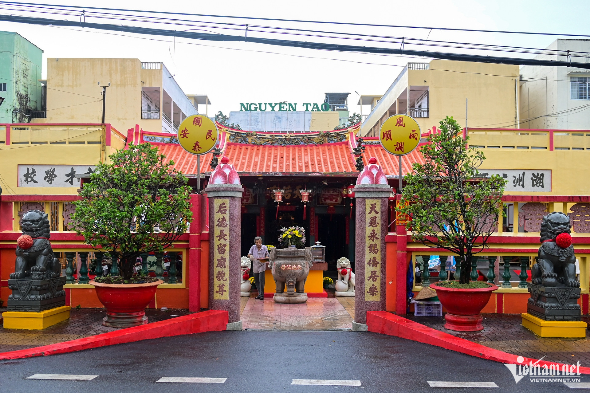
On the opposite side, across the canal is the sacred Thien Hau Pagoda, built in 1882 and is a typical Chinese architectural work in Ca Mau.
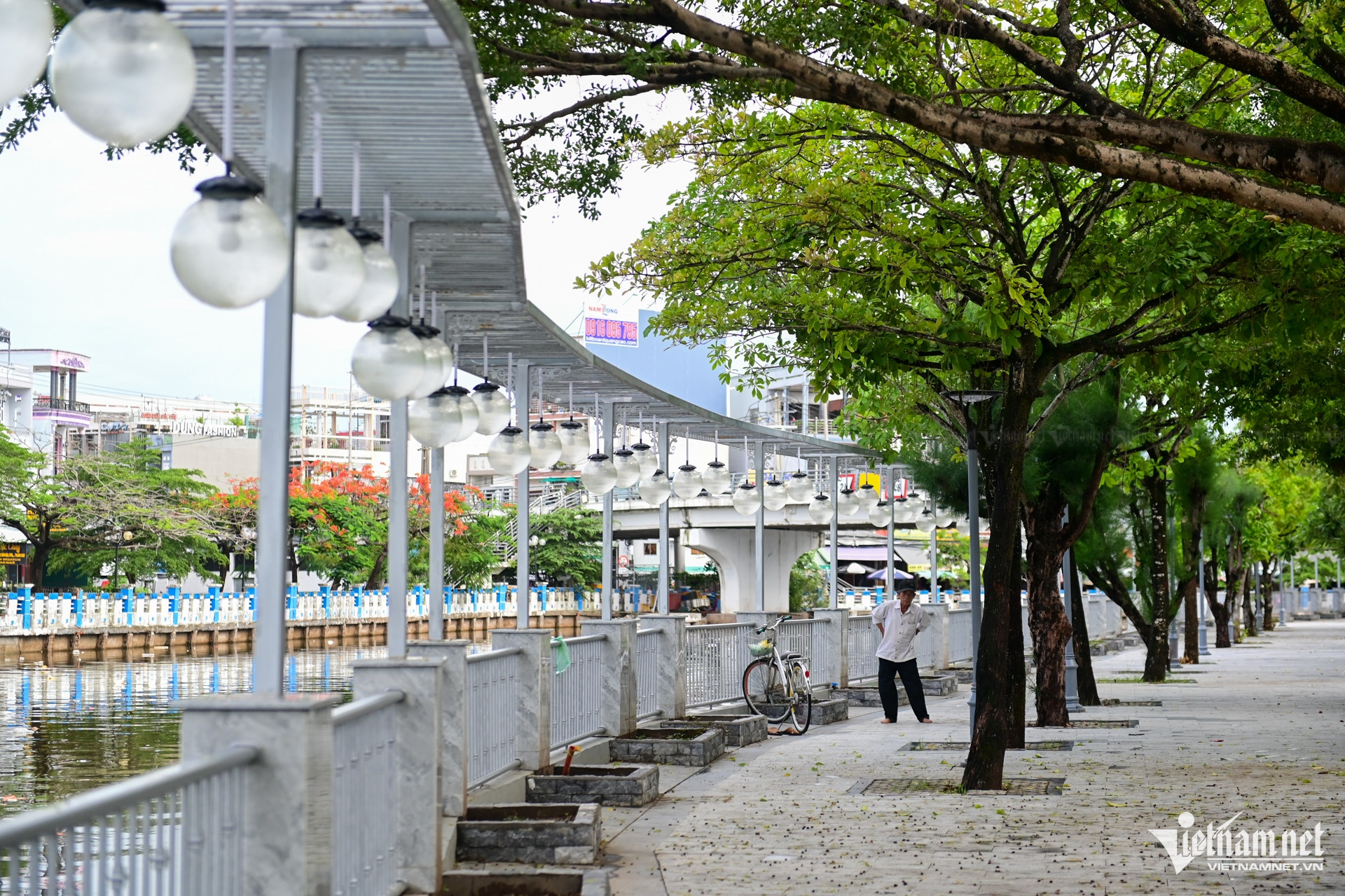
Along many canals running through the inner city, roads are built spaciously, creating green spaces for people to walk and exercise.
Ca Mau passenger wharf is where 15-20 years ago people crowded to take routes from Ca Mau to Dam Doi, Cai Nuoc, Nam Can, Rach Goc, Dat Mui when the road was not yet developed.
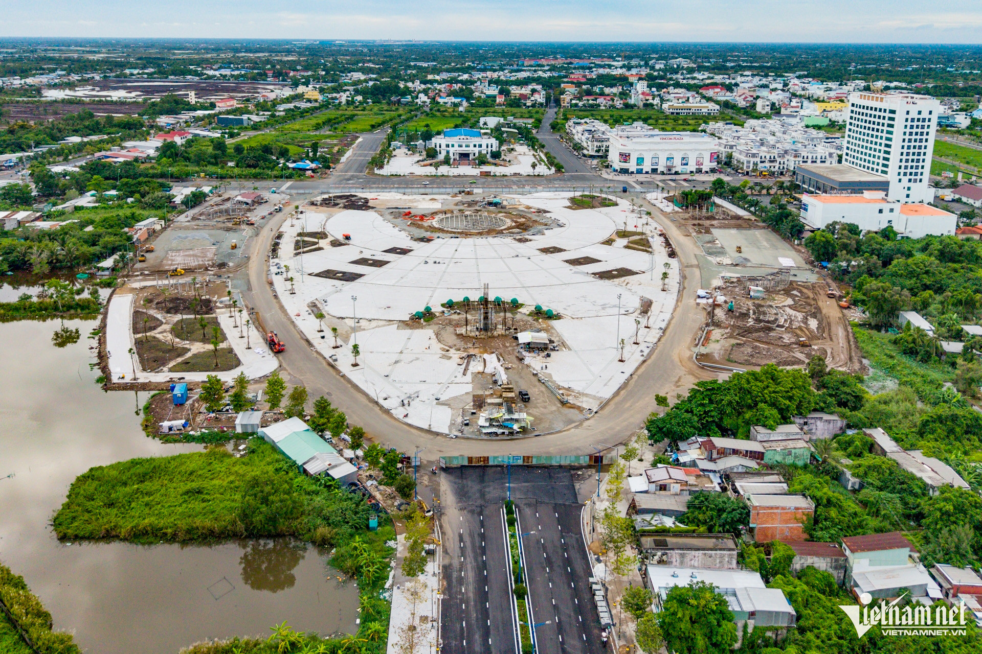
Phan Ngoc Hien Square located in the center of Ca Mau city is under construction with a total investment of 236 billion VND (unadjusted). The entire project has a total area of over 50,700 m2, including many works such as stage, artistic water fountain system, yard, internal road, lighting, water supply and drainage...
In particular, a reinforced concrete and ceramic-clad Shrimp symbol of Ca Mau will be built here, located in the middle of the square.
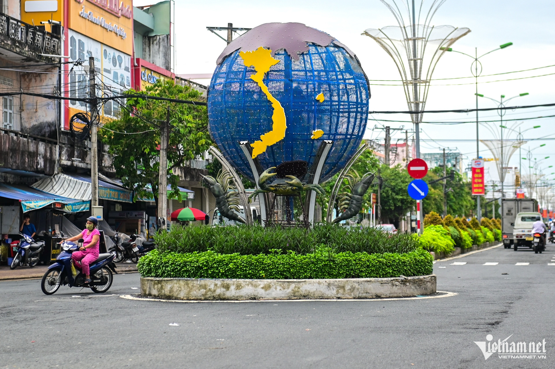
Image of shrimp and crab at Ca Mau bridge intersection. In which, shrimp is the main industry that helps people get rich, making an important contribution to the local economy.
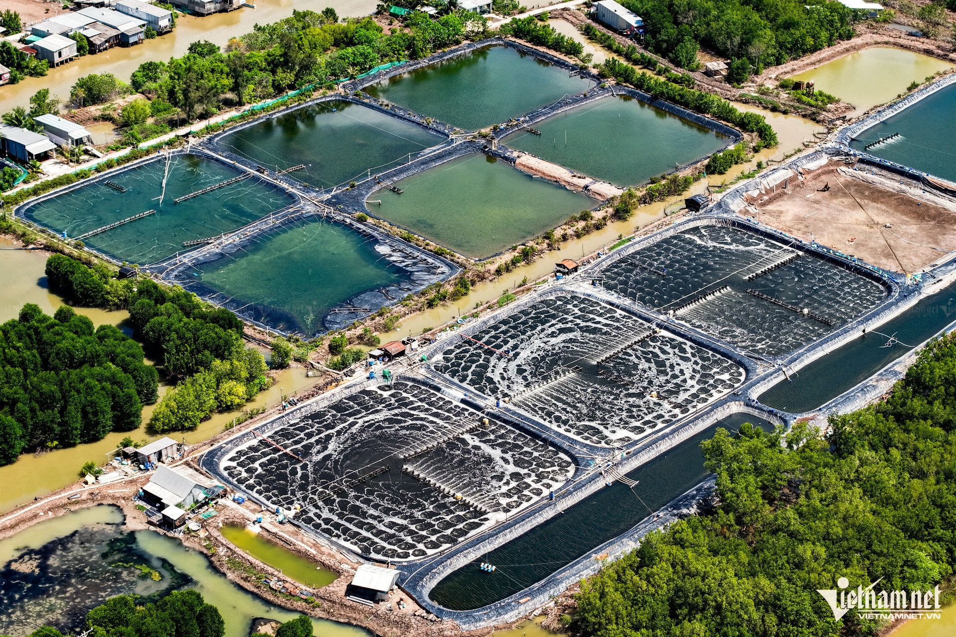
Favored by nature with three ecosystems of salt, fresh and brackish water, Ca Mau possesses abundant resources for the development of exploitation and aquaculture. The whole province currently has about 303,000 hectares of aquaculture area, the largest in the country, accounting for nearly 30% of the total aquaculture area nationwide and 40% of the Mekong Delta region.
Shrimp has become a key industry. Currently, the province's shrimp farming area is about 280,000 hectares, with an output of 242,000 tons in 2024 and an estimated export turnover of 1.12 billion USD.
From the city center, travel about 54 km to Nam Can town. This place is famous for Nam Can crab, the most delicious crab of Ca Mau land.
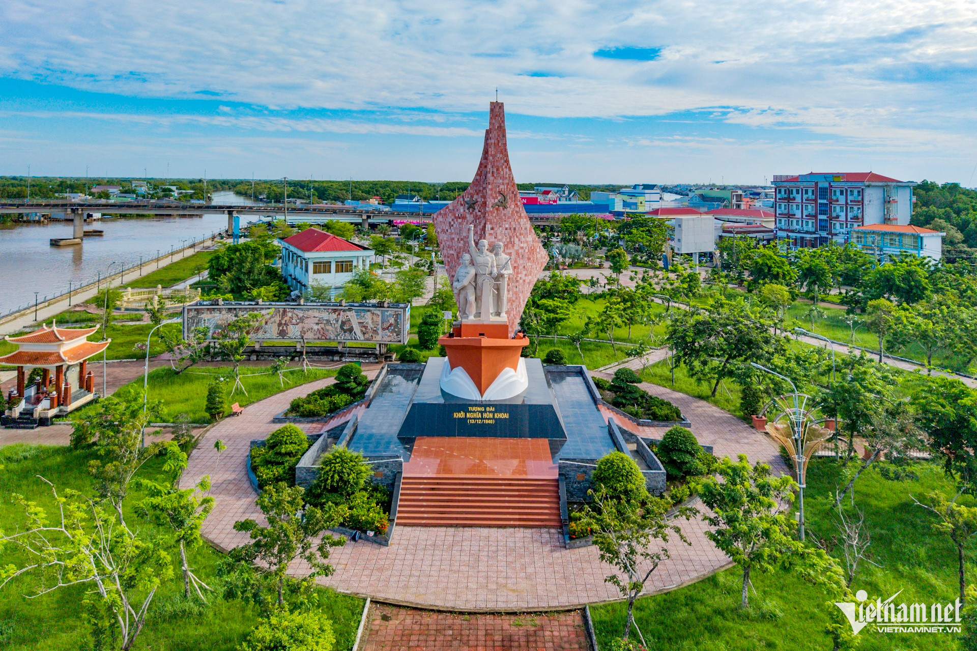
Located right in the center of Nam Can town, Hon Khoai Uprising Monument is associated with the uprising led by Hero Phan Ngoc Hien on December 13, 1940.
The monument is a ship with two sails soaring high, with three people on board. Under the hull are three waves symbolizing passionate patriotism, indomitable will, and determination to sacrifice for the independence and freedom of the people.
About 110 km from the center of Ca Mau city, Dat Mui commune is like a peninsula bordering the East Sea and the Gulf of Thailand, an area where rivers flow out and alluvium deposits. In the photo is the central intersection of Dat Mui commune leading to the sea, in the distance is Hon Khoai standing out against the blue sky.
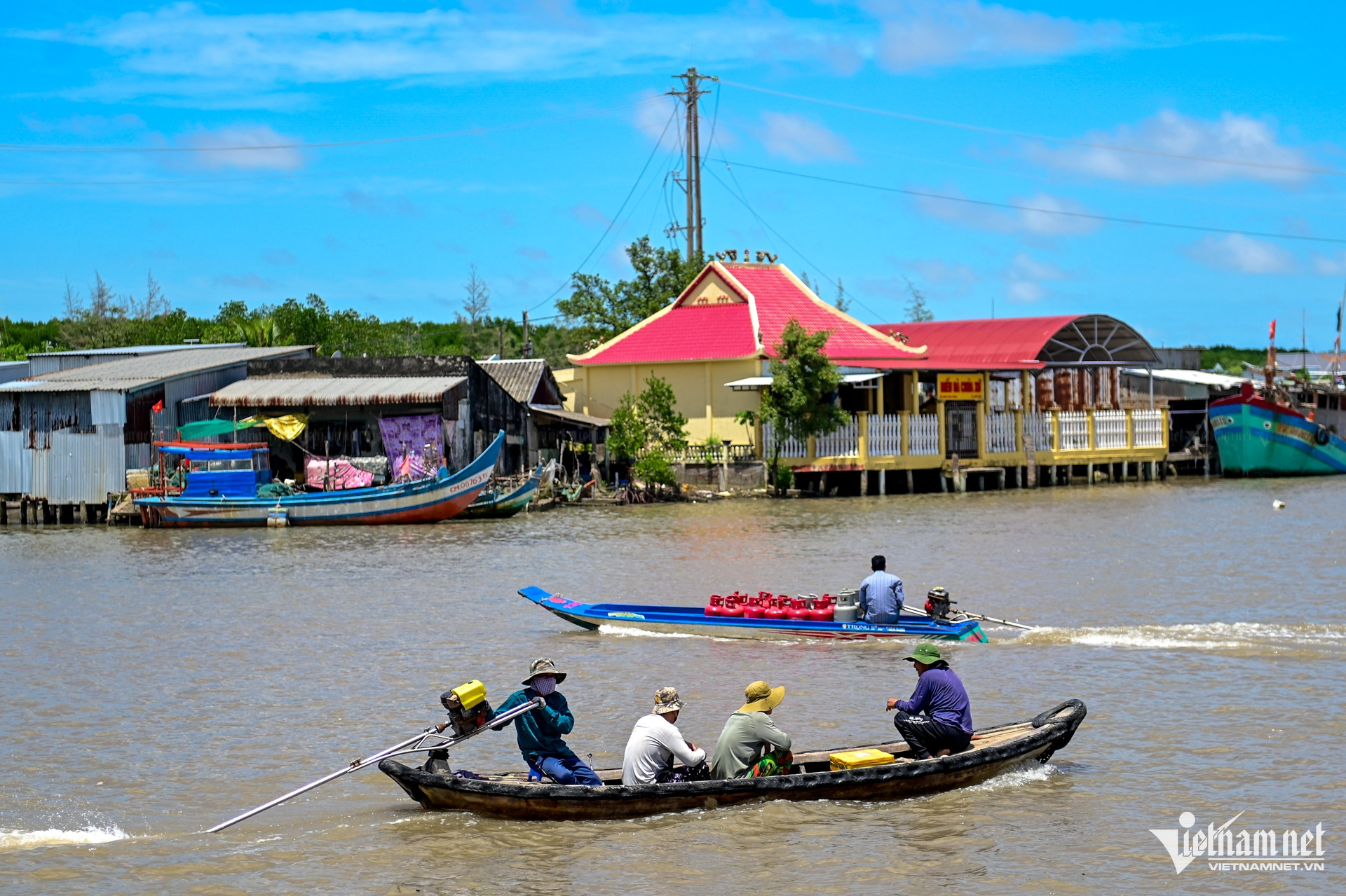
Here, the main means of transportation for people is sampan.
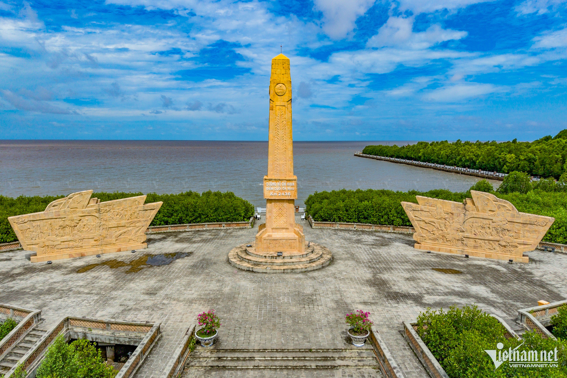
The national tourist area of Ca Mau Cape is the sacred place at the end of the country on the mainland. This is also the last point of the Ho Chi Minh trail. Km 2436 of the Ho Chi Minh trail starts from Pac Bo - Cao Bang, passes through 28 provinces and cities and ends at the southernmost point of the country.
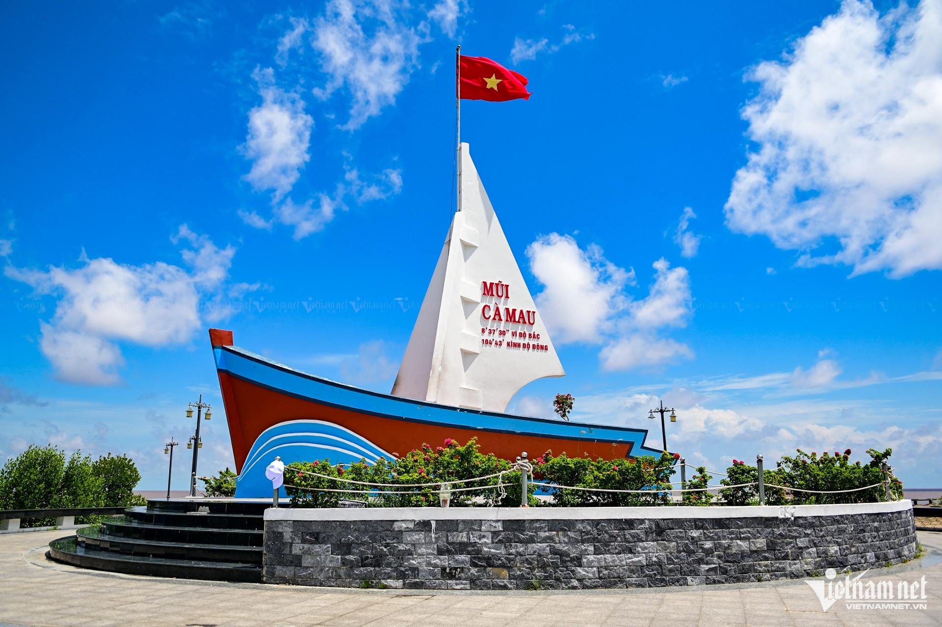
The ship symbol faces the East Sea, with the coordinates of Ca Mau Cape written on the sail. This place is likened to the place where “the land expands, the forest advances to the sea, the sea constantly grows” - showing the miraculous movement of nature. Every year, this area encroaches on the sea by 80 to 100 meters, forming an ever-expanding alluvial plain. This special geological phenomenon not only creates a unique landscape, but also contributes to the unique identity of the southernmost region of the Fatherland.
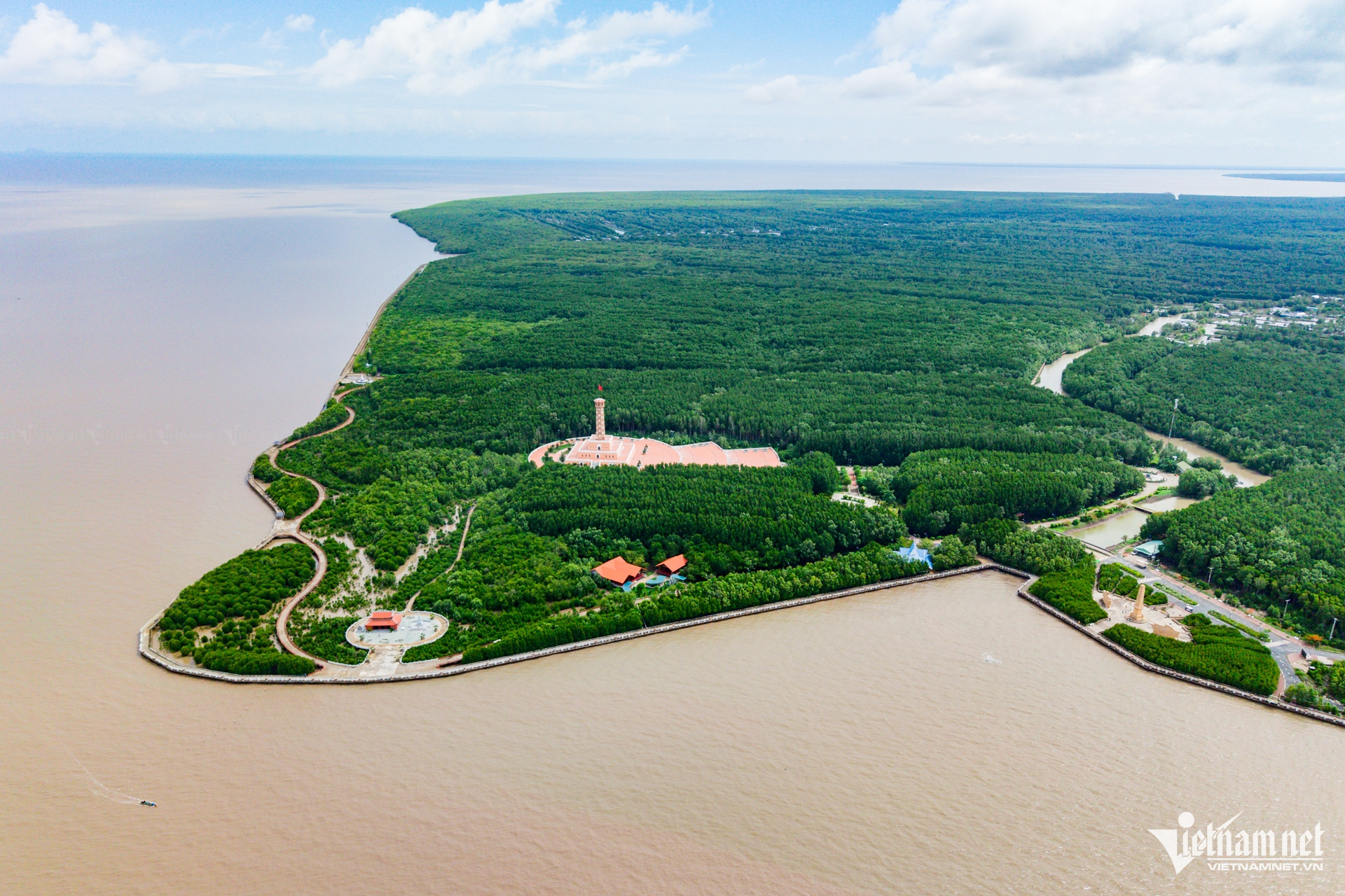
Mui Ca Mau National Park is also the largest primeval mangrove forest in the country. Located at the junction of the East Sea and the West Sea, it is affected by both tidal regimes: the semi-diurnal tide of the East Sea and the diurnal tide of the West Sea. This place is the breeding ground of many economically valuable aquatic species and a stopping point for many migratory waterfowl species during winter.
Because of the values of this ecosystem, on December 13, 2012, the Ramsar Convention Secretariat recognized Ca Mau National Park as the 2088th Ramsar Site in the world and the 5th in Vietnam.
Nguyen Hue - Vietnamnet.vn
Source: https://vietnamnet.vn/ca-mau-vung-dat-nen-kinh-te-mui-nhon-cua-dbscl-2410424.html


![Dong Nai OCOP transition: [Part 2] Opening new distribution channel](https://vphoto.vietnam.vn/thumb/402x226/vietnam/resource/IMAGE/2025/11/09/1762655780766_4613-anh-1_20240803100041-nongnghiep-154608.jpeg)


Comment (0)