
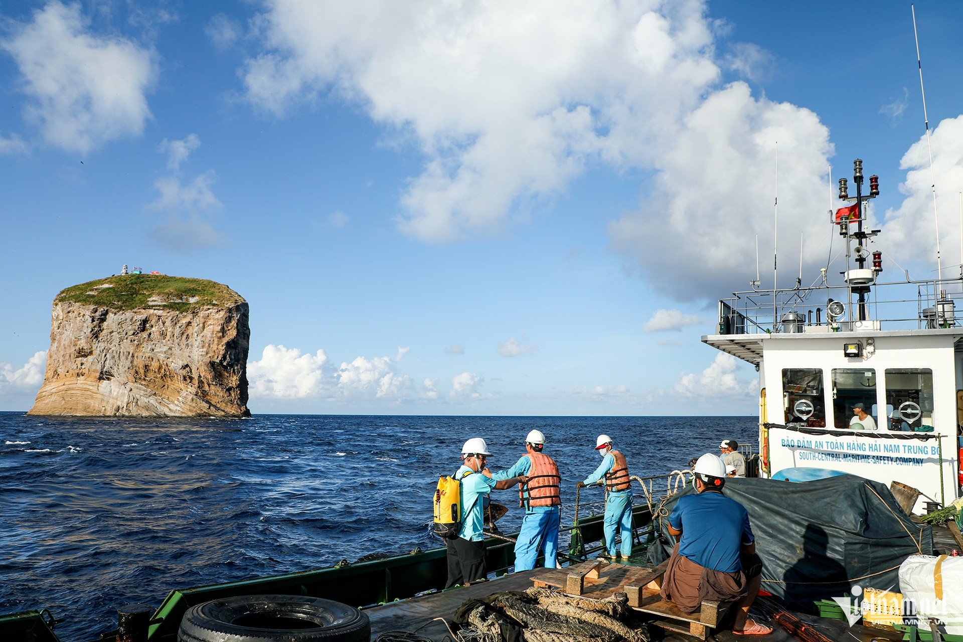
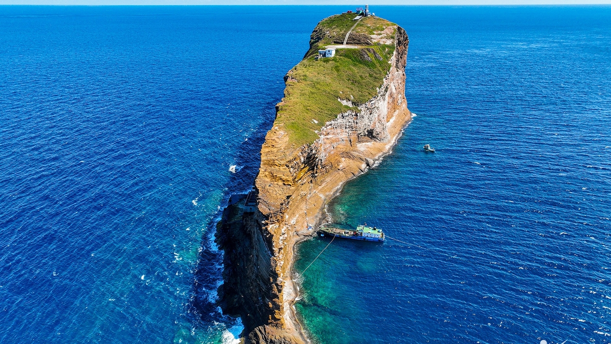
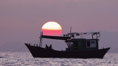
During a trip with the South Central Coast maritime safety ship, VietNamNet reporters had the opportunity to set foot on Hon Hai lighthouse in the Binh Thuan sea (Lam Dong province). This is considered the farthest point of our country's internal waters in the South East Sea, about 60km south-southeast of Phu Quy island.
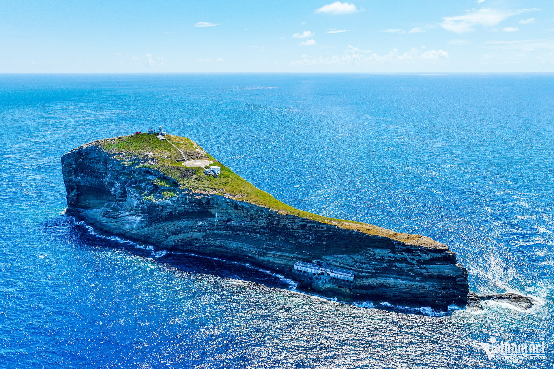
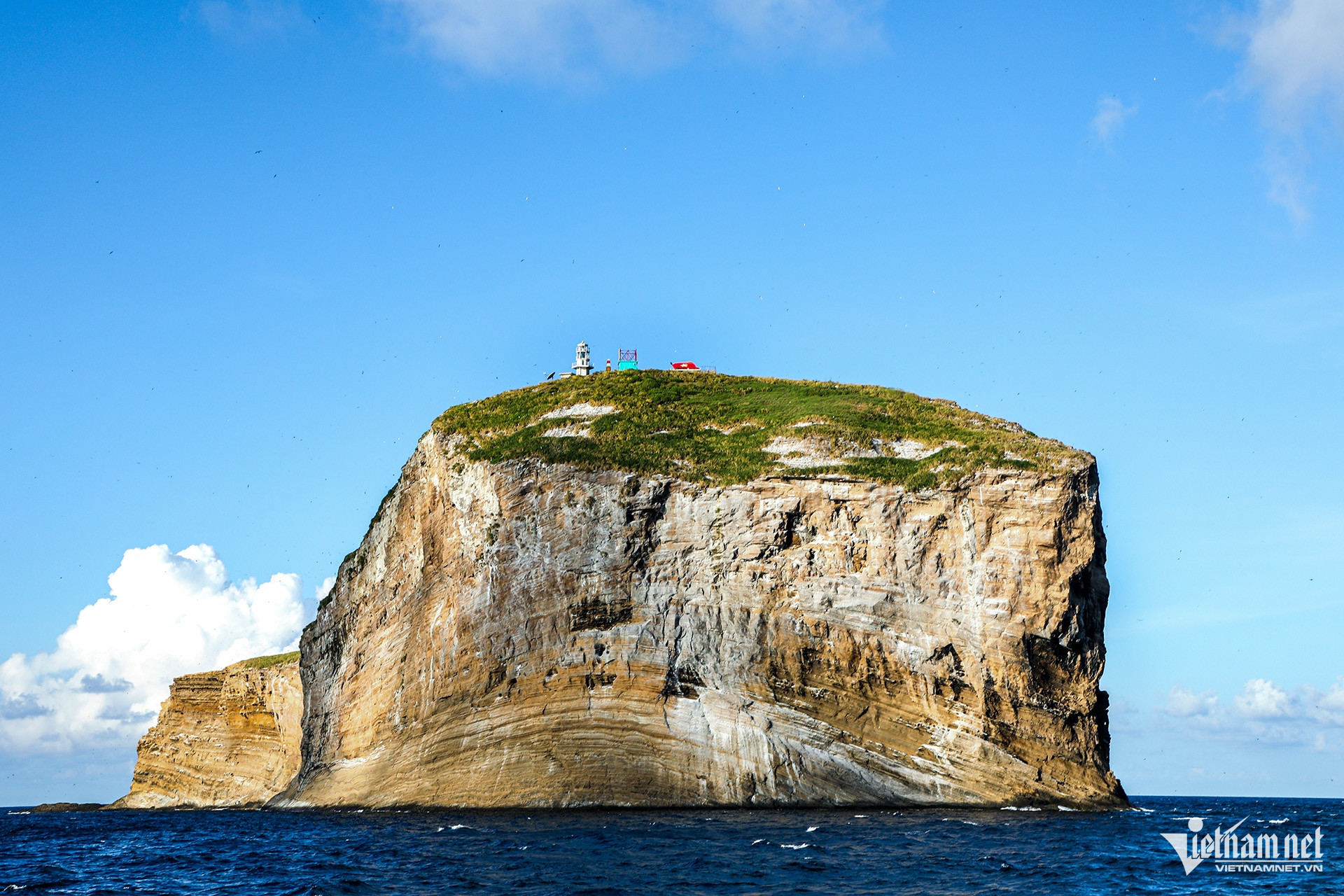
From afar, Hon Hai Island looks like a giant rock rising from the sea. Landmark A6 on Hon Hai is one of 11 base points to calculate the width of Vietnam's territorial waters.
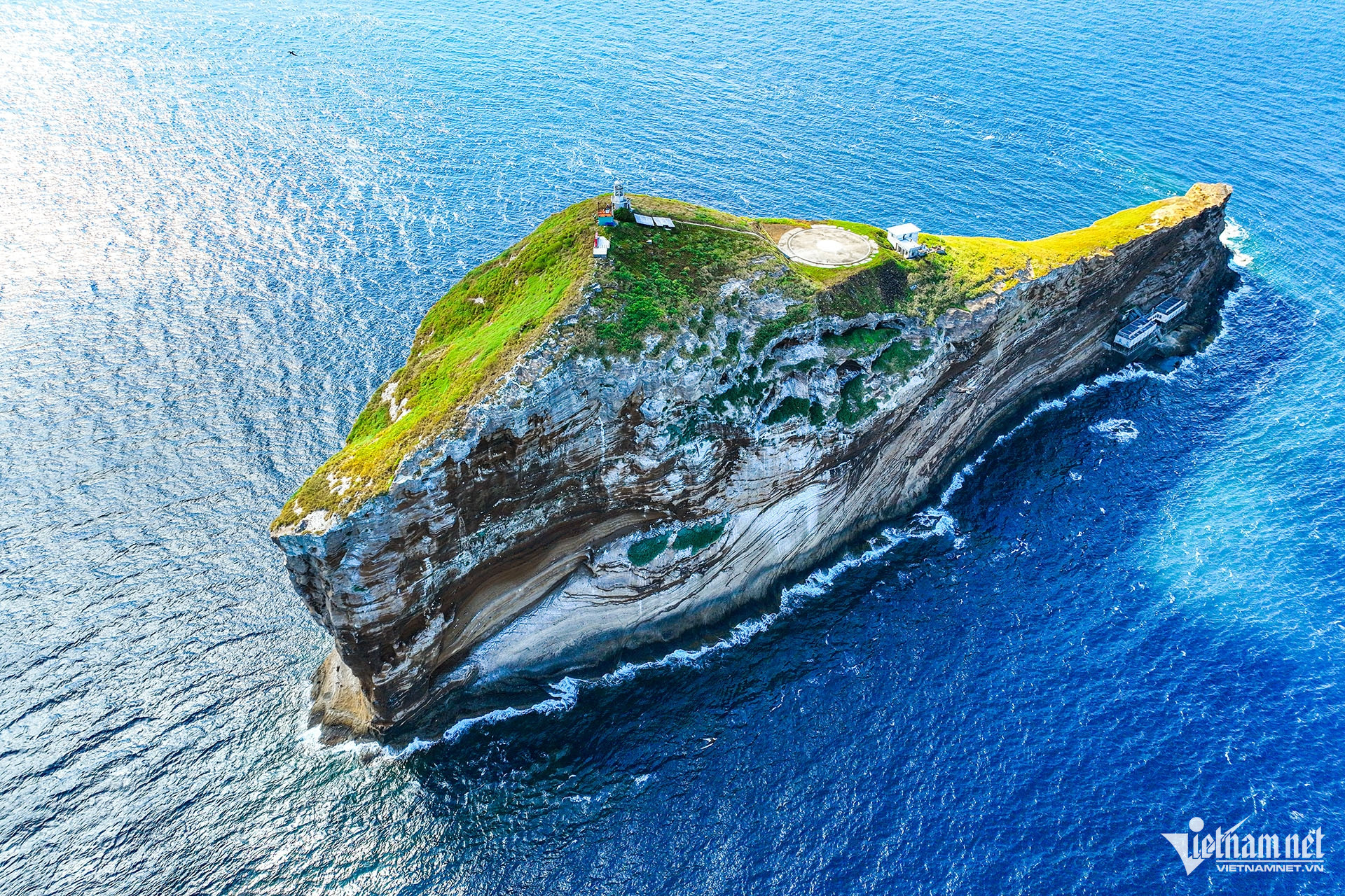
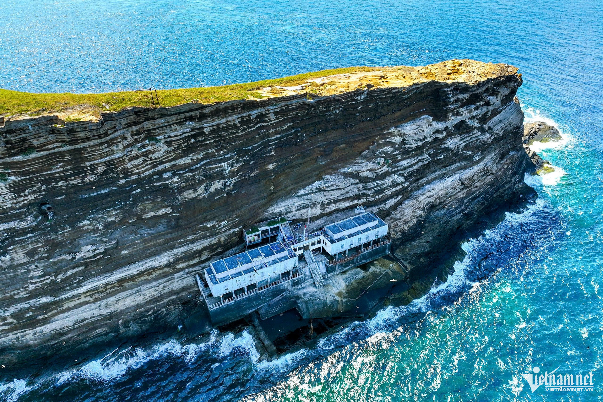
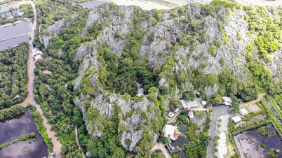
From above, the island looks like a giant whale or sperm whale rising from the water, which is really impressive. The island is very small, with steep rocky terrain and no large trees. The island is surrounded by coral reefs, deep sea and often has strong waves. There are 2 piers on both sides of the island for anchoring boats.
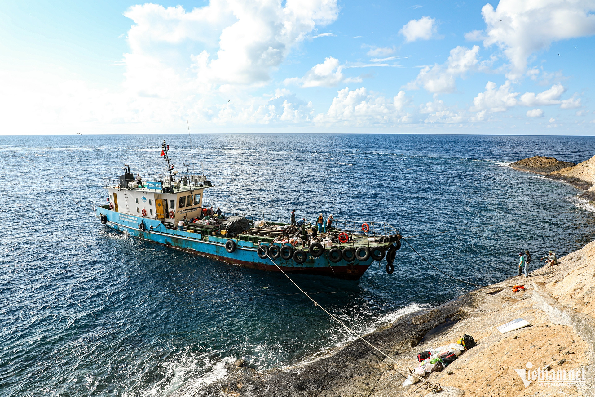
This area often has very strong waves, so depending on the tide and wave direction, the captain will decide which side to anchor the ship. In mid-August, the waves hit the island very strongly, the working group's ship had to anchor far away, and people and goods were moved to the island by basket boats.
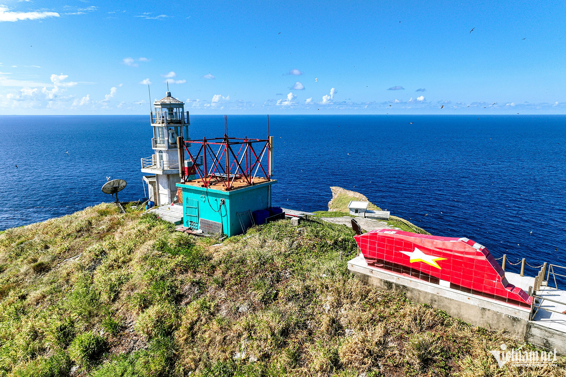
Located at the southeasternmost position of the baseline, the island is also a landmark in the system of determining Vietnam's maritime sovereignty , helping us control the vast southeastern sea area - where there are rich seafood resources and important international shipping routes.
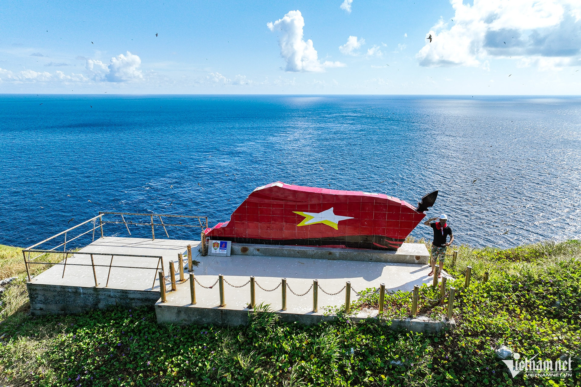
Hon Hai is a strategic fulcrum for Navy Region 4 (the unit managing the Truong Sa and South Central regions).
 Around the beginning of 2000, the Ministry of National Defense (specifically Naval Region 4) surveyed and planned to build a solid pier for Hon Hai. Lung Lo Construction Company was assigned to directly carry out the construction, implementing the construction under extremely difficult conditions.
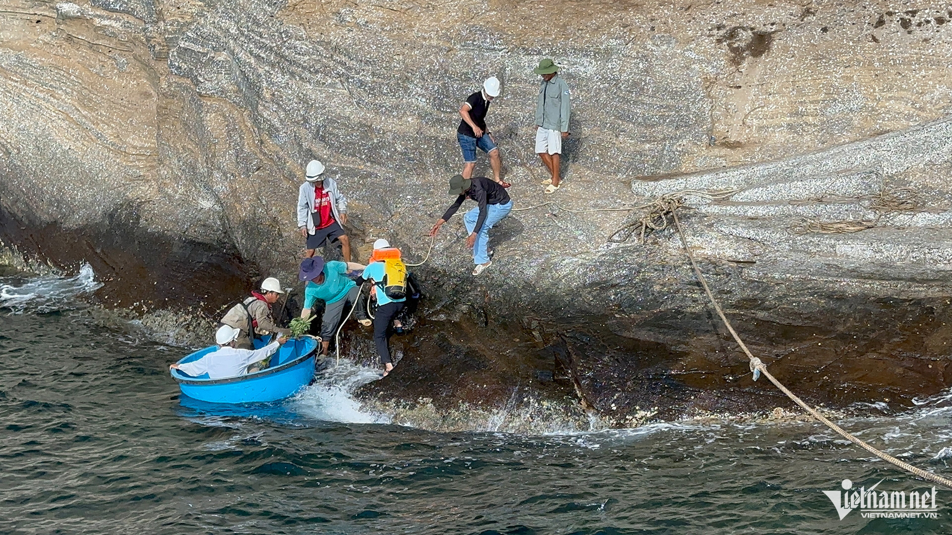
Big waves, strong winds, no flat ground to gather materials. All materials such as cement, steel, stone, etc. were transported by ship from the mainland and transported by hand to the island. During the process of transporting materials and constructing the pier, the engineering soldiers lived and worked directly on the island under extremely harsh conditions.
Waves were 3-4 meters high, and there was no safe anchorage. The soldiers had to anchor the ship far away and then use ropes to pull each bag of cement and iron bars to the island. During many monsoons, the ship was washed away, and people and supplies were swept into the sea.
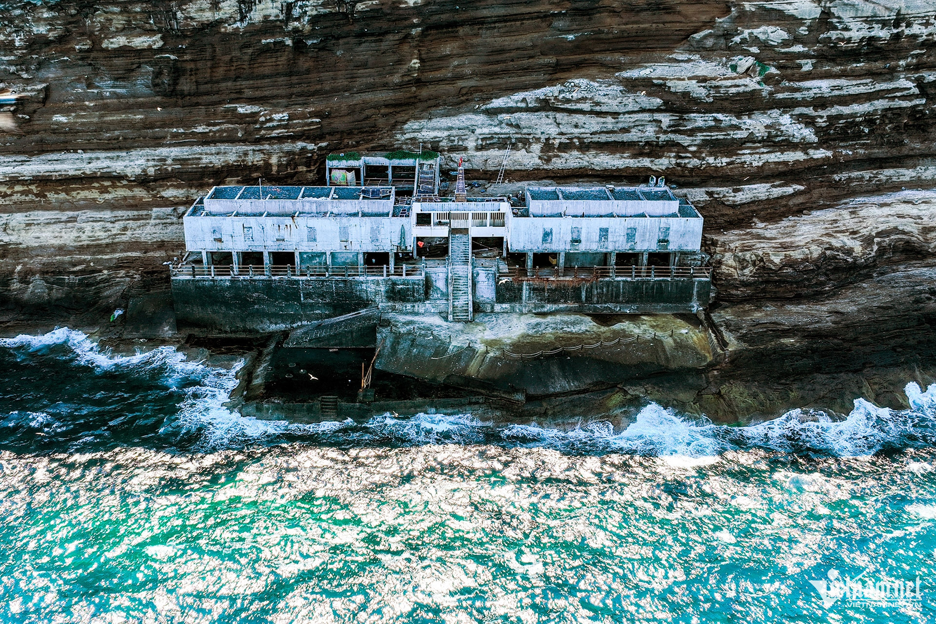
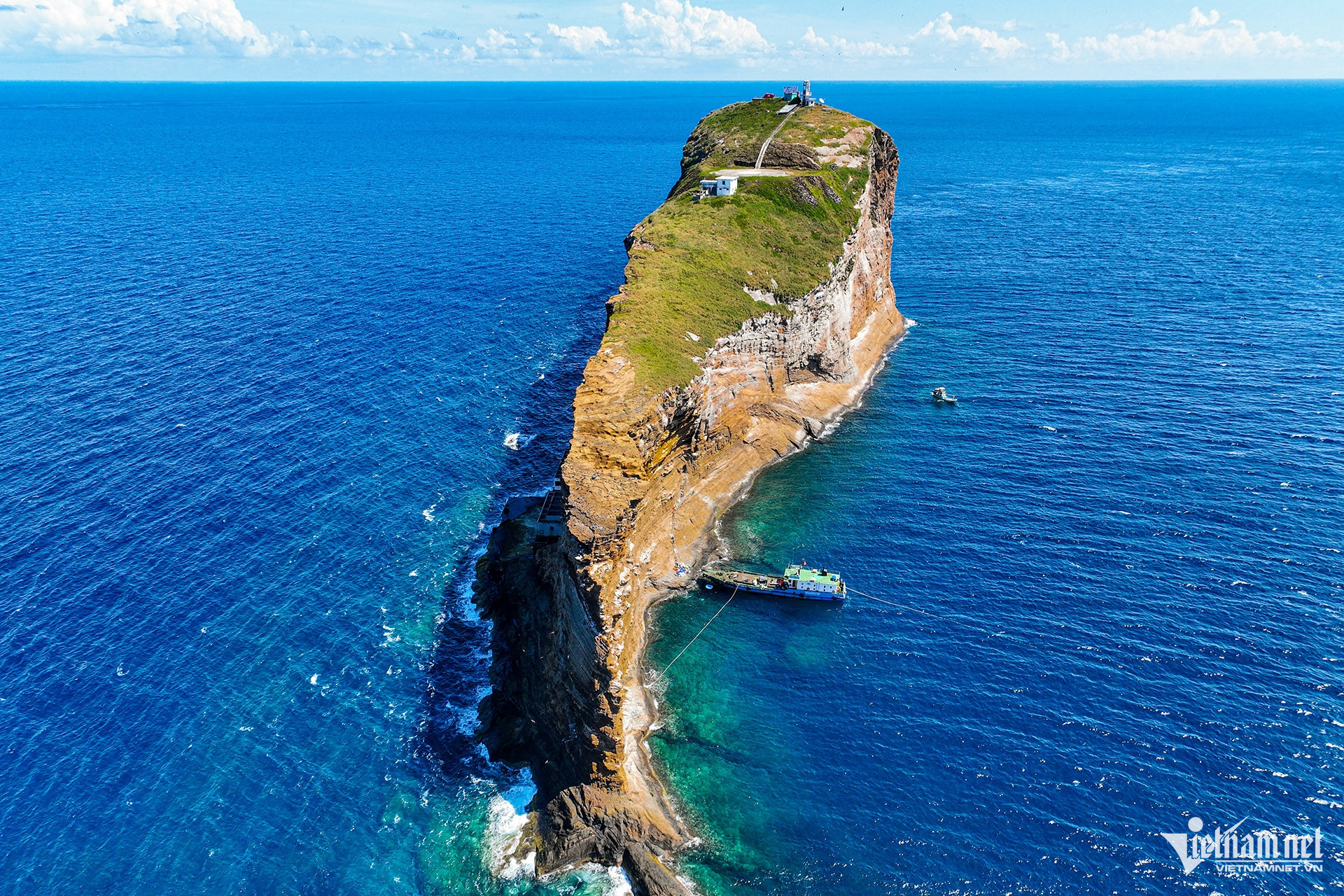
In the photo is Hon Hai pier which was completed and put into use in 2005. The pier has a solid reinforced concrete structure, about 30-40m long, extending to the west of the island - where the wind and waves are lighter. The pier is large enough to receive patrol boats and small transport ships of the Navy and Fisheries Surveillance to dock directly to supply food, fresh water, fuel, change troops, transport scientific equipment, carry out rescue work and maintain the lighthouse.
The pier also serves as a residence and workplace for the island's staff, with a tunnel leading to the other side and up to the top of the island.
The tunnel that runs across both sides of the wharf and goes straight to the top of the island was built by the engineering soldiers to facilitate the transportation of equipment and technical supplies, convenient for technicians to take temporary shelter during rough seas.
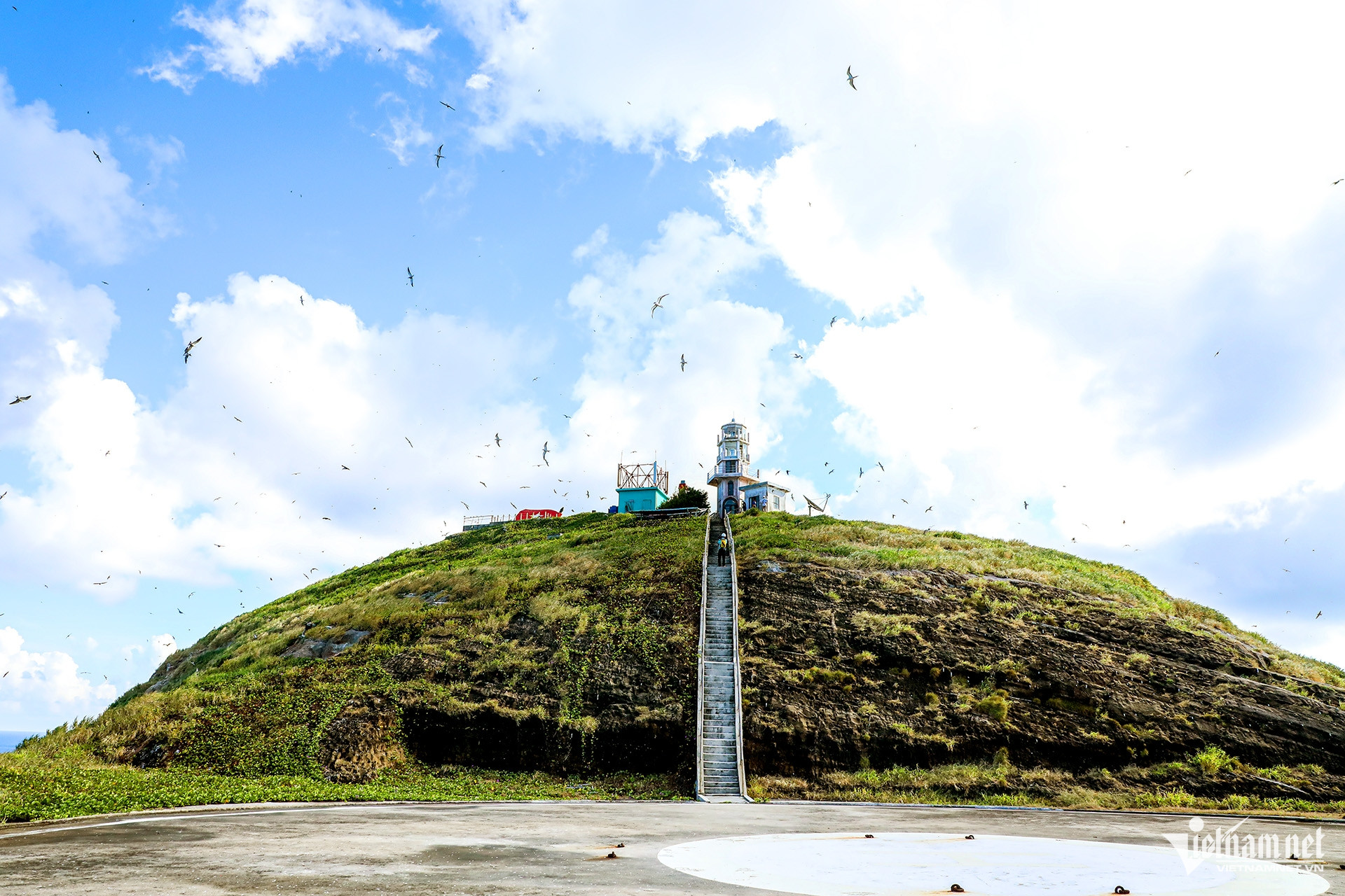
Currently, on the island there is always a technical team of the South Central Coast Maritime Safety Company on duty to manage, maintain and operate Hon Hai lighthouse.
Vietnamnet.vn
Source: https://vietnamnet.vn/can-canh-hon-dao-chu-quyen-viet-nam-mang-hinh-ca-voi-khong-lo-giua-bien-khoi-2462411.html


![[Photo] Unique architecture of the deepest metro station in France](https://vphoto.vietnam.vn/thumb/402x226/vietnam/resource/IMAGE/2025/11/14/1763107592365_ga-sau-nhat-nuoc-phap-duy-1-6403-jpg.webp)


Comment (0)