
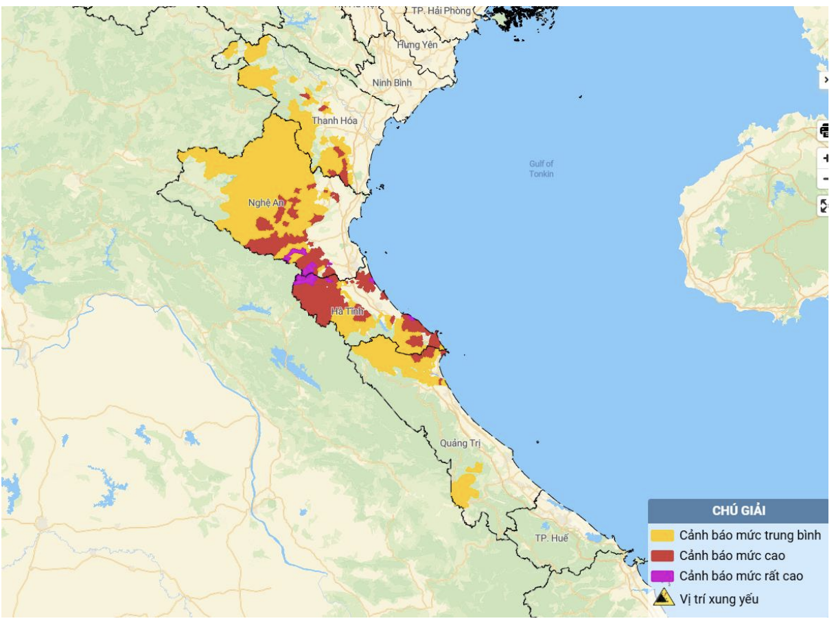
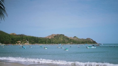
Map of flash flood and landslide risk in the areas.
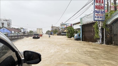
In the past 24 hours (from 4:00 a.m. on August 17 to 4:00 a.m. on August 18), the provinces from Thanh Hoa to Quang Tri had moderate rain, heavy rain, and in some places very heavy rain such as. The amount of rain measured in Nhu Xuan (Thanh Hoa) was 99.2mm; Con Cuong (Nghe An) was 129.6mm; Son Hong 2 ( Ha Tinh ) was 129.8mm; Tan Lam (Quang Tri) was 60.6mm...
Soil moisture models show that some areas in the above provinces are close to saturation (over 85%) or have reached saturation.
In the next 3-6 hours, the area from Thanh Hoa to Quang Tri provinces will continue to have rain with accumulated rainfall ranging from 20-50mm, in some places over 70mm.
Within 6 hours (from 4am to 10am on August 18), there is a risk of flash floods on small rivers and streams, and landslides on steep slopes in many communes and wards.
For Thanh Hoa province, the communes: Dong Luong, Linh Son, Minh Son, Nhu Thanh, Nhu Xuan, Thanh Ky, Xuan Binh, Yen Tho; Cam Thach, Cam Tu, Cong Chinh, Giao An, Hien Kiet, Hoa Quy, Hop Tien, Luong Son, Mau Lam, Muong Lat, Muong Ly, Muong Min, Na Meo, Ngoc Lac, Ngoc Lien, Quan Son, Son Dien, Son Thuy, Tam Lu, Tan Thanh, Thang Loc, Thanh Phong, Thanh Quan, Thien Phu, Thuong Xuan, Trung Ly, Trung Son, Truong Lam, Van Nho, Van Xuan, Xuan Chinh, Xuan Du, Xuan Thai, Xuan Tin, Yen Nhan are on the warning list of risks of flash floods and landslides.
The meteorological agency recommends that local authorities pay attention to reviewing bottlenecks and vulnerable locations in the area to have prevention and response measures.
See detailed list of areas at risk of flash floods and landslides here.
NM
Source: https://baothanhhoa.vn/canh-bao-lu-quet-sat-lo-dat-khu-vuc-tu-thanh-hoa-den-quang-tri-258488.htm

![[Photo] Lam Dong: Panoramic view of Lien Khuong waterfall rolling like never before](/_next/image?url=https%3A%2F%2Fvphoto.vietnam.vn%2Fthumb%2F1200x675%2Fvietnam%2Fresource%2FIMAGE%2F2025%2F11%2F20%2F1763633331783_lk7-jpg.webp&w=3840&q=75)
![[Photo] National Assembly Chairman Tran Thanh Man holds talks with South Korean National Assembly Chairman Woo Won Shik](/_next/image?url=https%3A%2F%2Fvphoto.vietnam.vn%2Fthumb%2F1200x675%2Fvietnam%2Fresource%2FIMAGE%2F2025%2F11%2F20%2F1763629724919_hq-5175-jpg.webp&w=3840&q=75)


![[Photo] President Luong Cuong receives President of the Senate of the Czech Republic Milos Vystrcil](/_next/image?url=https%3A%2F%2Fvphoto.vietnam.vn%2Fthumb%2F1200x675%2Fvietnam%2Fresource%2FIMAGE%2F2025%2F11%2F20%2F1763629737266_ndo_br_1-jpg.webp&w=3840&q=75)


Comment (0)