
Unique geological structure
The Lam Dong Provincial Meteorological and Hydrological Station has been continuously issuing warnings about heavy rains since the beginning of the year, along with warnings about flooding and especially landslides. Data shows that rainfall in Da Lat sometimes reaches 70-100 mm/24h, even peaking at over 140 mm/24h during the peak season from August to October. With nearly 200 rainy days a year, and a record 206 days, the already weak and less cohesive soil and rocks become saturated and prone to landslides. This external factor awakens the potential hazards beneath the ground in the Lam Vien plateau. The concern is not only present on mountain passes, but is also evident in the densely populated residential areas of Da Lat that have been established for many years.
According to an in-depth analysis in the old Lam Dong Regional Gazetteer, the engineering geology of the Da Lat urban area is divided into three groups. Among them, the group of medium-mountain tectonic-erosion zones, mainly distributed in the high mountains of the North, the eastern slopes of Da Lat, and the Prenn Pass, is assessed as "unsuitable for the construction of civil and industrial buildings, power lines, and pipelines." Geological experts only recommend the construction of roads or small-scale irrigation works in these areas.
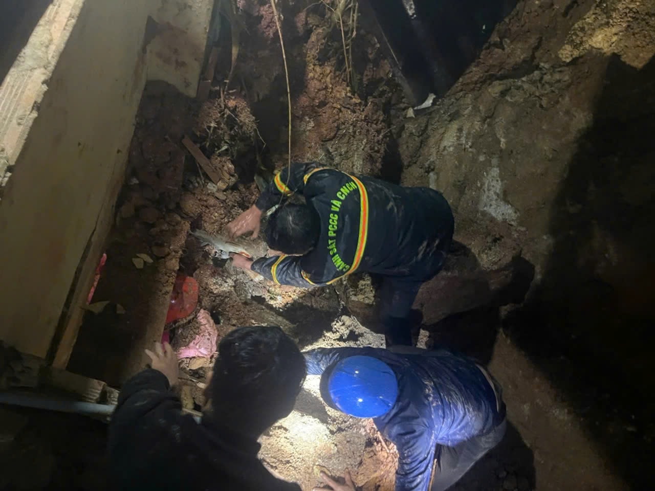
These scientific warnings have been proven true by heartbreaking events in recent times. Following continuous heavy rains, areas with weak geological conditions such as Dang Thai Than, Dong Da, Hoang Hoa Tham, and Tuyen Lam Lake have experienced a series of incidents including falling trees, landslides, house collapses, and embankment collapses, even causing loss of life and property. There have been fatalities, injuries, and property damage due to embankment landslides in Xuan Truong ward, Da Lat. An embankment landslide buried two people on the afternoon of August 12th. Most recently, on the evening of November 19th, a landslide occurred on the road leading to Tay Ho alley, burying a house and injuring a young girl.
"Matrix" of spontaneously formed slopes
Rapid urbanization combined with the complex hilly terrain has created a disorganized construction landscape in Da Lat today. For decades, residents and organizations have been quite arbitrary in leveling, filling in land, and constructing retaining walls to obtain building space. Significantly, this process in the past lacked strict management and regulations tailored to the specific topographical characteristics of each area.
Previously, when population density was low, small houses had little impact. But as land values increased, the demand for housing grew, leading to increasingly steep, vertical slopes in hilly areas. More importantly, drainage systems – crucial for minimizing landslide risk – are often neglected. Many residential areas on the edge of forests currently lack wastewater collection systems. As a result, these slopes easily become "ticking time bombs," ready to collapse at any time during heavy or prolonged rainfall.
Given the recent complex developments and serious consequences, provincial and ward authorities have continuously issued directives to strengthen inspections, reviews, and prevention of landslides and embankments. Construction management, especially regulations on embankment construction, has also been more strictly regulated and managed. However, in reality, these directives have not been able to completely prevent landslides.
It's time that geological notes and observations are no longer just lines of text in books, but become the foundation for all development and planning decisions, so that Da Lat, the city of a thousand flowers, truly becomes a livable, safe, and sustainable place for both residents and tourists.
Source: https://baolamdong.vn/da-lat-thap-thom-mua-mua-404108.html


Comment (0)