
Hydrometeorological experts have given their opinions on the reasons why the North has been experiencing heavy rain day and night, lasting until July 2, with some places experiencing over 500mm/period.
Experts say the cause of heavy rain in the North will last until about July 2. (Source: Department of Hydrometeorology)
The North is experiencing widespread showers and thunderstorms. This rain started in the evening and night of June 26 and lasted until the morning of June 28. The rain returned in the evening and night of June 28. This weather pattern is likely to last until July 2.
Explaining this prolonged heavy rain, Mr. Nguyen Van Huong - Head of Weather Forecast Department, National Center for Hydro-Meteorological Forecasting said: "The cause of this heavy rain is due to the low pressure trough with an axis passing through the Northern region that tends to become more active and stronger in the coming days.
In addition, on this low pressure trough, there is a low vortex located in the Northern region, operating at an altitude of 3,000-5,000m. The low vortex affects the low pressure trough, creating a large amount of humidity in the Northern region, causing very heavy rain in this area in the coming time."
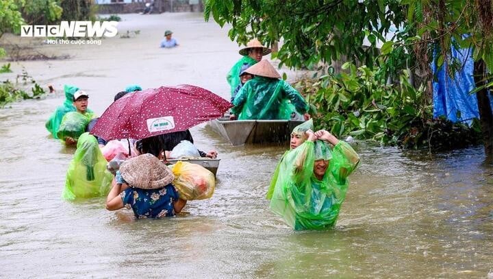
The total rainfall during this period is generally between 100-300mm, with some places reaching over 500mm. According to Mr. Nguyen Van Huong, the total rainfall in the 5 days from June 28 to July 2 is large, but if divided equally, it is not too large.
Local rainfall totals could reach 500mm, which is not particularly high compared to the early June rains.
Heavy rains are still concentrated in the North. This area has recently experienced widespread and prolonged rains, with total rainfall higher than the average of many years. This area continues to experience moderate to heavy rains over a wide area for a long time, with some areas still experiencing heavy rains with rainfall of over 100mm within 3 hours.
Mr. Huong noted that dangerous weather phenomena such as flash floods and landslides in mountainous and midland areas of the North could cause loss of life and property. In addition, urban flooding could also occur in the near future.
According to the forecast of the National Center for Hydro-Meteorological Forecasting, from June 28 to June 29, on the upper reaches of Thao, Lo, Cau, Thuong and Luc Nam rivers and small rivers in the North, there is a possibility of a flood, with flood amplitude on the rivers from 2-4m.
Flood peaks on small rivers, upstream of Thao River, Lo River, small rivers may reach alarm level (BĐ)1-BĐ2, downstream of Thao River, Lo River is still below BĐ1.
In Hanoi , in the past 3 hours, satellite images, thunderstorm location data and weather radar detected convective clouds developing, causing heavy thunderstorms in the Dong Anh, Me Linh and Soc Son areas. In addition, other districts of Hanoi are experiencing rain and showers.
In the next 1-4 hours, thunderstorms will continue to develop and cause thunderstorms in the above areas, then expand to other districts of Hanoi.
Source: https://baolangson.vn/chuyen-gia-ly-giai-hien-tuong-mua-lon-keo-dai-nhieu-ngay-o-mien-bac-5051459.html


Comment (0)