There are two trajectory scenarios for the storm strengthening from the tropical depression.
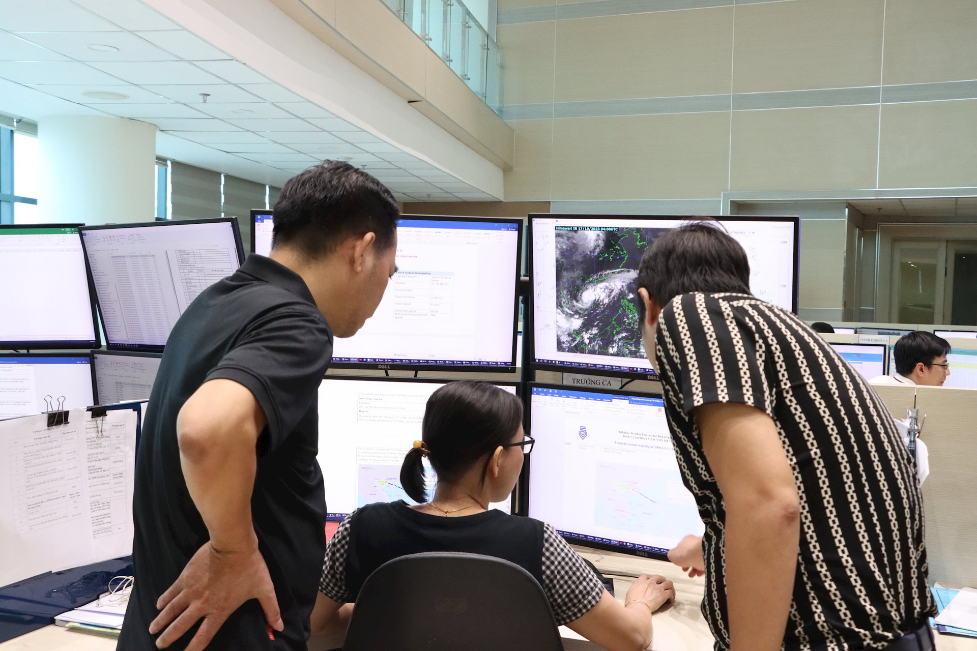
Reporting on the development of the tropical depression (updated at 2:00 p.m. on October 17), Mr. Nguyen Van Huong, Head of the Weather Forecast Department (National Center for Hydro-Meteorological Forecasting) said: At 1:00 p.m. on October 17, the center of the tropical depression was at about 15.7 degrees North latitude; 110.6 degrees East longitude, about 160km southwest of Hoang Sa archipelago. The strongest wind near the center of the tropical depression is level 6-7 (39-61km/h), gusting to level 9; moving northwest at a speed of about 5km/h.

It is forecasted that by 1pm on October 18, the tropical depression will move northwest at a speed of about 10 km/h and is likely to strengthen into a storm. It is forecasted that in the next 48 to 72 hours, the storm will continue to move west-northwest at a speed of about 5-10 km/h.
Mr. Huong said that in terms of trajectory, the storm is moving mainly in the North-Northwest direction, at about 10km/h. Around the morning of October 19, the storm will enter the Gulf of Tonkin. The National Center for Hydro-Meteorological Forecasting has proposed two scenarios for the trajectory of this storm. Specifically, scenario 1 is that the storm moves as it is now, parallel to the Central coast, about 1-1.5 degrees longitude from the coast, with rain tending to move from South to North, with strong winds mainly on the Central coast and the Gulf of Tonkin. Scenario 2 is that the storm moves closer to the mainland, with the possibility of making landfall in the North Central region, the Southern Delta region, causing heavy rain in the Central region, strong winds on the Central coast, the Gulf of Tonkin and coastal areas of provinces from Quang Binh to the coastal areas of the Northern Delta.
“The second scenario is not as likely to happen as the first scenario, but it is more suitable for the current weather situation than the first scenario,” Mr. Huong added.

According to him, there are currently over 11,000 fishing boats in the coastal area from Quang Ninh to Quang Ngai. The tropical depression could affect fishing and aquaculture, infrastructure, fishing boats for fishermen and disrupt tourism.
Commenting on the tropical depression in the East Sea, Mr. Truong Ba Kien - Deputy Director of the Center for Meteorological and Climate Research, Institute of Hydrometeorology and Climate Change said: In the next 24 hours (from 1:00 p.m. on October 17), the tropical depression will move in a north-northwest direction, along the coast of the Central provinces, with the possibility of strengthening into a storm on October 18 with an intensity of level 8, gusting to level 10 due to thermal and dynamic conditions such as SST, wind shear, OHC, convergence and divergence... at a moderate-good level, along with the strengthening of cold air with strong winds in the North, so the storm may reach the end of level 8, beginning of level 9, gusting to level 10-11 (Southern Gulf of Tonkin), continuing to move to the Gulf of Tonkin with the intensity decreasing to about level 8.

Regarding the risk of flooding in the Central region, Mr. Truong Ba Kien said that from 1:00 p.m. on October 17 to 7:00 p.m. on October 18, the areas of Ha Tinh, Quang Binh, Quang Tri, and Thua Thien Hue had a total rainfall of 100-200mm, with some places having over 300mm (Quang Tri, Thua Thien Hue). From 1:00 a.m. on October 19 to 7:00 a.m. on October 20, the areas of the Northern Delta and the Northeast had a total rainfall of 100-150mm, with some places having over 250mm (North Central - Hai Duong, Hung Yen, Nam Dinh).
Mr. Truong Ba Kien also gave his opinion on the risk of strong winds. Accordingly, from now until October 19, the sea area from Quang Tri to Binh Dinh will have strong winds of level 6-7; from now until October 20, the sea area from Quang Tri to the Gulf of Tonkin will have strong winds of level 8-9.
According to the Institute of Hydrometeorology and Climate Change, due to the influence of the tropical depression in the East Sea, in the next 24 to 72 hours (from 1:00 p.m. on October 17), the sea areas of the provinces from Quang Ninh to Binh Dinh, including the Gulf of Tonkin and the Hoang Sa archipelago, may experience large waves of over 2 meters, the largest of which may be approximately 4 meters.
In the coming days, heavy rain in the Central region will continue, the heavy rain area will move from the South to the North following the direction of the tropical depression. On land, it is necessary to continue to maintain a high level of warning for flash floods, landslides, and urban flooding. At sea, dangerous areas for boating and aquaculture activities include: Bac Bo Gulf; the sea area from Quang Tri to Quang Ngai today and in the coming days.
Mr. Mai Van Khiem - Director of National Center for Hydro-Meteorological Forecasting
Pay attention to review all coastal activities
Speaking at the meeting, Deputy Director General of the General Department of Hydrometeorology Hoang Duc Cuong agreed with the assessment of the National Center for Hydrometeorological Forecasting that the tropical depression is likely to strengthen into a storm and further assess the impact after the storm enters the Gulf of Tonkin, combined with cold air that is likely to be strongest from October 19-20, causing the storm to be at level 8-9.
According to Deputy Director General Hoang Duc Cuong, when a tropical depression is likely to affect the mainland, the National Center for Hydro-Meteorological Forecasting will issue an emergency tropical depression warning, or when it strengthens into a storm, the frequency of the warning will increase to 8 times/day. Thus, the change in forecast status is very fast, so the national forecasting and warning system needs to pay attention and be ready.

When the low pressure area strengthens into a tropical depression and is likely to strengthen into a storm, moving along the Central coast, the cloud area causing strong rain will change, swirling into the center of the storm, unlike the rain in the past few days in the Central region...
To ensure forecasting and warning work to respond to natural disasters in the coming days, Mr. Hoang Duc Cuong directed the National Center for Hydro-Meteorological Forecasting to preside over the forecasting of tropical depressions, storms, heavy rains, risks of floods, inundation, flash floods, landslides, thunderstorms, tornadoes, lightning, etc., paying special attention to strong winds, thunderstorms, tornadoes, and storms in sea areas that affect ships and boats, fully and promptly notifying regional and provincial hydro-meteorological stations to warn of natural disasters, levels of natural disaster risks, and impacts of natural disasters for localities to serve the work of preventing, combating, and overcoming the consequences of natural disasters, minimizing damage to localities; proactively proposing online discussions; strengthening monitoring, forecasting, and warning of the effects and impacts of dangerous natural disasters.
Speaking at the meeting, Deputy Director General of the General Department of Hydrometeorology Le Hong Phong said: In recent times, the forecasting and warning system, as well as the hydrometeorological network management system, have actively participated in providing bulletins to serve the direction and operation work, contributing to significantly reducing damage caused by natural disasters.
When the tropical depression strengthens into a storm, the level of impact caused by the storm will be large, the dangerous area of the storm will expand from the South to the North, so all units need to closely monitor the development of this storm. Regional meteorological stations in the storm's affected area must regularly exchange specific information to have timely response plans.
According to Deputy Director General Le Hong Phong, although this storm is not forecast to be too strong, it is likely to move into the waters of the Gulf of Tonkin, which could affect many fishing boats operating in the area. Therefore, it is necessary to provide timely forecast and warning information so that the Steering Committees for Disaster Prevention and Control in the affected provinces can respond promptly.
At the same time, it is necessary to review all coastal activities, aquaculture areas, tourism activities, and routes from the mainland to the islands, including the northern islands, to have timely information in forecast bulletins.
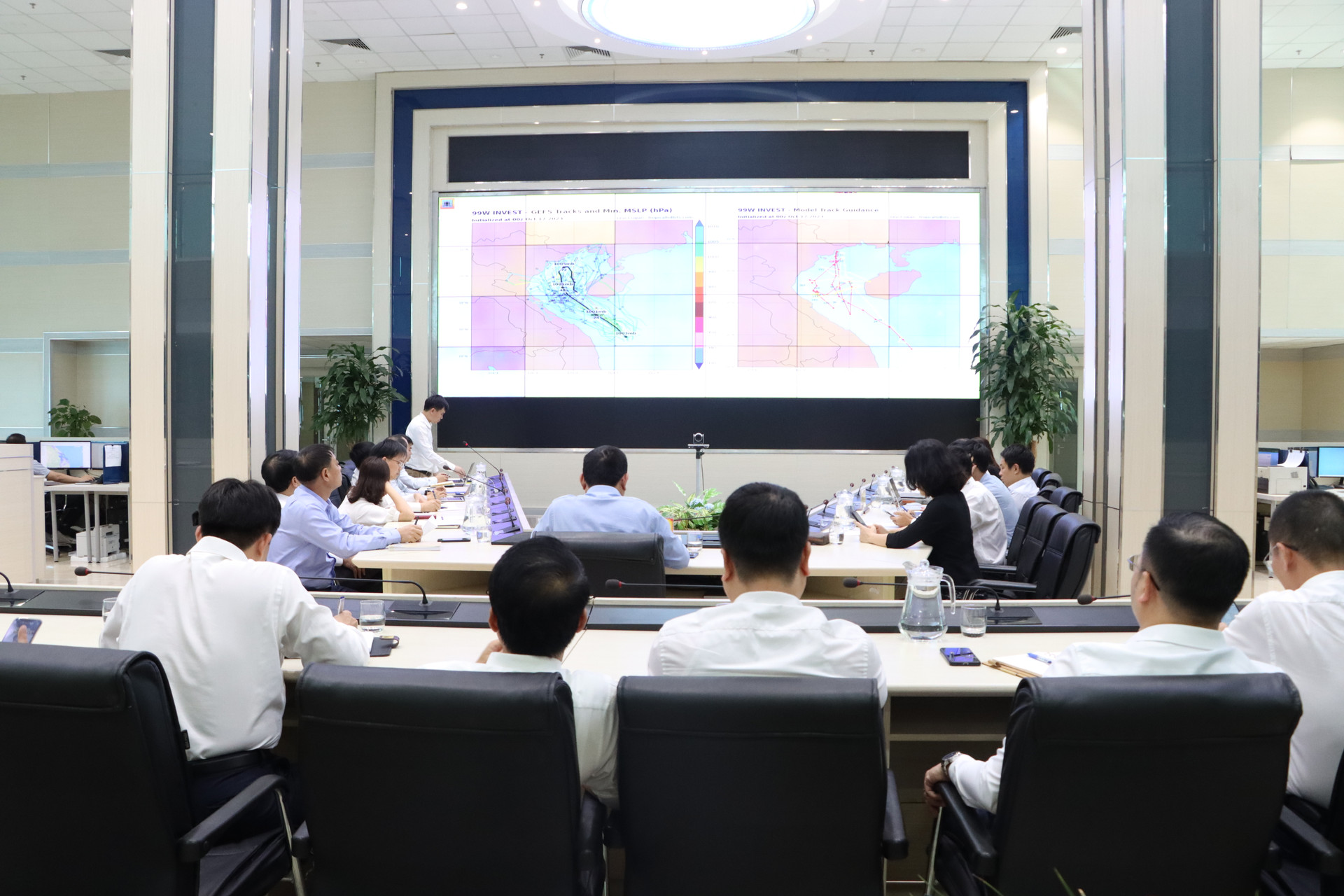
Mr. Le Hong Phong suggested that the National Center for Hydro-Meteorological Forecasting consider and propose enhanced monitoring plans and enhanced monitoring times to best grasp the impact and developments of the storm, thereby providing appropriate forecasting plans to best serve forecasting and warning work.
On October 17, the General Department of Hydrometeorology issued a document requesting units under the General Department to strengthen monitoring, forecasting, and warning of tropical depressions, rain, and floods. Deputy Director General Le Hong Phong directed the units to immediately deploy assigned tasks. In particular, for regional Hydrometeorological Stations, the Station Directors issued written instructions to provincial stations as well as Hydrometeorological stations, specifying the instructions of each unit. The Forecast Management Department is responsible for urging the stations to implement this task.
Source




![[Photo] Prime Minister Pham Minh Chinh chairs Government Standing Committee meeting on Gia Binh airport project](https://vphoto.vietnam.vn/thumb/1200x675/vietnam/resource/IMAGE/2025/5/10/6d3bef55258d417b9bca53fbefd4aeee)


![[Photo] General Secretary To Lam holds a brief meeting with Russian President Vladimir Putin](https://vphoto.vietnam.vn/thumb/1200x675/vietnam/resource/IMAGE/2025/5/10/bfaa3ffbc920467893367c80b68984c6)









Comment (0)