
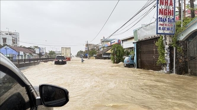
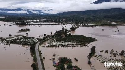
The flood peak at Van Canh station was 45.35m appearing at 8am on November 19, 0.75m lower than the historical flood in 2009 (the historical flood in 2009 was 46.10m); at Dieu Tri station it was 7.4m appearing at 12pm on November 19, 0.23m higher than the historical flood in 2009.
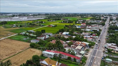
According to forecasts, in the next 24 hours, widespread flooding will continue to occur in low-lying areas along rivers and fields, local flooding in hamlets, villages, hamlets, groups and residential areas, and flooding in urban areas. The common flooding depth is from 0.20 - 0.80 meters in the following communes/wards: An Khe, An Binh, Tuy Phuoc, Tuy Phuoc Dong, Tuy Phuoc Tay, Tuy Phuoc Bac, Binh Dinh, An Nhon, An Nhon Dong, An Nhon Nam, An Nhon Bac, An Nhon Tay, Quy Nhon, Quy Nhon Dong, Quy Nhon Tay, Quy Nhon Nam, Quy Nhon Bac.
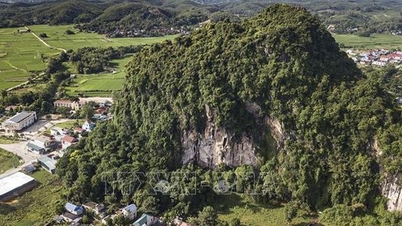
Common flooding depth is from 0.50 - 2.50m in the following communes/wards: Ya Hoi, Dak Po, Chu Krey, Ya Ma, Cho Long, Kon Chro, Po To, Ia Hiao, Phu Thien, Ayun Pa, Ia Pa, Ia Rbol, Ia Sao, Ia Tul, Ia Rsai, Uar, Phu Tuc, Ia Dreh; in some places, flooding is from 2.5 - 4.0m deep.
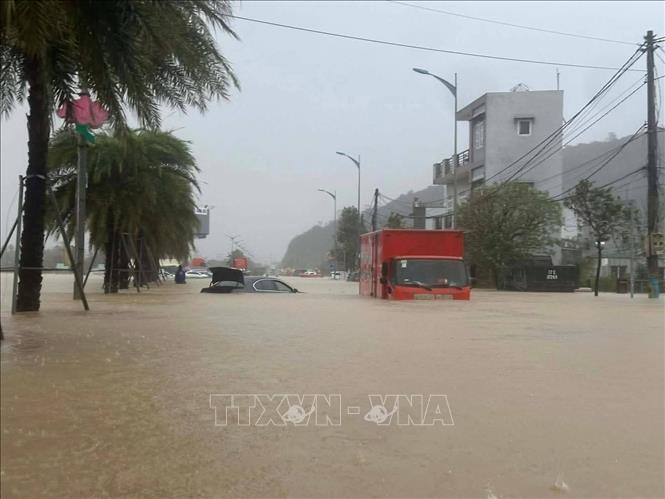
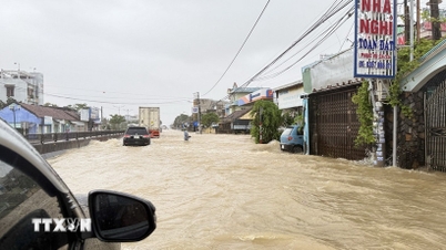
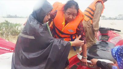
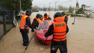
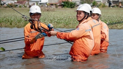
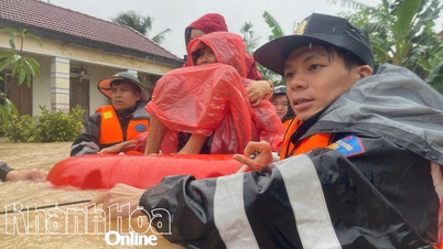
Due to the impact of heavy rain, 10,426 households/42,597 people have been flooded and isolated. The floods have also partially flooded some roads, causing landslides and damage to some traffic points and infrastructure works in the province.
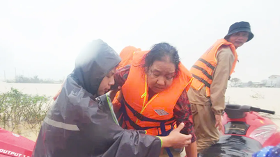
In Quy Nhon ward, a house collapsed, trapping two people inside. At 5:00 a.m., the forces rescued one person (an old man) to safety. At 12:00 p.m., the forces found the body of one person (an old woman named Dang Thi Chim, born in 1967).
In addition, the floods also isolated many localities, paralyzed some traffic routes, making it impossible to move, such as National Highway 1A, National Highway 1D, National Highway 19 connecting Quy Nhon with Pleiku, etc.
Source: https://baotintuc.vn/xa-hoi/muc-nuoc-song-o-gia-lai-dang-cao-ky-luc-nhieu-tuyen-duong-bi-tac-nghen-te-liet-20251119182839350.htm


![[Photo] Prime Minister Pham Minh Chinh and his wife meet the Vietnamese community in Algeria](https://vphoto.vietnam.vn/thumb/1200x675/vietnam/resource/IMAGE/2025/11/19/1763510299099_1763510015166-jpg.webp)
![[Photo] The Standing Committee of the Organizing Subcommittee serving the 14th National Party Congress meets on information and propaganda work for the Congress.](https://vphoto.vietnam.vn/thumb/1200x675/vietnam/resource/IMAGE/2025/11/19/1763531906775_tieu-ban-phuc-vu-dh-19-11-9302-614-jpg.webp)


![[Photo] General Secretary To Lam receives CEO of AP Moller-Maersk Group, Denmark](https://vphoto.vietnam.vn/thumb/1200x675/vietnam/resource/IMAGE/2025/11/18/1763462288958_a3-bnd-8222-2510-jpg.webp)
![[Photo] General Secretary To Lam receives Slovakian Deputy Prime Minister and Minister of Defense Robert Kalinak](https://vphoto.vietnam.vn/thumb/1200x675/vietnam/resource/IMAGE/2025/11/18/1763467091441_a1-bnd-8261-6981-jpg.webp)


Comment (0)