
If in Lo Go-Xa Mat National Park there is the Trung Quan leaf (it is said that King Gia Long named it), then in the upper reaches of the Vam Co Dong River there is the Trung Dan wharf. No one knows when that name came into being and who named it. But the concept of “Trung Dan” was still strange in the feudal era. So it could only have existed since the time when our people followed the revolution.
")
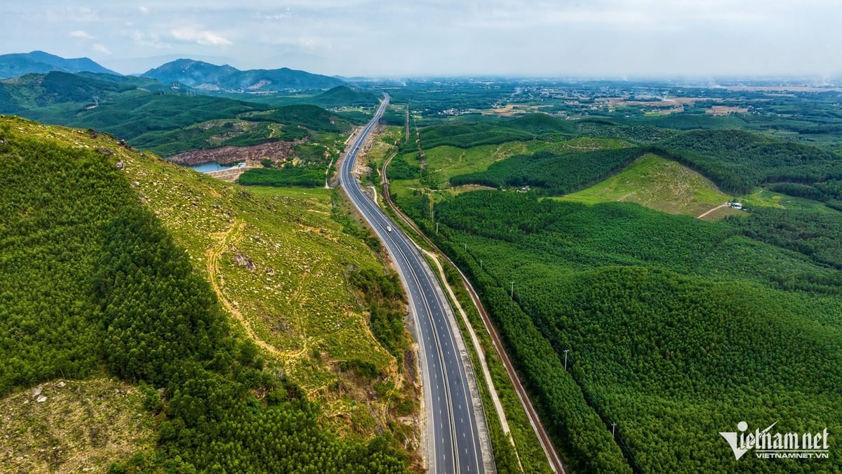
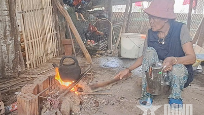
Trung Dan Wharf
Perhaps to thank the person who gave it such a beautiful name, this river wharf has a specialty to thank people. But that was more than 20 years ago. At that time, every May, a species of fish fry would float back. The newly hatched fish were only as small as a toothpick tip, as clear as water bubbles.
So it is almost invisible to the naked eye. Only the experienced eyes of fishermen can recognize it. So during the 2-week fish fry season, fishermen from all over flock to the wharf like a festival. Boats row slowly. Boats with engines speed up and down. There are hundreds of boats on the river from Trung Dan wharf up to the mouth of the plain.
On the boat, fishermen held nets, eyes scanning the water. Wherever there were signs of fry, they scooped them up. In those years, ornamental fish lovers in Saigon were very fond of the striped red fish, which were raised from this type of fry. A fish as small as a toothpick cost from 15,000 to 20,000 VND. And that was the price 20 years ago. Some people caught hundreds of fish a day.
Then, for some unknown reason, the fry stopped coming to Trung Dan wharf. Perhaps it was like the plantain flower on the Vinh River, unable to stand the polluted river water, so it gradually retreated upstream. Strangely enough, only the Cai Cay River branch had that precious fish. This branch ran along the Bien Gioi Commune bank for only 2km, then went deep into the neighboring land. Until now, the red striped fish have completely disappeared. Recalling this story is just like recalling a happy memory of Trung Dan wharf.
Following the river, about 4 kilometers downstream is Lo Co wharf. When he was alive, poet Canh Tra once wrote: “Lo Co Hamlet lies beside the cool green Vam Co Dong River/ There is a river wharf and a girl rowing a boat…”.
That was more than 20 years ago! And also in a different season, not the flood season. That year, the ferry still had a girl rowing the boat. Shortly after, the boat was replaced by a square ferry with an empty cockpit covered loosely with a sheet of corrugated iron. And today, at the end of 2023, it is the flood season, both banks are flooded.
Stopping at Lo Co wharf, I only saw a deserted river wharf. The ferry was anchored among the rubbish and water hyacinth. There was also a small boat, for the ferryman to go back and forth on the wharf when needed. He was sitting on a lonely stone bench, singing a folk opera. Sadly, he said that on normal days, there were already few people passing by, let alone during the flood season.
Yes! Since 2020, when Ben Cay Oi bridge opened to traffic, there have been fewer passengers crossing the river. But why do people still patiently hold the ferry and the wharf? Or is it because people are too attached to the river wharf? On the right bank is Lo Co wharf; on the left bank is Cay Sao wharf in Phuoc Vinh commune. Every place bears the mark of a time of resistance.
The book History of Tay Ninh Provincial Political School (2014) also recorded: “During this period (from early 1960 to mid-1965), the school also increased 1.5 hectares of rice fields at Lo Co canal to be self-sufficient in food, averaging 220 bushels of rice per year. The school had to sell some of the rice, buy a pair of female buffaloes, a sewing machine, a hair clipper, and accept a new employee… who knew how to sew.”
It can be said that this was the period when the food and clothing of the Party School (the predecessor of Tay Ninh Political School) was most improved…” Then: “In May 1965, Tay Ninh Party School at Cay Sao wharf was honored to be chosen as the place to hold the Provincial Party Congress.
The school’s staff and officers have wholeheartedly served and actively contributed to the success of the Congress. In this Congress, comrade Vo Duc Tu was the only representative of the Party School elected as an alternate member of the Provincial Party Committee and was assigned to be Deputy Head of the Propaganda Department, in charge of the Party School…”. Meanwhile, many other revolutionary forces had passed through or were attached to this river wharf during the resistance war against the US.
From Cay Sao wharf, go downstream for about 3 kilometers to Bang Dung wharf, and to Cay Oi wharf, it is nearly 9 kilometers more. But please skip Bang Dung and go straight to Cay Oi, because today there is a new bridge across the river.
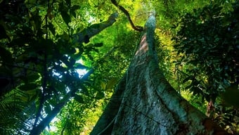
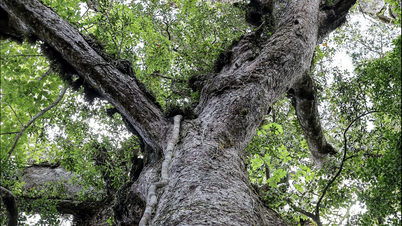
This riverside is strangely beautiful, because on the Hoa Thanh side there are still a few majestic tamarind trees lying close to the riverbank reflecting in the water. The tamarind trees are not very tall, but looking at the large trunk that takes 3-4 people to hug around, we know that the tree is over a hundred years old.
The trunk splits into several branches, spreading its leaves like a giant green umbrella. When building the bridge, people cleverly left the bridge abutment to pass through, preserving the tamarind trees. So today, even if you drive fast uphill, you can still see the tamarind canopy green all year round, protecting a beautiful stretch of riverbank. Here, water hyacinths in patches are floating on the river. The banks are open so that the eyes can see far away, filled with the green of young rice or the golden color of ripe rice.
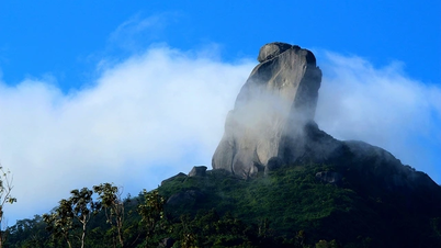
Going down to the riverbank, under the bridge looking downstream, on a beautiful day, Ba Den mountain can be seen rising in a light purple-blue color, under the vast blue sky and white clouds. This part of the river also had pink striped fish fry drifting down from upstream, but that was about 30 years ago. After that, the fish gradually retreated to Trung Dan wharf as mentioned above. The recent story is the story of the bridge built from 2019 to 2020 when it was completed.
In 2019, there were still flocks of storks passing through this river wharf and the skies of Hoa Hoi and Hao Duoc to find food. Until now, small fishing villages along the river are still there, they diligently fish on the river to make a living.
Reading the book “Dictionary of Southern Administrative Place Names” (Nguyen Dinh Tu, National Political Publishing House, 2008), we know that the villages on both sides of Cay Oi wharf have existed for a long time. Phuoc Vinh used to be Tapang Pro Sroc village, established in 1876 under the French colonial period. On the right bank, now Hoa Thanh, used to be Day Xoai Praha Miet village, established in 1877 under Khan Xuyen commune. There are villages, a large river running through the middle of the fertile fields and gardens.
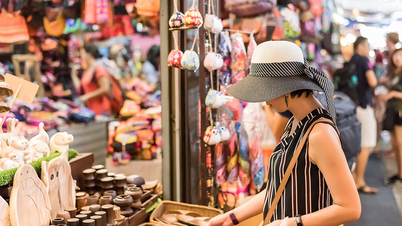
Spiritual life also flourished. On the Day Xoai side, there is the Khmer Hiep Phuoc pagoda, and on the Ta Pang side, there is also the Chua hamlet (because the old pagoda was lost, leaving only its name). So there must be a wharf, a ferry for people to cross and do business. The Ta Pang people (now Phuoc Vinh) often go through the Cay Oi wharf, and travel more than ten kilometers to reach Ben Cau market or Ta Nong market, where they exchange goods with the Khmer people from across the border. That tradition has been maintained until now, despite being interrupted by more than 30 years of resistance.
That is why by 2000, Cay Oi ferry terminal was “modernized”, surpassing the river terminals upstream. By 2020, there was a bridge. Anyone who has passed by here will surely remember that during the 2 years of building the bridge, the Cay Oi ferry terminal still diligently weaved through the concrete piers to transport passengers across the river, even though each trip only carried about 2-3 people and motorbikes.
I remember in 2016, when Ben Dinh bridge was completed, the head of the Cooperative announced that this ferry would be moved to Cay Oi wharf. Now that Cay Oi bridge is completed, where has that diligent ferry gone?
Tran Vu
Source
![[Photo] President Luong Cuong presents the 40-year Party membership badge to Chief of the Office of the President Le Khanh Hai](https://vphoto.vietnam.vn/thumb/1200x675/vietnam/resource/IMAGE/2025/5/19/a22bc55dd7bf4a2ab7e3958d32282c15)
![[Photo] Panorama of the Opening Ceremony of the 43rd Nhan Dan Newspaper National Table Tennis Championship](https://vphoto.vietnam.vn/thumb/1200x675/vietnam/resource/IMAGE/2025/5/19/5e22950340b941309280448198bcf1d9)


![[Photo] Close-up of Tang Long Bridge, Thu Duc City after repairing rutting](https://vphoto.vietnam.vn/thumb/1200x675/vietnam/resource/IMAGE/2025/5/19/086736d9d11f43198f5bd8d78df9bd41)


![[Photo] General Secretary To Lam attends the conference to review 10 years of implementing Directive No. 05 of the Politburo and evaluate the results of implementing Regulation No. 09 of the Central Public Security Party Committee.](https://vphoto.vietnam.vn/thumb/1200x675/vietnam/resource/IMAGE/2025/5/19/2f44458c655a4403acd7929dbbfa5039)


![[VIDEO] - Enhancing the value of Quang Nam OCOP products through trade connections](https://vphoto.vietnam.vn/thumb/402x226/vietnam/resource/IMAGE/2025/5/17/5be5b5fff1f14914986fad159097a677)


Comment (0)