
In Kim Ngan commune, water levels in rivers and streams rose rapidly. The road from the commune center to Con Cung dam and the road to An Bai village was flooded about 1 meter deep. On National Highway 9B, the section through Km25 and Km23 tunnels was flooded from 0.4 to 0.6 meters, temporarily cutting off traffic. Lang Ho Border Guard Station coordinated with local authorities to place warning signs at deep flooded areas, reminding people not to cross the above tunnels to ensure safety.
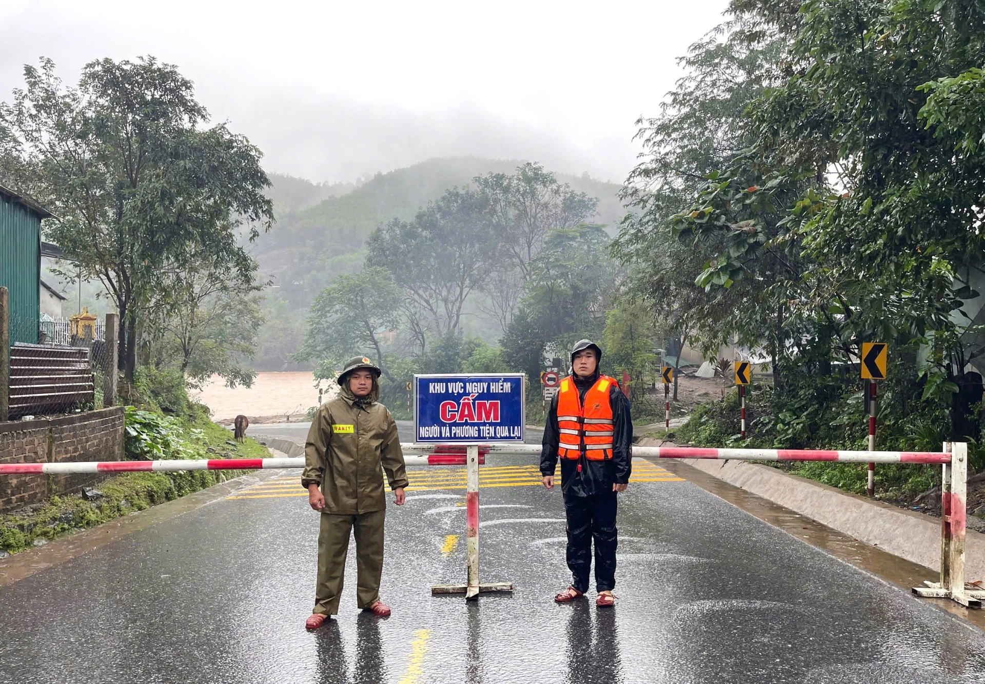 |
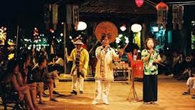
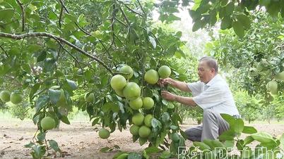
| Officers and soldiers of La Lay International Border Guard Station block the spillways - Photo: Hoai Nam |
In La Lay commune, heavy rains over a large area flooded the spillway in A Ngo and A Rong villages by about 0.5m. The La Lay international border gate border guard station has dispatched officers and soldiers to block off key points to ensure the safety of local people.
Currently, the Provincial Border Guard Command continues to direct units to deploy working groups to grasp the situation of floods and rains, coordinate with local authorities to set up danger warnings, and propagate to people not to go to vulnerable locations, at risk of flooding and landslides to ensure safety.
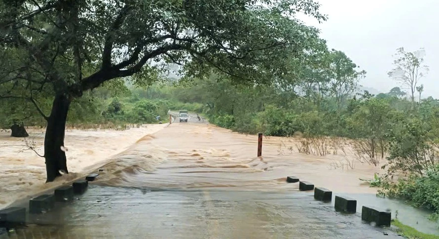 |
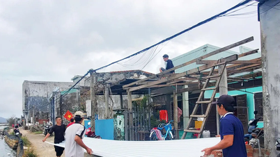
| Many locations in Kim Ngan commune are flooded nearly 1 meter deep - Photo: Hoai Nam |
According to information from the Quang Tri Province Hydrometeorological Station, in the next 6-24 hours, floods on rivers will continue to rise to alert level 1, alert level 2, some rivers will be close to alert level 3, warning of deep and widespread flooding in the downstream areas of rivers, especially the downstream area of Kien Giang River. There is a very high risk of flash floods and landslides on the slopes of mountainous areas; landslides at waste dumps of wind power construction projects, highway works in the Van Ninh-Cam Lo and Cam Lo-La Son sections.
To Linh - Hoai Nam
Source: https://baoquangtri.vn/xa-hoi/202511/quang-tri-nhieu-diem-bi-ngap-chia-cat-do-mua-lon-2535ffb/


![[Photo] Prime Minister Pham Minh Chinh meets with representatives of outstanding teachers](https://vphoto.vietnam.vn/thumb/1200x675/vietnam/resource/IMAGE/2025/11/15/1763215934276_dsc-0578-jpg.webp)
![[Photo] General Secretary To Lam receives Vice President of Luxshare-ICT Group (China)](https://vphoto.vietnam.vn/thumb/1200x675/vietnam/resource/IMAGE/2025/11/15/1763211137119_a1-bnd-7809-8939-jpg.webp)


Comment (0)