
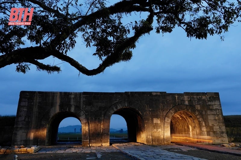
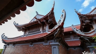
South Gate of Ho Dynasty Citadel (Photo: Geoff Steven)
Since the beginning of the 20th century, a number of French scholars have been interested in the unique and distinctive values of the Ho Dynasty Citadel heritage, diligently surveying and researching according to Western empirical methods and have published many valuable research works. Among them are La province de Thanh Hoa (Breton, printed in 1918), Le Thanh Hoa (Ch. Robinquin, printed in 1918).
These are considered the earliest works by foreign scholars to research and mention issues related to Tay Do citadel. The two works above both present an overview of Thanh Hoa province, including Tay Do citadel and the characters and administrative units of Vinh Loc district. However, these two books mainly focus on introducing the administration serving the French rule, so the history of Tay Do citadel and the values of the citadel and historical relics have not been mentioned much.

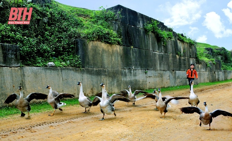
Scenery of the village in the vicinity of Ho Dynasty Citadel (Photo: Ho Dynasty Citadel Heritage Conservation Center).
In 1922, H. Le Breton published Thanh Hoa Pittoresque (Beautiful Thanh Hoa), dedicating many pages to the relics of the Ho Dynasty Citadel and the Ho Dynasty. H. Le Breton used "beautiful words" to praise the Tay Do citadel: "That is the most beautiful relic of military architecture in Vietnamese history that still exists in Indochina". And "Tay Do has a line of earthen ramparts about 20 km around, we can still see the relics today. The citadel was built near the Ma River. After choosing the location and orienting the ground plan of the project according to the rules of feng shui, people began to dig the foundation and fill the land. In workshops in the province, people carved large blocks of limestone with patterns to make the citadel walls, inside which were palaces for the King and the Regent, temples, and camps were built. The effort to carry out such a project was enormous" (1) .
The wall area at Ho Dynasty Citadel (Photo: Ho Dynasty Citadel Heritage Conservation Center).
By the mid-twentieth century, Louis Bezacier, another French expert, specializing in Indochina architecture in general and Vietnamese architecture in particular, in his work L'art Viet Namien (Vietnamese Art), briefly described the strategic location of Tay Do land, the citadel and expressed the opinion that this was a unique military citadel in Southeast Asia, and affirmed that Tay Do citadel (Imperial Citadel) was still relatively intact, unchanged from its current state. The four remaining walls and gates were a great architectural work. Evidence of An Ton - Thanh Hoa used to be the political center of the whole country in the late 14th and early 15th centuries.
He commented: "We need to make it clear that this citadel is a unique example of large limestone blocks that were skillfully chiseled and joined together" or "the Ho Dynasty citadel is one of the most beautiful works of Annamese architecture" and "the most beautiful architectural work in Southeast Asia" (2) .

Ho Dynasty Citadel Gate Area (Photo: Ho Dynasty Citadel Heritage Conservation Center).
In particular, after conducting a direct and thorough survey, L. Bezacier made a very detailed assessment: " When observing on the plane, you can still clearly see the raised ground of the gates, the general shape of the mansions, the foundations and the walkways are very clear. For example, the North - South axis, the ground plan of the residence of Ho Quy Ly in the Capital, called Nhan Tho Palace. The location of the palace is marked on the ground not only by the rice fields, but also the entrance, right in front of the now lost three-step porch, indicated by two dragon-shaped railings, on the railings are four-petaled flowers, an impressive beauty reminiscent of Dai La art. In February 1403, Dong Thai Mieu was built as a temple to worship the ancestors of the Royal family". And "a few kilometers behind the citadel, scattered with a series of hills, formed a natural defense system, with a river to the west. But the south and east sides were plains. Therefore, in front of the moats, about a kilometer away, Ho Quy Ly also built a fairly large earthen rampart, surrounding the entire two vulnerable sides and thus forming the first line of defense connecting to the river to the south and the mountain system to the north" (3) .
In the early 21st century, Japanese scholars paid special attention to the Ho Dynasty Citadel. In 2002, a joint research program between Showa Women's University (Japan), the University of Social Sciences and Humanities - Vietnam National University, Hanoi and Thanh Hoa General Museum conducted basic research on the Ho Dynasty Citadel using modern methods; analyzed the chemical composition of the stone samples used to build the citadel and the rocks in the area.
Japanese scientists expressed interest and highly appreciated the multifaceted value of the Ho Dynasty Citadel. Professor Kikuchi (Showa Women's University, Japan) commented in his report: "The citadel is the crystallization of the skill of building citadels and is the pinnacle of urban planning and architecture in Vietnam in the 14th - 15th centuries. It demonstrates the harmony between the planning departments, the talent in construction techniques, design and execution" (4) .
Research works, with a general, objective scientific view of foreign scholars on Tay Do citadel, have contributed to identifying and honoring the value of Ho Dynasty Citadel, and at the same time contributing to introducing and spreading to international friends about the people and culture of Thanh land as well as our beautiful country of Vietnam.
Long Nguyen
(Deputy Director of the Ho Dynasty Citadel Heritage Conservation Center)
(1) H. LeBreton, Beautiful Thanh Hoa, translated version, 2010, p.75.
(2) Loui Bezacier, Vietnamese Art, translated, p.86.
(3) Loui Bezacier, Vietnamese Art, translated, p.86.
(4) Excavation report of Ho Dynasty Citadel, 2005.
Source: https://baothanhhoa.vn/thanh-nha-ho-trong-mat-hoc-gia-nuoc-ngoai-247256.htm


Comment (0)