
 |
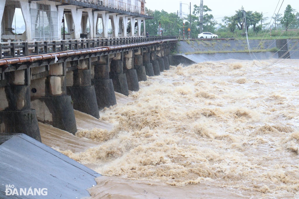
| Floods on the Yen River at An Trach dam are rising slowly, expected to peak this evening (June 12). Photo: HOANG HIEP |
As of 2:00 p.m. on June 12, due to the remaining empty capacity of the A Vuong, Song Bung 4 and Song Tranh 2 hydropower reservoirs, the reservoirs were operating to cut off all flood discharge to these reservoirs for downstream areas with the highest flood discharges being 1,225m3 /s, 894.7m3 /s and 865m3 /s, respectively.
As for Dak Mi 4 hydropower reservoir, due to the flood flow into the reservoir being too large, up to 1,940m3 /s, at 1:00 p.m. on June 12, this reservoir was discharging water through the power generation to the Thu Bon River with a flow of 102m3 /s and discharging flood water through the spillway to the Vu Gia River at 176m3 /s to maintain the lake water level not exceeding the normal rising water level.
Deputy General Director of Dak Mi Hydropower Joint Stock Company Nguyen Thanh Binh said that the flood flow to Dak Mi 4 Hydropower Reservoir has decreased significantly, only about 600m3 /s and is continuing to decrease. Dak Mi 4 Hydropower Plant operates to discharge water through the deep spillway to Vu Gia River combined with discharging water through power generation to Thu Bon River to ensure the safety of the dam.
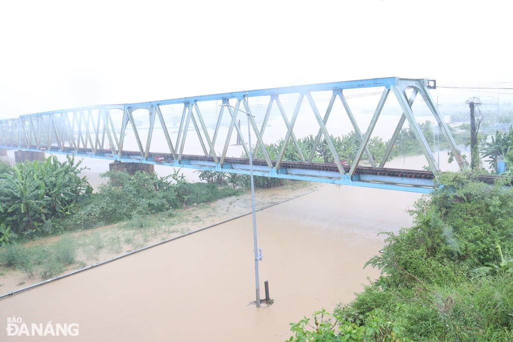 |
| Floods have also overflowed the banks of Cam Le River and inundated low-lying sections of Thang Long Street. Photo: HOANG HIEP |
According to Quang Nam Irrigation Exploitation Company Limited, although the forces have reinforced with sandbags and covered the top of the seasonal dam on Vinh Dien River (a dam to prevent salinity, retain fresh water, and ensure water for agricultural production in some localities of Quang Nam province and Da Nang city) to avoid landslides due to heavy rain, the flood on the river rose high, overflowed the top of the dam and swept away the dam when it was flooded more than 40cm deep.
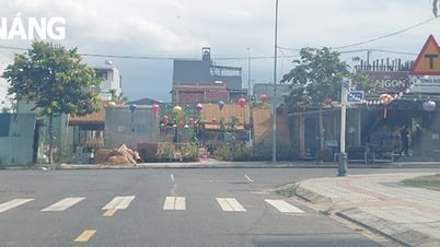
Currently, rainfall in areas of Quang Nam province, especially in Dai Loc district, is gradually decreasing. The flood level on Yen river at An Trach dam has risen to 5m and is rising slowly, expected to peak this evening.
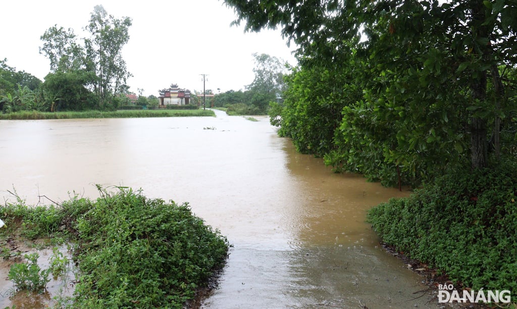 |
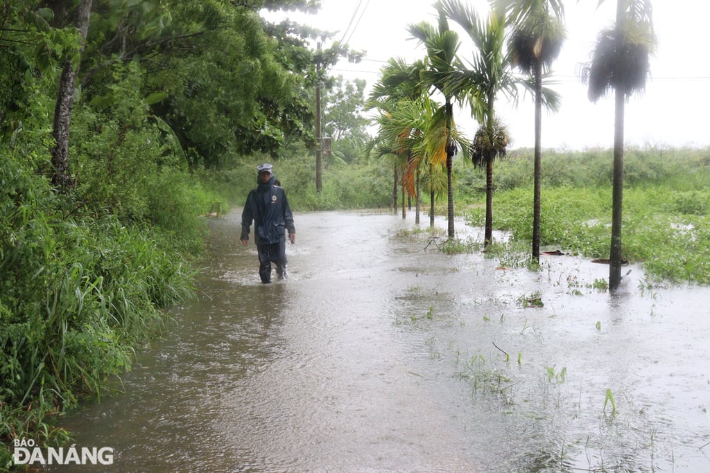
| Floods have deeply inundated the road connecting Hoa Tien commune, Hoa Vang district with Dien Tien commune, Dien Ban town (Quang Nam province). Photo: HOANG HIEP |
However, due to the flood overflowing the Yen River and deeply inundating the low-lying road connecting Hoa Tien Commune, Hoa Vang District ( Da Nang City) with Dien Tien Commune, Dien Ban Town (Quang Nam Province), it is expected that this afternoon and evening, some low-lying roads in Hoa Tien Commune will be flooded.
According to the forecast of the National Center for Hydro-Meteorological Forecasting, from today (June 12) to June 14, on rivers from Quang Binh to Quang Ngai, there will be a flood with the flood peak generally fluctuating at and above alert level 1; Vu Gia River (Quang Nam) from alert level 1 to alert level 2.
There is a high risk of flooding in low-lying areas along rivers, flash floods and landslides on steep slopes in mountainous areas of provinces from Quang Binh to Quang Ngai.
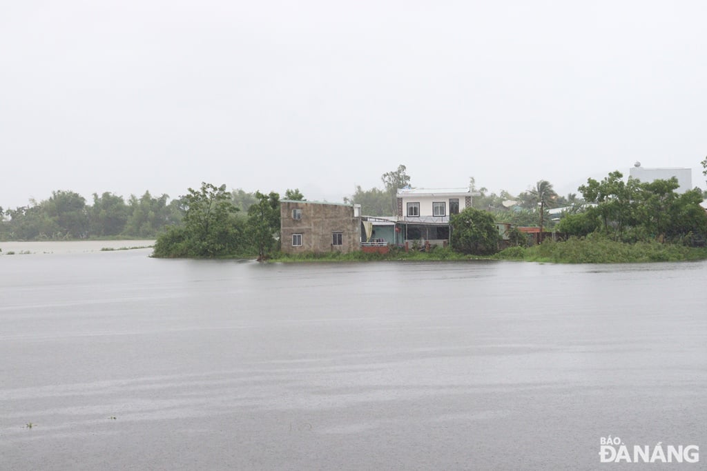 |
| Some areas in Hoa Tien commune are being "surrounded" by flood water. Photo: HOANG HIEP |
Due to the influence of storm No. 1, from the evening of June 12 to June 13, in provinces and cities from Ha Tinh to Hue, there will be heavy to very heavy rain with common rainfall from 100-180mm, in some places more than 350mm.
From the evening to the night of June 12, provinces and cities from Da Nang to Quang Ngai will have heavy to very heavy rain with common rainfall of 40-90mm, in some places over 150mm.
Risk of flash floods, landslides in mountainous areas, urban flooding in low-lying areas.
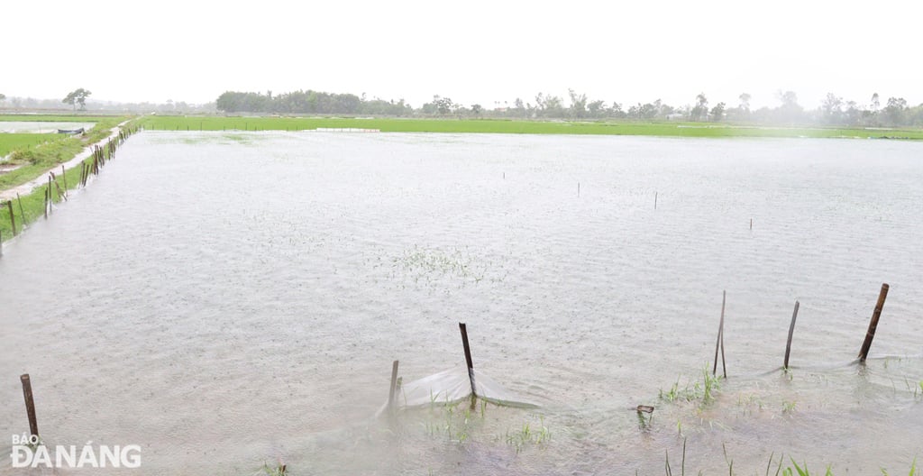 |
| Many summer-autumn rice fields were completely flooded. Photo: HOANG HIEP |
 |
| Most of the cultivated area in La Huong vegetable area has also been flooded. Photo: HOANG HIEP |
HOANG HIEP
Source: https://baodanang.vn/xa-hoi/202506/thuy-dien-cat-lu-cho-ha-du-den-day-ho-dap-thoi-vu-tren-song-vinh-dien-bi-cuon-troi-4008585/


![[Photo] General Secretary To Lam chairs the 14th Central Military Commission Conference](https://vphoto.vietnam.vn/thumb/1200x675/vietnam/resource/IMAGE/2025/6/20/a9d25fc6dd664fb9a3757502f32e5db0)


![[Maritime News] Wan Hai Lines invests $150 million to buy 48,000 containers](https://vphoto.vietnam.vn/thumb/402x226/vietnam/resource/IMAGE/2025/6/20/c945a62aff624b4bb5c25e67e9bcc1cb)


Comment (0)