
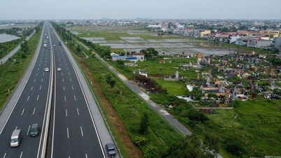
Illustration photo: National Center for Hydro-Meteorological Forecasting
According to the National Center for Hydro-Meteorological Forecasting, the flood on Trung River (Lang Son) is rising slowly, the flood upstream of Lo River at Ha Giang station is at its peak of 102.59m (at 6:00 a.m. on October 8), 0.41m below alert level 3.
In the next 12 hours, flood on Cau River at Dap Cau station will continue to rise above alert level 3, at Gia Bay station it will continue to fall and be above historical level; flood on Thuong River at Phu Lang Thuong station will continue to rise and is likely to exceed the historical flood level of 1986 (7.52m); flood on Trung River will continue to rise and is likely to peak at noon and afternoon this afternoon, then fall.
In the next 12-24 hours, flood on Cau River at Dap Cau station will continue to rise and be above alert level 3, at Gia Bay station it will continue to fall and be above alert level 3; flood on Thuong River at Phu Lang Thuong station will continue to rise and possibly be above historical flood level; flood on Trung River will fall and be above historical level.
Warning: From now (October 8) to October 9, the flood in the upper reaches of Lo River (Tuyen Quang) and Hoang Long River (Ninh Binh) will recede. Floods on some small rivers in Lang Son and Cao Bang will remain above alert level 3. Floods on Luc Nam River (Bac Ninh) at Luc Nam station will change slowly from alert level 1 to alert level 2. Floods on Thai Binh River (Hai Phong) at Pha Lai station will continue and remain above alert level 2.
River floods inundate low-lying areas along the river, affecting activities such as waterway transport, aquaculture, agricultural production, people's lives and socio- economic activities.
Flood disaster risk warning level: Level 3.
Risk of flooding
Thai Nguyen: Phan Dinh Phung Ward, Linh Son Ward, Tich Luong Ward, Gia Sang Ward, Quyet Thang Ward, Quan Trieu Ward, Pho Yen Ward, Song Cong Ward, Ba Xuyen Ward, Phu Binh Commune, Diem Thuy Commune, Kha Son Commune, Tan Khanh Commune, Dong Hy Commune, Van Lang Commune, Bach Quang Ward, Van Xuan Ward, Trung Thanh Ward, Cho Don Commune, Thanh Thinh Commune, Cho Moi Commune.
Bac Ninh: Hop Thinh, Xuan Cam, Tam Giang, Yen Trung, Nenh Ward, Yen Dung, Canh Thuy, Kep Commune, Tien Luc, Nha Nam, Yen The, Tien Phong Ward, Phuong Son Ward, Chu Ward, Tuan Dao, An Lac, Duong Huu, Dai Son, Bien Son, Bien Dong, Luc Ngan, Deo Gia, Truong Son, Luc Son, Luc Nam, Nghia Phuong, Cam Ly, Tan An, Phat Tich Commune, Tri Qua Ward, Thuan Thanh Ward, Mao Dien Ward, Chi Lang Commune, Bong Lai Ward, Dao Vien Ward, Dai Lai, Nhan Thang, Cao Duc.
Lang Son: That Khe, Trang Dinh, Khang Chien, Quoc Viet, Yen Binh, Van Nham, Huu Lung.
Cao Bang: Bao Lac, Bao Lam, Quang Lam, Ly Bon, Nam Quang, Thuc Phan, Nung Chi Cao, Tan Giang.
Source nhandan.vn
Source: https://baophutho.vn/tin-lu-dac-biet-lon-tren-song-cau-song-thuong-240785.htm


![[Photo] National Assembly Chairman Tran Thanh Man receives First Vice Chairman of the Federation Council of the Federal Assembly of the Russian Federation](/_next/image?url=https%3A%2F%2Fvphoto.vietnam.vn%2Fthumb%2F1200x675%2Fvietnam%2Fresource%2FIMAGE%2F2025%2F12%2F02%2F1764648408509_ndo_br_bnd-8452-jpg.webp&w=3840&q=75)





























Comment (0)